Estimated Value: $192,000 - $216,000
--
Bed
2
Baths
1,568
Sq Ft
$132/Sq Ft
Est. Value
About This Home
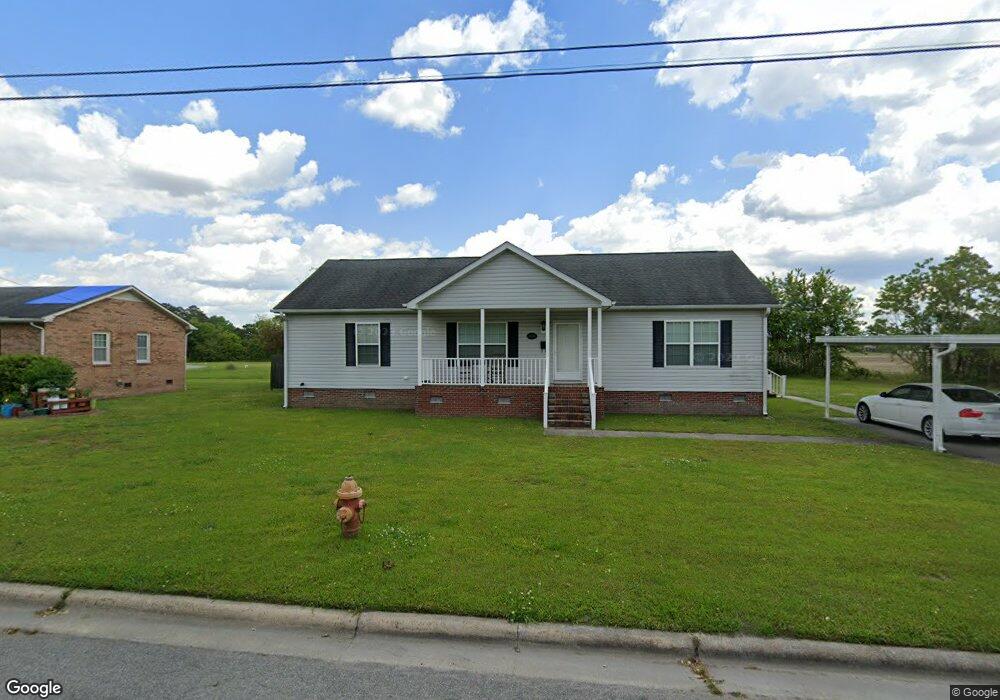
This home is located at 4439 Reaves Rd, Ayden, NC 28513 and is currently estimated at $206,284, approximately $131 per square foot. 4439 Reaves Rd is a home located in Pitt County with nearby schools including Ayden Elementary School, Ayden Middle School, and Ayden-Grifton High School.
Ownership History
Date
Name
Owned For
Owner Type
Purchase Details
Closed on
Jul 15, 2010
Sold by
Dixon Bethenia and Dixon Freddie Lee
Bought by
Britt Dorothy J
Current Estimated Value
Home Financials for this Owner
Home Financials are based on the most recent Mortgage that was taken out on this home.
Original Mortgage
$118,100
Interest Rate
4.79%
Mortgage Type
Construction
Purchase Details
Closed on
Mar 26, 2010
Sold by
Dixon Nathaniel
Bought by
Britt Dorothy J
Create a Home Valuation Report for This Property
The Home Valuation Report is an in-depth analysis detailing your home's value as well as a comparison with similar homes in the area
Home Values in the Area
Average Home Value in this Area
Purchase History
| Date | Buyer | Sale Price | Title Company |
|---|---|---|---|
| Britt Dorothy J | -- | None Available | |
| Britt Dorothy J | -- | None Available |
Source: Public Records
Mortgage History
| Date | Status | Borrower | Loan Amount |
|---|---|---|---|
| Closed | Britt Dorothy J | $118,100 |
Source: Public Records
Tax History Compared to Growth
Tax History
| Year | Tax Paid | Tax Assessment Tax Assessment Total Assessment is a certain percentage of the fair market value that is determined by local assessors to be the total taxable value of land and additions on the property. | Land | Improvement |
|---|---|---|---|---|
| 2025 | $2,208 | $177,048 | $7,500 | $169,548 |
| 2024 | $2,196 | $177,048 | $7,500 | $169,548 |
| 2023 | $1,696 | $123,127 | $3,450 | $119,677 |
| 2022 | $1,700 | $123,127 | $3,450 | $119,677 |
| 2021 | $1,696 | $123,127 | $3,450 | $119,677 |
| 2020 | $1,702 | $123,127 | $3,450 | $119,677 |
| 2019 | $1,577 | $114,153 | $3,450 | $110,703 |
| 2018 | $1,534 | $114,153 | $3,450 | $110,703 |
| 2017 | $1,534 | $114,153 | $3,450 | $110,703 |
| 2016 | $1,523 | $114,153 | $3,450 | $110,703 |
| 2015 | -- | $103,151 | $4,945 | $98,206 |
| 2014 | -- | $103,151 | $4,945 | $98,206 |
Source: Public Records
Map
Nearby Homes
- 0 Parcels 20490 20494 10921 Unit 100523857
- 1083 Queensland Ln
- 1091 Queensland Ln
- 1082 Queensland Ln
- 1077 Queensland Ln
- 4270 High St
- 316 Allen Dr
- 4325 Martin Luther King Junior St
- 4264 High St
- 4318 Martin Luther King jr St
- 4590 Wilson Dr
- 4214 Park Ave
- 361 Snow Hill St
- 4257 Washington St
- 0 Blount St
- 4311 Lee St
- 4241 Montague Ave
- 4220 Montague Ave
- 2307 N Carolina 102
- 2293 N Carolina 102