Estimated Value: $431,000 - $453,000
3
Beds
2
Baths
1,870
Sq Ft
$235/Sq Ft
Est. Value
About This Home
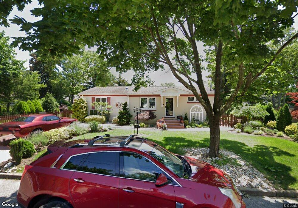
This home is located at 444 19th Ave, Brick, NJ 08724 and is currently estimated at $439,036, approximately $234 per square foot. 444 19th Ave is a home located in Ocean County with nearby schools including Veterans Memorial Elementary School, Veterans Memorial Middle School, and Brick Township Memorial High School.
Ownership History
Date
Name
Owned For
Owner Type
Purchase Details
Closed on
Mar 30, 2004
Current Estimated Value
Home Financials for this Owner
Home Financials are based on the most recent Mortgage that was taken out on this home.
Original Mortgage
$179,000
Outstanding Balance
$83,882
Interest Rate
5.6%
Mortgage Type
Purchase Money Mortgage
Estimated Equity
$355,154
Create a Home Valuation Report for This Property
The Home Valuation Report is an in-depth analysis detailing your home's value as well as a comparison with similar homes in the area
Home Values in the Area
Average Home Value in this Area
Purchase History
| Date | Buyer | Sale Price | Title Company |
|---|---|---|---|
| -- | $194,900 | -- | |
| Orr Anthony | $194,000 | Fidelity National Title Ins |
Source: Public Records
Mortgage History
| Date | Status | Borrower | Loan Amount |
|---|---|---|---|
| Open | Orr Anthony | $179,000 |
Source: Public Records
Tax History Compared to Growth
Tax History
| Year | Tax Paid | Tax Assessment Tax Assessment Total Assessment is a certain percentage of the fair market value that is determined by local assessors to be the total taxable value of land and additions on the property. | Land | Improvement |
|---|---|---|---|---|
| 2025 | $5,980 | $229,100 | $142,500 | $86,600 |
| 2024 | $5,675 | $229,100 | $142,500 | $86,600 |
| 2023 | $5,592 | $229,100 | $142,500 | $86,600 |
| 2022 | $5,592 | $229,100 | $142,500 | $86,600 |
| 2021 | $5,475 | $229,100 | $142,500 | $86,600 |
| 2020 | $5,404 | $229,100 | $142,500 | $86,600 |
| 2019 | $5,308 | $229,100 | $142,500 | $86,600 |
| 2018 | $5,187 | $229,100 | $142,500 | $86,600 |
| 2017 | $5,047 | $229,100 | $142,500 | $86,600 |
| 2016 | $5,020 | $229,100 | $142,500 | $86,600 |
| 2015 | $4,889 | $229,100 | $142,500 | $86,600 |
| 2014 | $4,848 | $229,100 | $142,500 | $86,600 |
Source: Public Records
Map
Nearby Homes
- 462 Austin Ave
- 291 Prospect Dr
- 270 Westwood Place
- 405 17th Ave
- 404 Driscol Dr
- 600 Driscol Dr
- 384 18th Ave
- 456 Rose Ave
- 302 Maxwell Ct
- 128 Harding Dr
- 528 Azalea Dr
- 491 Driscol Dr
- 853 Stengel Ave
- 116 Roosevelt Dr
- 861 Wraight Ave
- 411 Hulse Ave
- 10 Foxwood Ct Unit 93
- 775 Maple Ave
- 279 Old Squan Rd
- 27 Newport Ct Unit 239