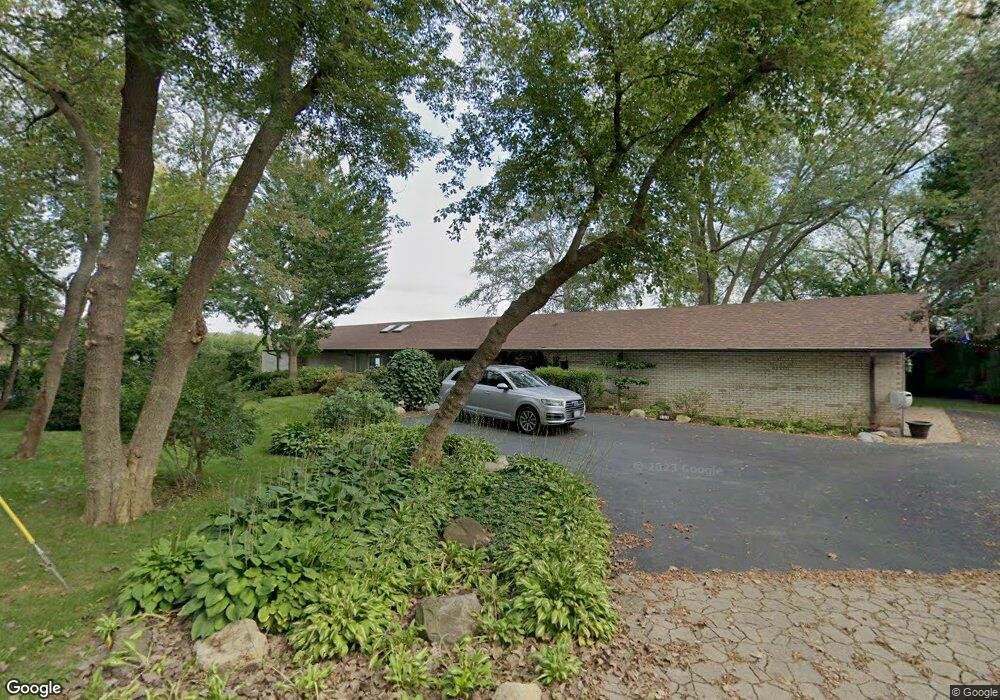
444 Appley Ave Unit 2 Libertyville, IL 60048
Estimated Value: $885,000 - $1,246,000
--
Bed
3
Baths
2,124
Sq Ft
$510/Sq Ft
Est. Value
About This Home
This home is located at 444 Appley Ave Unit 2, Libertyville, IL 60048 and is currently estimated at $1,083,900, approximately $510 per square foot. 444 Appley Ave Unit 2 is a home located in Lake County with nearby schools including Adler Park School, Highland Middle School, and Libertyville High School.
Ownership History
Date
Name
Owned For
Owner Type
Purchase Details
Closed on
Sep 17, 2025
Sold by
Atz Michael
Bought by
Atz Michael and Atz Marta
Current Estimated Value
Purchase Details
Closed on
Jan 29, 2019
Sold by
Atz Susan M and Atz Edward D
Bought by
Atz Michael
Purchase Details
Closed on
Oct 15, 2005
Sold by
Atz Edward D and Atz Susan M
Bought by
Atz Edward D and Atz Susan M
Purchase Details
Closed on
Jul 25, 1996
Sold by
Palmieri Vincent L and Palmieri Madeleine Y
Bought by
Atz Edward D and Atz Susan M
Create a Home Valuation Report for This Property
The Home Valuation Report is an in-depth analysis detailing your home's value as well as a comparison with similar homes in the area
Home Values in the Area
Average Home Value in this Area
Purchase History
| Date | Buyer | Sale Price | Title Company |
|---|---|---|---|
| Atz Michael | -- | None Listed On Document | |
| Atz Michael | -- | Attorney | |
| Atz Edward D | -- | -- | |
| Atz Edward D | $500,000 | Chicago Title Insurance Co |
Source: Public Records
Tax History Compared to Growth
Tax History
| Year | Tax Paid | Tax Assessment Tax Assessment Total Assessment is a certain percentage of the fair market value that is determined by local assessors to be the total taxable value of land and additions on the property. | Land | Improvement |
|---|---|---|---|---|
| 2024 | $23,417 | $332,593 | $178,492 | $154,101 |
| 2023 | $23,417 | $306,763 | $164,630 | $142,133 |
| 2022 | $26,093 | $337,263 | $188,431 | $148,832 |
| 2021 | $25,124 | $330,003 | $184,375 | $145,628 |
| 2020 | $24,180 | $324,455 | $181,275 | $143,180 |
| 2019 | $23,579 | $321,370 | $179,551 | $141,819 |
| 2018 | $25,180 | $349,098 | $215,453 | $133,645 |
| 2017 | $24,494 | $338,077 | $208,651 | $129,426 |
| 2016 | $23,689 | $331,425 | $197,830 | $133,595 |
| 2015 | $24,312 | $309,772 | $184,905 | $124,867 |
| 2014 | $22,579 | $277,834 | $165,840 | $111,994 |
| 2012 | $21,093 | $280,244 | $167,279 | $112,965 |
Source: Public Records
Map
Nearby Homes
- 224 Newberry Ave
- 217 E Church St
- 922 N Milwaukee Ave Unit A
- 601 Broadway St
- 1211 Parliament Ct
- 121 4th St
- 204 W Ellis Ave
- 112 3rd St
- 208 W Ellis Ave
- 212 W Ellis Ave
- 212 Elm Ct
- 505 Lange Ct
- 420 W Cook Ave
- 619 Parkside Ct
- 616 Parkside Ct
- 31132-31140 N Milwaukee Ave
- 662 Parkside Ct
- 694 Parkside Ct
- 15393 W Oak Spring Rd
- 308 Mckinley Ave