
Seller's Agent in 2022
Vickie Giles-Griffin
Re/Max Of Albany
116 Total Sales
Estimated Value: $51,000 - $98,000
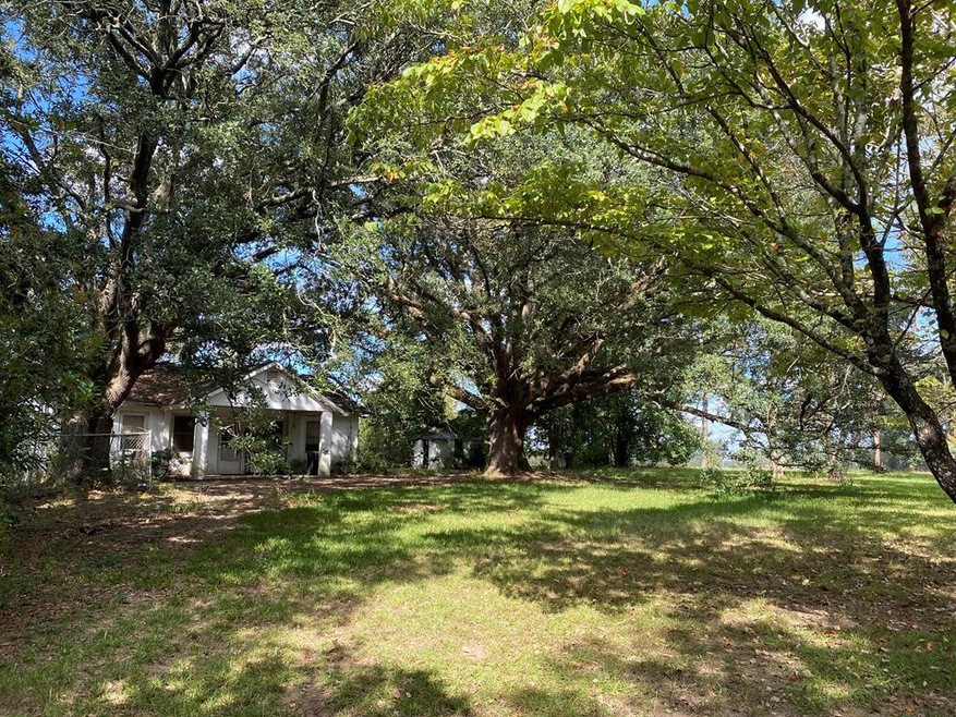
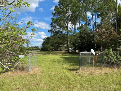
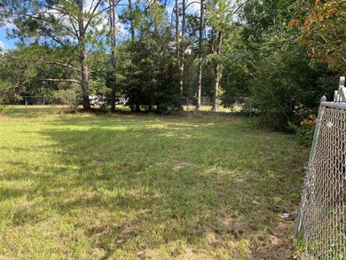
3 Bedroom 1 Bath Block Home that sits privately on a 0.9 Acre lot that is completely fenced with 2 entrances. There is a separate smaller fenced-in area approx 60x70. Would make for a good investment property. Close to Miller & MCLB. For more information contact a Realtor today!
Last Agent to Sell the Property
Re/Max Of Albany Brokerage Phone: 2294341600 License #47729 Listed on: 01/31/2022
Last Buyer's Agent
Re/Max Of Albany Brokerage Phone: 2294341600 License #47729 Listed on: 01/31/2022
| Date | Buyer | Sale Price | Title Company |
|---|---|---|---|
| Morales Alfonso Lopez | $35,000 | -- | |
| Casa Del Sol Mhp Albany Ga Llc | $3,191,912 | -- | |
| Tran Kimberly | $20,000 | -- | |
| Calhoun James Virgle | -- | -- | |
| Watson Mona O | $45,000 | -- | |
| Mercer David | -- | -- |
| Date | Event | Price | List to Sale | Price per Sq Ft | Prior Sale |
|---|---|---|---|---|---|
| 02/10/2022 02/10/22 | Sold | $35,000 | +75.0% | $30 / Sq Ft | |
| 01/31/2022 01/31/22 | Pending | -- | -- | -- | |
| 10/30/2020 10/30/20 | Sold | $20,000 | -- | $17 / Sq Ft | View Prior Sale |
| 10/22/2020 10/22/20 | Pending | -- | -- | -- |
| Year | Tax Paid | Tax Assessment Tax Assessment Total Assessment is a certain percentage of the fair market value that is determined by local assessors to be the total taxable value of land and additions on the property. | Land | Improvement |
|---|---|---|---|---|
| 2024 | $854 | $18,486 | $3,120 | $15,366 |
| 2023 | $647 | $18,486 | $3,120 | $15,366 |
| 2022 | $857 | $18,486 | $3,120 | $15,366 |
| 2021 | $343 | $18,486 | $3,120 | $15,366 |
| 2020 | $513 | $18,486 | $3,120 | $15,366 |
| 2019 | $514 | $18,486 | $3,120 | $15,366 |
| 2018 | $515 | $18,486 | $3,120 | $15,366 |
| 2017 | $471 | $18,486 | $3,120 | $15,366 |
| 2016 | $472 | $18,486 | $3,120 | $15,366 |
| 2015 | $472 | $18,486 | $3,120 | $15,366 |
| 2014 | $463 | $18,484 | $3,120 | $15,364 |
Seller's Agent in 2022
Vickie Giles-Griffin
Re/Max Of Albany
116 Total Sales
Seller's Agent in 2020
Carrie Hutchinson
Re/Max Of Albany
(229) 344-4992
86 Total Sales
Source: Albany Board of REALTORS®
MLS Number: 149390
APN: 00138-00001-04A