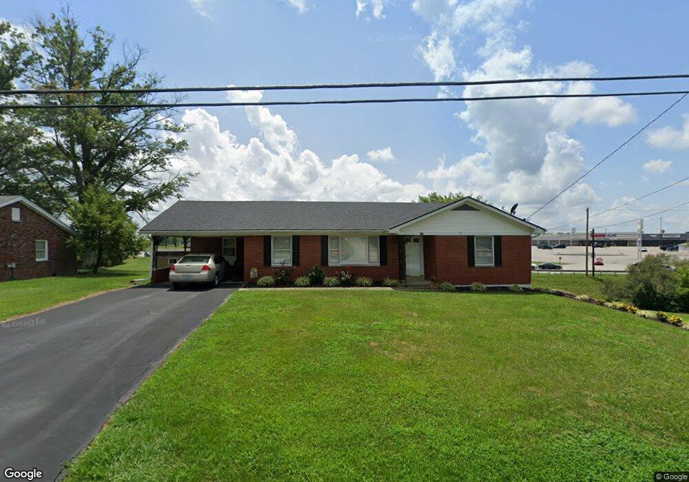
444 Cardinal Dr Harrodsburg, KY 40330
Estimated Value: $185,500 - $349,000
2
Beds
1
Bath
1,368
Sq Ft
$190/Sq Ft
Est. Value
About This Home
This home is located at 444 Cardinal Dr, Harrodsburg, KY 40330 and is currently estimated at $259,375, approximately $189 per square foot. 444 Cardinal Dr is a home located in Mercer County with nearby schools including Mercer County Elementary School, Mercer County Intermediate School, and King Middle School.
Ownership History
Date
Name
Owned For
Owner Type
Purchase Details
Closed on
Aug 15, 2007
Sold by
Ellis Pamela Mcginnis and Estte Of Ernestine
Bought by
Cummins David and Cummins Linda
Current Estimated Value
Home Financials for this Owner
Home Financials are based on the most recent Mortgage that was taken out on this home.
Original Mortgage
$90,000
Outstanding Balance
$57,100
Interest Rate
6.7%
Estimated Equity
$202,275
Create a Home Valuation Report for This Property
The Home Valuation Report is an in-depth analysis detailing your home's value as well as a comparison with similar homes in the area
Home Values in the Area
Average Home Value in this Area
Purchase History
| Date | Buyer | Sale Price | Title Company |
|---|---|---|---|
| Cummins David | $112,500 | -- |
Source: Public Records
Mortgage History
| Date | Status | Borrower | Loan Amount |
|---|---|---|---|
| Open | Cummins David | $90,000 |
Source: Public Records
Tax History Compared to Growth
Tax History
| Year | Tax Paid | Tax Assessment Tax Assessment Total Assessment is a certain percentage of the fair market value that is determined by local assessors to be the total taxable value of land and additions on the property. | Land | Improvement |
|---|---|---|---|---|
| 2024 | $1,280 | $161,184 | $10,000 | $151,184 |
| 2023 | $804 | $117,774 | $0 | $0 |
| 2022 | $859 | $117,774 | $0 | $0 |
| 2021 | $869 | $117,774 | $0 | $0 |
| 2020 | $882 | $112,500 | $15,000 | $97,500 |
| 2019 | $836 | $112,500 | $15,000 | $97,500 |
| 2018 | $835 | $112,500 | $0 | $0 |
| 2017 | $805 | $112,500 | $0 | $0 |
| 2016 | $797 | $112,500 | $0 | $0 |
| 2015 | $783 | $112,500 | $15,000 | $97,500 |
| 2014 | $783 | $112,500 | $15,000 | $97,500 |
| 2010 | -- | $112,500 | $15,000 | $97,500 |
Source: Public Records
Map
Nearby Homes
- 547 Legion Dr Unit 6
- 547 Legion Dr
- 547 Legion Dr Unit 5
- 547 Legion Dr Unit 4
- 547 Legion Dr Unit 7
- 630 Elizabeth Ct
- Lots 28-35 Beaumont Inn Dr
- 655 Beaumont Ave
- 404 Goddard St
- 214 Sparrow Ln
- 517 Beaumont Ave
- 441 Magoffin St
- 496 Atlee Dr
- 497 Atlee Dr
- 340 Dixie Manor
- 501 Ashley Dr
- 471 Chestnut St
- 435 Linden Ave
- 549 Poteet St
- 531 Fairway Dr
- 454 Cardinal Dr
- 441 Cardinal Dr
- 451 Cardinal Dr
- 431 Cardinal Dr
- 905 S College St
- 464 Cardinal Dr
- 461 Cardinal Dr
- 501 Joseph Dr
- 471 Cardinal Dr
- 474 Cardinal Dr
- 481 Cardinal Dr
- 484 Cardinal Dr
- 483 Cardinal Dr
- 912 Bob o Link Dr
- 908 Bob o Link Dr
- 922 Bob o Link Dr
- 902 Bob o Link Dr
- 908 Bob-O-link Dr
- 942 Bob o Link Dr
- 922 Bob-O-link Dr