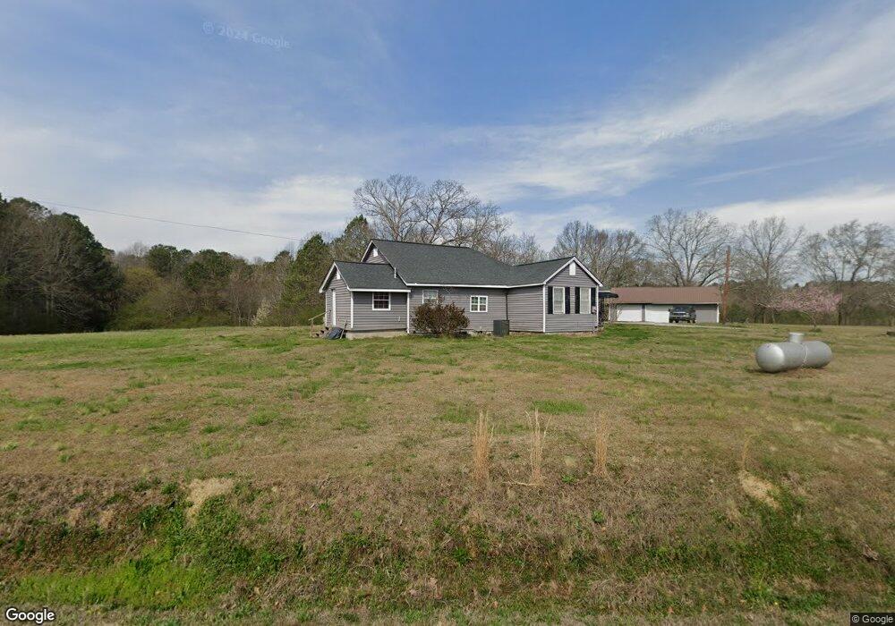
444 Edwards Rd Cedartown, GA 30125
Estimated Value: $239,000 - $251,000
2
Beds
1
Bath
1,324
Sq Ft
$185/Sq Ft
Est. Value
About This Home
This home is located at 444 Edwards Rd, Cedartown, GA 30125 and is currently estimated at $245,558, approximately $185 per square foot. 444 Edwards Rd is a home located in Polk County with nearby schools including Cedar Christian School.
Ownership History
Date
Name
Owned For
Owner Type
Purchase Details
Closed on
Jul 16, 2015
Sold by
Coleman James David
Bought by
Streetman Melissa Rene
Current Estimated Value
Purchase Details
Closed on
Jun 14, 2012
Sold by
Coleman David
Bought by
Coleman David and Coleman Martha
Purchase Details
Closed on
Jan 8, 2008
Sold by
Not Provided
Bought by
Coleman David
Purchase Details
Closed on
Jul 31, 2000
Sold by
Coleman James F and Coleman Lois M
Bought by
Coleman David
Purchase Details
Closed on
Mar 11, 1992
Sold by
Coleman James F
Bought by
Coleman James F and Coleman Lois M
Purchase Details
Closed on
Apr 18, 1963
Sold by
Coleman Daniel R
Bought by
Coleman James Fred
Purchase Details
Closed on
May 16, 1955
Bought by
Coleman Daniel R
Create a Home Valuation Report for This Property
The Home Valuation Report is an in-depth analysis detailing your home's value as well as a comparison with similar homes in the area
Home Values in the Area
Average Home Value in this Area
Purchase History
| Date | Buyer | Sale Price | Title Company |
|---|---|---|---|
| Streetman Melissa Rene | -- | -- | |
| Coleman David | -- | -- | |
| Coleman David | -- | -- | |
| Coleman David | -- | -- | |
| Coleman James F | -- | -- | |
| Coleman James Fred | -- | -- | |
| Coleman Daniel R | -- | -- |
Source: Public Records
Tax History Compared to Growth
Tax History
| Year | Tax Paid | Tax Assessment Tax Assessment Total Assessment is a certain percentage of the fair market value that is determined by local assessors to be the total taxable value of land and additions on the property. | Land | Improvement |
|---|---|---|---|---|
| 2024 | $1,615 | $77,275 | $20,607 | $56,668 |
| 2023 | $1,350 | $56,899 | $20,607 | $36,292 |
| 2022 | $1,019 | $44,942 | $13,738 | $31,204 |
| 2021 | $1,032 | $44,942 | $13,738 | $31,204 |
| 2020 | $1,034 | $44,942 | $13,738 | $31,204 |
| 2019 | $993 | $38,986 | $13,738 | $25,248 |
| 2018 | $758 | $29,491 | $13,738 | $15,753 |
| 2017 | $748 | $29,491 | $13,738 | $15,753 |
| 2016 | $795 | $31,203 | $15,450 | $15,753 |
| 2015 | $860 | $31,497 | $15,450 | $16,047 |
| 2014 | $866 | $31,497 | $15,450 | $16,047 |
| 2013 | -- | $31,497 | $15,450 | $16,047 |
Source: Public Records
Map
Nearby Homes
- 1849 Prior Station Rd Unit 77.57 ACRES
- 1849 Prior Station Rd
- 148 Persons Rd
- 323 Mountain Home Rd
- 0 Mountain Home Rd Unit 1020-B 10351940
- 0 Mountain Home Rd Unit 1020-C 10351948
- 0 Mountain Home Rd Unit 1020-A 10351930
- 35 Harris Loop
- 0 Old Potash Rd Unit 7675402
- 0 Old Potash Rd Unit 10636176
- 00 Cornelius Rd
- 1806 Piedmont Hwy
- 1810 Piedmont Hwy
- 0 Akes Station Rd Unit 25208781
- 0 Akes Station Rd Unit 25208783
- 0 Akes Station Rd Unit 25208784
- 0 Akes Station Rd Unit 25208785
- 0 Akes Station Rd Unit 25208782
- 382 5th St
- 293 4th St
- 421 Edwards Rd
- 0 Edwards Rd Unit 1364098
- 0 Edwards Rd Unit 1359155
- 1612 Prior Station Rd
- 520 Edwards Rd
- 474 Edwards Rd
- 1626 Prior Station Rd
- 363 Edwards Rd
- 336 Edwards Rd
- 1495 Prior Station Rd
- 353 Edwards Rd
- 343 Edwards Rd
- Tract 4 Prior Station Rd
- 318 Edwards Rd
- 331 Edwards Rd
- 317 Edwards Rd
- 1485 Prior Station Rd
- 1475 Prior Station Rd
- 1472 Prior Station Rd
- 607 Edwards Rd