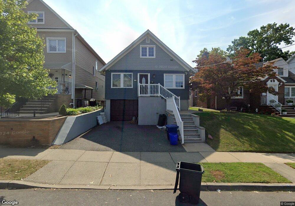
444 Forest Ave Lyndhurst, NJ 07071
Estimated Value: $639,000 - $859,000
4
Beds
2
Baths
2,115
Sq Ft
$348/Sq Ft
Est. Value
About This Home
This home is located at 444 Forest Ave, Lyndhurst, NJ 07071 and is currently estimated at $736,069, approximately $348 per square foot. 444 Forest Ave is a home located in Bergen County with nearby schools including Lyndhurst High School and Sacred Heart School.
Ownership History
Date
Name
Owned For
Owner Type
Purchase Details
Closed on
Jan 19, 2018
Sold by
Sgroi Philip A and Sgroi Heidi
Bought by
Sgroi Vita
Current Estimated Value
Home Financials for this Owner
Home Financials are based on the most recent Mortgage that was taken out on this home.
Original Mortgage
$315,679
Outstanding Balance
$267,611
Interest Rate
4.12%
Mortgage Type
FHA
Estimated Equity
$468,458
Purchase Details
Closed on
Jun 22, 2017
Sold by
Sgroi Philip A and Sgroi Vita
Bought by
Sgroi Philip A and Sgroi Heidi
Purchase Details
Closed on
Sep 11, 1998
Sold by
Mustardo Julian
Bought by
Mustardo Julian
Create a Home Valuation Report for This Property
The Home Valuation Report is an in-depth analysis detailing your home's value as well as a comparison with similar homes in the area
Home Values in the Area
Average Home Value in this Area
Purchase History
| Date | Buyer | Sale Price | Title Company |
|---|---|---|---|
| Sgroi Vita | $365,000 | -- | |
| Sgroi Philip A | -- | None Available | |
| Mustardo Julian | -- | -- |
Source: Public Records
Mortgage History
| Date | Status | Borrower | Loan Amount |
|---|---|---|---|
| Open | Sgroi Vita | $315,679 |
Source: Public Records
Tax History Compared to Growth
Tax History
| Year | Tax Paid | Tax Assessment Tax Assessment Total Assessment is a certain percentage of the fair market value that is determined by local assessors to be the total taxable value of land and additions on the property. | Land | Improvement |
|---|---|---|---|---|
| 2025 | $11,855 | $574,600 | $281,300 | $293,300 |
| 2024 | $11,420 | $568,300 | $278,300 | $290,000 |
| 2023 | $9,951 | $562,000 | $275,300 | $286,700 |
| 2022 | $9,951 | $313,700 | $170,700 | $143,000 |
| 2021 | $9,388 | $308,800 | $170,700 | $138,100 |
| 2020 | $9,184 | $308,800 | $170,700 | $138,100 |
| 2019 | $9,116 | $308,800 | $170,700 | $138,100 |
| 2018 | $9,190 | $308,800 | $170,700 | $138,100 |
| 2017 | $8,958 | $308,800 | $170,700 | $138,100 |
| 2016 | $8,758 | $308,800 | $170,700 | $138,100 |
| 2015 | $8,483 | $308,800 | $170,700 | $138,100 |
| 2014 | $8,372 | $308,800 | $170,700 | $138,100 |
Source: Public Records
Map
Nearby Homes
- 448 Fern Ave
- 424 Page Ave
- 524 Octavia Place
- 518 8th St
- 549-1-551 Laurel Ave
- 533 Kingsland Ave
- 416 Kingsland Ave
- 310 Lincoln Ave
- 614 10th St
- 418 Stuyvesant Ave
- 506 Park Place
- 325 Valley Brook Ave
- 258 Kingsland Ave
- 274 Warren St
- 249-251 Sanford Ave
- 237 Kingsland Ave
- 217 Page Ave
- 683 Kingsland Ave
- 471 Harding Ave
- 561 New York Ave