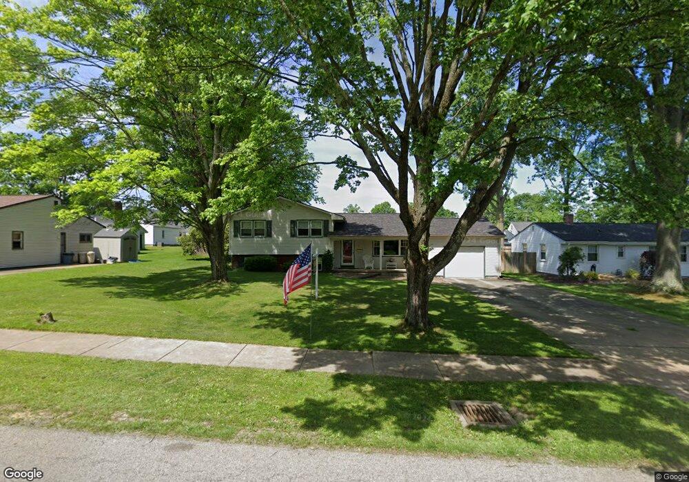
444 Hood Dr Canfield, OH 44406
Estimated Value: $267,000 - $292,000
3
Beds
2
Baths
1,892
Sq Ft
$149/Sq Ft
Est. Value
About This Home
This home is located at 444 Hood Dr, Canfield, OH 44406 and is currently estimated at $281,208, approximately $148 per square foot. 444 Hood Dr is a home located in Mahoning County with nearby schools including Canfield Village Middle School and Canfield High School.
Ownership History
Date
Name
Owned For
Owner Type
Purchase Details
Closed on
Mar 23, 2022
Sold by
Wagner Kenneth T and Wagner Isabel
Bought by
Oakley Vicky L
Current Estimated Value
Purchase Details
Closed on
Mar 2, 2011
Sold by
Frazzini Theodore J and Frazzini Betty J
Bought by
Carney Kimberly A
Home Financials for this Owner
Home Financials are based on the most recent Mortgage that was taken out on this home.
Original Mortgage
$80,000
Interest Rate
4.78%
Mortgage Type
New Conventional
Purchase Details
Closed on
Jul 11, 2000
Sold by
Baker Kenneth P and Baker Catherine S
Bought by
Frazzini Theodore J and Frazzini Betty J
Purchase Details
Closed on
Dec 2, 1971
Bought by
Baker Kenneth P and C S
Create a Home Valuation Report for This Property
The Home Valuation Report is an in-depth analysis detailing your home's value as well as a comparison with similar homes in the area
Home Values in the Area
Average Home Value in this Area
Purchase History
| Date | Buyer | Sale Price | Title Company |
|---|---|---|---|
| Oakley Vicky L | $200,500 | Stewart Title Guaranty Company | |
| Carney Kimberly A | $135,000 | Attorney | |
| Frazzini Theodore J | $119,000 | -- | |
| Baker Kenneth P | -- | -- |
Source: Public Records
Mortgage History
| Date | Status | Borrower | Loan Amount |
|---|---|---|---|
| Previous Owner | Carney Kimberly A | $80,000 |
Source: Public Records
Tax History Compared to Growth
Tax History
| Year | Tax Paid | Tax Assessment Tax Assessment Total Assessment is a certain percentage of the fair market value that is determined by local assessors to be the total taxable value of land and additions on the property. | Land | Improvement |
|---|---|---|---|---|
| 2024 | $3,755 | $87,110 | $9,790 | $77,320 |
| 2023 | $3,695 | $87,110 | $9,790 | $77,320 |
| 2022 | $2,888 | $54,150 | $9,320 | $44,830 |
| 2021 | $2,802 | $54,150 | $9,320 | $44,830 |
| 2020 | $2,814 | $54,150 | $9,320 | $44,830 |
| 2019 | $2,587 | $45,180 | $9,320 | $35,860 |
| 2018 | $2,556 | $45,180 | $9,320 | $35,860 |
| 2017 | $2,553 | $45,180 | $9,320 | $35,860 |
| 2016 | $2,337 | $42,130 | $6,990 | $35,140 |
| 2015 | $2,286 | $42,130 | $6,990 | $35,140 |
| 2014 | $2,295 | $42,130 | $6,990 | $35,140 |
| 2013 | $2,212 | $42,130 | $6,990 | $35,140 |
Source: Public Records
Map
Nearby Homes
- 459 Holly St
- 80 Squires Ct
- 227 Cross St
- 419 Carriage Hill Dr
- 473 Carriage Hill Dr
- 40 Barnstone Ln Unit 17
- 124 Wadsworth St
- 125 Callahan Rd
- 5060 Leffingwell Rd
- 78 Neff Dr
- 38 Skyline Dr
- 58 Skyline Dr
- 102 Skyline Dr
- 4808 Leffingwell Rd
- 100 Talsman Dr
- 120 Talsman Dr Unit 4
- 5025 Macy Ln
- 5034 Macy Ln
- 321 Hilltop Blvd
- 331 Verdant Ln
- 140 Fairground Blvd
- 461 Fairview Ave
- 120 Fairground Blvd
- 451 Fairview Ave
- 445 Fairview Ave
- 441 Hood Dr
- 202 Fairground Blvd
- 433 Hood Dr
- 110 Fairground Blvd
- 425 Fairview Ave
- 414 Hood Dr
- 421 Hood Dr
- 208 Fairground Blvd
- 405 Fairview Ave
- 411 Hood Dr
- 155 Indian Lake Blvd
- 50 Fairground Blvd
- 141 Fairground Blvd
- 131 Fairground Blvd
- 462 Fairview Ave