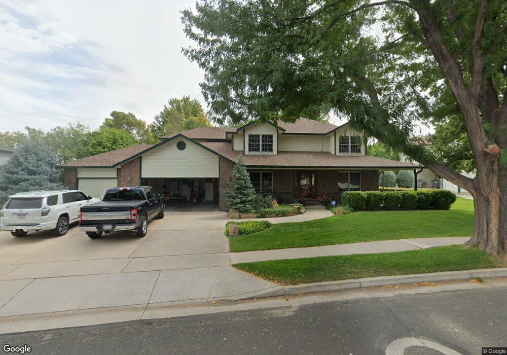
444 N Wyndham Ave Greeley, CO 80634
Estimated Value: $564,630 - $694,000
4
Beds
5
Baths
2,579
Sq Ft
$250/Sq Ft
Est. Value
About This Home
This home is located at 444 N Wyndham Ave, Greeley, CO 80634 and is currently estimated at $644,908, approximately $250 per square foot. 444 N Wyndham Ave is a home located in Weld County with nearby schools including Winograd K-8 Elementary School, Northridge High School, and West Ridge Academy Charter.
Ownership History
Date
Name
Owned For
Owner Type
Purchase Details
Closed on
Mar 27, 2018
Sold by
Hughes Vicki K and Hughes Gregory L
Bought by
Incline Minerals Llc
Current Estimated Value
Purchase Details
Closed on
Mar 6, 2013
Sold by
Hughes Vicki K
Bought by
Hughes Gregory L and Hughes Vicki K
Purchase Details
Closed on
Dec 23, 2008
Sold by
Hughes Gregory L and Hughes Vicki K
Bought by
Hughes Vicki K
Purchase Details
Closed on
Oct 4, 1990
Sold by
Tech Center Properties
Bought by
Hughes Gregory L and Hughes Vicki K
Purchase Details
Closed on
Aug 30, 1990
Create a Home Valuation Report for This Property
The Home Valuation Report is an in-depth analysis detailing your home's value as well as a comparison with similar homes in the area
Home Values in the Area
Average Home Value in this Area
Purchase History
| Date | Buyer | Sale Price | Title Company |
|---|---|---|---|
| Incline Minerals Llc | -- | None Available | |
| Hughes Gregory L | -- | None Available | |
| Hughes Vicki K | -- | None Available | |
| Hughes Gregory L | $24,500 | -- | |
| -- | -- | -- |
Source: Public Records
Tax History Compared to Growth
Tax History
| Year | Tax Paid | Tax Assessment Tax Assessment Total Assessment is a certain percentage of the fair market value that is determined by local assessors to be the total taxable value of land and additions on the property. | Land | Improvement |
|---|---|---|---|---|
| 2025 | $2,256 | $33,840 | $5,630 | $28,210 |
| 2024 | $2,256 | $33,840 | $5,630 | $28,210 |
| 2023 | $2,696 | $37,210 | $6,090 | $31,120 |
| 2022 | $2,377 | $27,130 | $4,870 | $22,260 |
| 2021 | $2,452 | $27,910 | $5,010 | $22,900 |
| 2020 | $2,389 | $27,280 | $3,930 | $23,350 |
| 2019 | $2,396 | $27,280 | $3,930 | $23,350 |
| 2018 | $2,212 | $26,570 | $3,670 | $22,900 |
| 2017 | $2,224 | $26,570 | $3,670 | $22,900 |
| 2016 | $1,478 | $19,870 | $3,820 | $16,050 |
| 2015 | $1,473 | $19,870 | $3,820 | $16,050 |
| 2014 | $1,665 | $21,920 | $3,820 | $18,100 |
Source: Public Records
Map
Nearby Homes
- 419 N Brisbane Ave
- 7141 W Canberra St
- 7200 W Canberra Street Dr
- 608 Riverside Ct
- 6911 W 3rd St Unit 920
- 6911 W 3rd St Unit 810
- 525 Sage Ave
- 117 N 66th Ave
- 6603 W 3rd St Unit 1620
- 317 N 64th Ave
- 6806 W 3rd St Unit 38
- BRIDGEPORT Plan at Northridge Estates
- 6618 2nd St
- HENNESSY Plan at Northridge Estates
- HENLEY Plan at Northridge Estates
- 6614 2nd St
- 516 Deville Dr
- 102 65th Ave
- 6608 W 3rd St Unit 69
- 6608 W 3rd St Unit 35-58
- 452 N Wyndham Ave
- 436 N Wyndham Ave
- 443 N Brisbane Ave
- 435 N Brisbane Ave
- 451 N Brisbane Ave
- 460 N Wyndham Ave
- 441 N Wyndham Ave
- 449 N Wyndham Ave
- 459 N Brisbane Ave
- 427 N Brisbane Ave
- 428 N Wyndham Ave
- 457 N Wyndham Ave
- 433 N Wyndham Ave
- 468 N Wyndham Ave
- 467 N Brisbane Ave
- 465 N Wyndham Ave
- 420 N Wyndham Ave
- 442 N Brisbane Ave
- 434 N Brisbane Ave
- 425 N Wyndham Ave