444 NW Armstrong Cemetery Rd Highfill, AR 72713
Estimated Value: $842,000 - $1,475,000
--
Bed
--
Bath
--
Sq Ft
80.26
Acres
About This Home
This home is located at 444 NW Armstrong Cemetery Rd, Highfill, AR 72713 and is currently estimated at $1,158,500. 444 NW Armstrong Cemetery Rd is a home with nearby schools including Vaughn Elementary, Grimsley Junior High School, and Creekside Middle School.
Ownership History
Date
Name
Owned For
Owner Type
Purchase Details
Closed on
Apr 10, 2017
Sold by
Mathias Samuel H
Bought by
Mathias Ranch Llc
Current Estimated Value
Purchase Details
Closed on
Jun 25, 2015
Sold by
Simmons First National Bank
Bought by
Mathias Samuel H
Home Financials for this Owner
Home Financials are based on the most recent Mortgage that was taken out on this home.
Original Mortgage
$2,350,000
Interest Rate
3.83%
Mortgage Type
Future Advance Clause Open End Mortgage
Purchase Details
Closed on
Apr 10, 2000
Bought by
Weston-Ar Teacher Ret 2P
Purchase Details
Closed on
May 10, 1990
Bought by
Weston T
Create a Home Valuation Report for This Property
The Home Valuation Report is an in-depth analysis detailing your home's value as well as a comparison with similar homes in the area
Home Values in the Area
Average Home Value in this Area
Purchase History
| Date | Buyer | Sale Price | Title Company |
|---|---|---|---|
| Mathias Ranch Llc | -- | None Available | |
| Mathias Samuel H | $4,449,033 | Waco Title | |
| Weston-Ar Teacher Ret 2P | $375,000 | -- | |
| Weston T | -- | -- |
Source: Public Records
Mortgage History
| Date | Status | Borrower | Loan Amount |
|---|---|---|---|
| Previous Owner | Mathias Samuel H | $2,350,000 |
Source: Public Records
Tax History Compared to Growth
Tax History
| Year | Tax Paid | Tax Assessment Tax Assessment Total Assessment is a certain percentage of the fair market value that is determined by local assessors to be the total taxable value of land and additions on the property. | Land | Improvement |
|---|---|---|---|---|
| 2025 | $1,420 | $23,385 | $4,208 | $19,177 |
| 2024 | $1,434 | $23,385 | $4,208 | $19,177 |
| 2023 | $1,421 | $23,180 | $4,003 | $19,177 |
| 2022 | $1,254 | $20,030 | $4,000 | $16,030 |
| 2021 | $1,251 | $20,030 | $4,000 | $16,030 |
| 2020 | $1,254 | $19,840 | $3,810 | $16,030 |
| 2019 | $1,254 | $19,840 | $3,810 | $16,030 |
| 2018 | $320 | $5,070 | $3,810 | $1,260 |
| 2017 | $311 | $5,070 | $3,810 | $1,260 |
| 2016 | $311 | $5,070 | $3,810 | $1,260 |
| 2015 | $205 | $3,350 | $3,350 | $0 |
| 2014 | $205 | $3,350 | $3,350 | $0 |
Source: Public Records
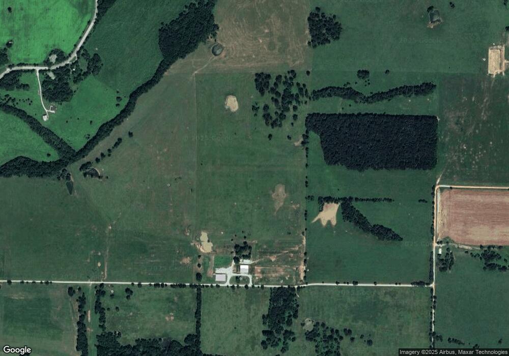
Map
Nearby Homes
- 14400 W Cowan Rd
- 492 NW Cowan Ave
- 14400 Cowan Rd
- 0 Hutchens Rd
- 81 ac N Center St
- 19.99 ac NW Hutchens Rd
- 1571 N Center St
- 541 Ave
- 414 NW 59 Ave
- 406 NW 59th Ave
- 404 NW 59th Ave
- 5901 NW Silas St
- 5900 NW Hancock St
- 5902 NW Hoover St
- 5905 NW Ettie May St
- 5909 NW Reynolds St
- 5908 NW Meade St
- 5909 NW Grant St
- 5908 NW Sherman St
- 1257 NW Malone Rd
- 13395 Cowan Rd
- 1025 W Highway 12
- 310 NW Cowan Ave
- 58.38 AC W Highway 12
- 14379 W Highway 12
- 281 NW Cowan Ave
- 977 W Highway 12
- 977 W Hwy 12
- 1368 12 Hwy
- 1601 Snyder Wolf Cove
- 332 NW Cowan Ave
- 1170 W Highway 12
- 14378 W Highway 12
- 1587 W Highway 12
- 456 NW Cowan Ave
- 951 NW Pautsky Ave
- 1600 Snyder Wolf Cove
- 959 NW Pautsky Ave
- 14237 Pautsky Ln
- 1616 Snyder Wolf Cove