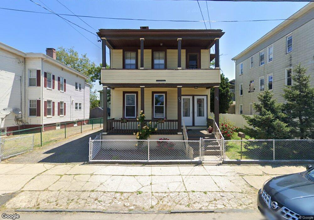
444 Pembroke St Bridgeport, CT 06608
East Side Bridgeport NeighborhoodEstimated Value: $398,905 - $484,000
6
Beds
2
Baths
2,650
Sq Ft
$172/Sq Ft
Est. Value
About This Home
This home is located at 444 Pembroke St, Bridgeport, CT 06608 and is currently estimated at $456,476, approximately $172 per square foot. 444 Pembroke St is a home located in Fairfield County with nearby schools including Waltersville School, Harding High School, and Capital Prep Harbor Upper School.
Ownership History
Date
Name
Owned For
Owner Type
Purchase Details
Closed on
Jan 4, 2021
Sold by
Acevedo Mariano
Bought by
Acevedo Natalie and Rodriguez Jose F
Current Estimated Value
Home Financials for this Owner
Home Financials are based on the most recent Mortgage that was taken out on this home.
Original Mortgage
$220,500
Outstanding Balance
$196,797
Interest Rate
2.71%
Mortgage Type
Purchase Money Mortgage
Estimated Equity
$259,679
Purchase Details
Closed on
Feb 24, 1977
Bought by
Acevedo Mariano
Create a Home Valuation Report for This Property
The Home Valuation Report is an in-depth analysis detailing your home's value as well as a comparison with similar homes in the area
Home Values in the Area
Average Home Value in this Area
Purchase History
| Date | Buyer | Sale Price | Title Company |
|---|---|---|---|
| Acevedo Natalie | $245,000 | None Available | |
| Acevedo Natalie | $245,000 | None Available | |
| Acevedo Mariano | -- | -- |
Source: Public Records
Mortgage History
| Date | Status | Borrower | Loan Amount |
|---|---|---|---|
| Open | Acevedo Natalie | $220,500 | |
| Closed | Acevedo Natalie | $220,500 |
Source: Public Records
Tax History Compared to Growth
Tax History
| Year | Tax Paid | Tax Assessment Tax Assessment Total Assessment is a certain percentage of the fair market value that is determined by local assessors to be the total taxable value of land and additions on the property. | Land | Improvement |
|---|---|---|---|---|
| 2025 | $6,493 | $149,426 | $37,486 | $111,940 |
| 2024 | $6,493 | $149,426 | $37,486 | $111,940 |
| 2023 | $6,493 | $149,426 | $37,486 | $111,940 |
| 2022 | $6,493 | $149,426 | $37,486 | $111,940 |
| 2021 | $6,493 | $149,426 | $37,486 | $111,940 |
| 2020 | $5,941 | $110,040 | $17,740 | $92,300 |
| 2019 | $5,941 | $110,040 | $17,740 | $92,300 |
| 2018 | $5,983 | $110,040 | $17,740 | $92,300 |
| 2017 | $5,983 | $110,040 | $17,740 | $92,300 |
| 2016 | $5,983 | $110,040 | $17,740 | $92,300 |
| 2015 | $6,568 | $155,650 | $30,060 | $125,590 |
| 2014 | $6,568 | $155,650 | $30,060 | $125,590 |
Source: Public Records
Map
Nearby Homes
- 509 Pembroke St
- 249 Hough Ave Unit 251
- 445 Nichols St
- 60 Gilmore St
- 691 E Main St
- 520 Seaview Ave
- 696 Kossuth St Unit 698
- 704 Maple St
- 800 Seaview Ave Unit 790-3
- 79 William St
- 180 Holly St
- 746 Maple St
- 247 6th St
- 40 5th St
- 228 Holly St Unit 230
- 93 Clifford St
- 147 Helen St Unit 149
- 221 Bunnell St
- 54 6th St
- 485 Noble Ave
- 454 Pembroke St
- 454 Pembroke St Unit RM 2
- 454 Pembroke St Unit RM 1
- 436 Pembroke St
- 424 Pembroke St
- 353 Nichols St
- 154 Cedar St Unit 156
- 347 Nichols St
- 427 Pembroke St Unit A
- 144 Cedar St Unit 146
- 447 Pembroke St
- 441 Pembroke St
- 303 Nichols St
- 303-307 Nichols St Unit 1st Floor
- 463 Pembroke St
- 361 Nichols St Unit 363
- 361 Nichols St Unit 2
- 361 Nichols St Unit 1
- 166 Cedar St Unit 2
- 371 Nichols St