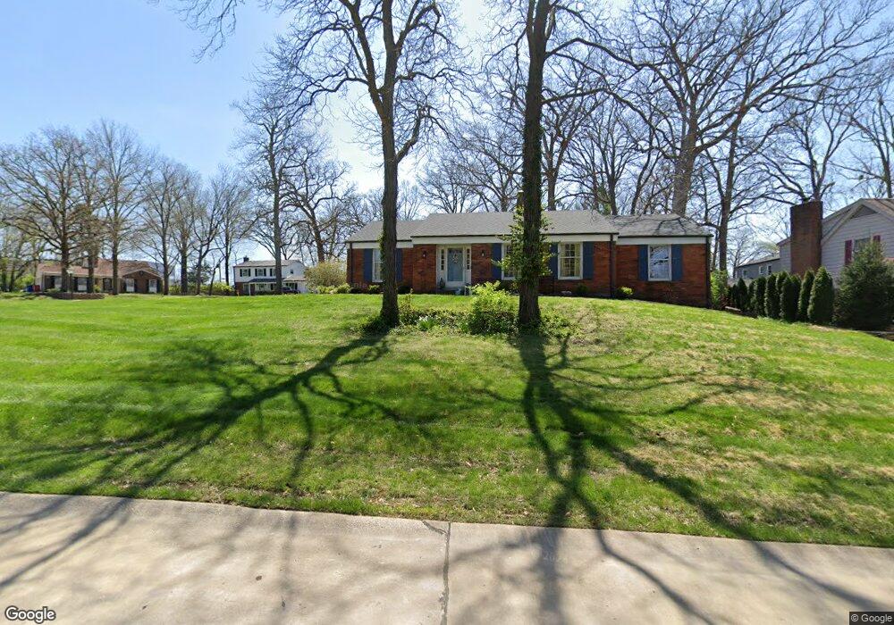
444 Wicksworth Ln Saint Louis, MO 63122
Estimated Value: $424,000 - $511,812
3
Beds
2
Baths
1,886
Sq Ft
$244/Sq Ft
Est. Value
About This Home
This home is located at 444 Wicksworth Ln, Saint Louis, MO 63122 and is currently estimated at $460,203, approximately $244 per square foot. 444 Wicksworth Ln is a home located in St. Louis County with nearby schools including Crestwood Elementary School, Truman Middle School, and Lindbergh High School.
Ownership History
Date
Name
Owned For
Owner Type
Purchase Details
Closed on
Jan 27, 2012
Sold by
Arnone Jill C
Bought by
Arnone Jill C and Jill C Arnone Revocable Trust Agreement
Current Estimated Value
Purchase Details
Closed on
Mar 31, 2010
Sold by
Ward James and Ward Janet
Bought by
Arnone Jill C
Purchase Details
Closed on
Oct 23, 1998
Sold by
Janda Mercedes A
Bought by
Ward Janet and Mullen Nancy
Create a Home Valuation Report for This Property
The Home Valuation Report is an in-depth analysis detailing your home's value as well as a comparison with similar homes in the area
Home Values in the Area
Average Home Value in this Area
Purchase History
| Date | Buyer | Sale Price | Title Company |
|---|---|---|---|
| Arnone Jill C | -- | None Available | |
| Arnone Jill C | $265,000 | None Available | |
| Ward Janet | -- | -- |
Source: Public Records
Tax History Compared to Growth
Tax History
| Year | Tax Paid | Tax Assessment Tax Assessment Total Assessment is a certain percentage of the fair market value that is determined by local assessors to be the total taxable value of land and additions on the property. | Land | Improvement |
|---|---|---|---|---|
| 2025 | $5,130 | $78,390 | $39,670 | $38,720 |
| 2024 | $5,130 | $71,740 | $35,700 | $36,040 |
| 2023 | $5,119 | $71,740 | $35,700 | $36,040 |
| 2022 | $4,788 | $64,540 | $35,700 | $28,840 |
| 2021 | $4,764 | $64,540 | $35,700 | $28,840 |
| 2020 | $4,581 | $59,920 | $19,490 | $40,430 |
| 2019 | $4,569 | $59,920 | $19,490 | $40,430 |
| 2018 | $3,348 | $41,040 | $11,760 | $29,280 |
| 2017 | $3,312 | $41,040 | $11,760 | $29,280 |
| 2016 | $3,309 | $41,040 | $13,740 | $27,300 |
| 2015 | $3,293 | $41,040 | $13,740 | $27,300 |
| 2014 | $3,374 | $41,460 | $16,280 | $25,180 |
Source: Public Records
Map
Nearby Homes
- 1 Boxwood Ln
- 1211 S Geyer Rd
- 119 Monica Dr
- 118 Monica Dr
- 12420 Rott Rd Unit 1B
- 222 Charmers Ct Unit 222
- 1074 Brooksgate Manor Dr
- 1011 Brooksgate Manor Dr
- 12685 Alberts Laumeier Ct
- 303 Danworth Ct
- 1264 Wilton Ln
- 10835 Big Bend Rd
- 1053 Geyer Grove Unit 9
- 301 Memphis St
- 1016 Forest Ave
- 343 Memphis St
- 322 Chicago St
- 338 Memphis St
- 318 Chicago St
- 362 Memphis St
- 450 Wicksworth Ln
- 406 Wicksworth Ln
- 1440 Royal Springs Dr
- 443 Wicksworth Ln
- 451 Wicksworth Ln
- 431 Wicksworth Ln
- 1448 Royal Springs Dr
- 400 Wicksworth Ln
- 415 Wicksworth Ln
- 405 Wicksworth Ln
- 419 Wicksworth Ln
- 423 Wicksworth Ln
- 1454 Royal Springs Dr
- 1410 Royal Springs Dr
- 1429 Royal Springs Dr
- 1437 Royal Springs Dr
- 412 Windsor Spring Dr
- 402 Heathstone Ln
- 340 Windsor Spring Dr
- 408 Windsor Spring Dr