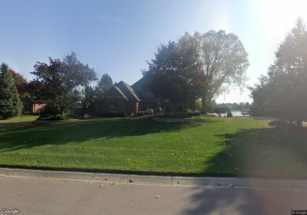
4441 Boulder Pond Dr Ann Arbor, MI 48108
Stonebridge NeighborhoodEstimated Value: $800,000 - $862,000
4
Beds
2
Baths
3,136
Sq Ft
$262/Sq Ft
Est. Value
About This Home
This home is located at 4441 Boulder Pond Dr, Ann Arbor, MI 48108 and is currently estimated at $822,806, approximately $262 per square foot. 4441 Boulder Pond Dr is a home located in Washtenaw County with nearby schools including Bryant Elementary School, Pattengill Elementary School, and Tappan Middle School.
Ownership History
Date
Name
Owned For
Owner Type
Purchase Details
Closed on
Nov 1, 2002
Sold by
Wassef Samy Y and Miller Christy
Bought by
Wassef Samy Y and Miller Christy
Current Estimated Value
Home Financials for this Owner
Home Financials are based on the most recent Mortgage that was taken out on this home.
Original Mortgage
$437,200
Interest Rate
5.25%
Mortgage Type
Stand Alone Refi Refinance Of Original Loan
Create a Home Valuation Report for This Property
The Home Valuation Report is an in-depth analysis detailing your home's value as well as a comparison with similar homes in the area
Home Values in the Area
Average Home Value in this Area
Purchase History
| Date | Buyer | Sale Price | Title Company |
|---|---|---|---|
| Wassef Samy Y | -- | -- |
Source: Public Records
Mortgage History
| Date | Status | Borrower | Loan Amount |
|---|---|---|---|
| Closed | Wassef Samy Y | $437,200 |
Source: Public Records
Tax History
| Year | Tax Paid | Tax Assessment Tax Assessment Total Assessment is a certain percentage of the fair market value that is determined by local assessors to be the total taxable value of land and additions on the property. | Land | Improvement |
|---|---|---|---|---|
| 2025 | $8,485 | $407,602 | $0 | $0 |
| 2024 | $8,282 | $387,544 | $0 | $0 |
| 2023 | $7,958 | $340,000 | $0 | $0 |
| 2022 | $11,947 | $325,400 | $0 | $0 |
| 2021 | $11,658 | $320,400 | $0 | $0 |
| 2020 | $11,437 | $316,600 | $0 | $0 |
| 2019 | $10,769 | $312,500 | $312,500 | $0 |
| 2018 | $10,600 | $304,700 | $0 | $0 |
| 2017 | $10,267 | $296,100 | $0 | $0 |
| 2016 | $6,615 | $260,079 | $0 | $0 |
| 2015 | -- | $259,302 | $0 | $0 |
| 2014 | -- | $251,200 | $0 | $0 |
| 2013 | -- | $251,200 | $0 | $0 |
Source: Public Records
Map
Nearby Homes
- 1989 Stonebridge Dr N
- 2040 Bay Hill Ct
- 1729 Monterey Ct Unit 69
- 3959 Fox Glen Dr
- 1717 Foxdale Ln Unit 133
- 2222 Stonebridge Dr N
- 3824 Santa fe Trail
- 4703 Sawgrass Dr W
- 2427 Moors Ct Unit 2
- 1487 Saint James Blvd
- 1411 Whispering Maples Dr N
- 4641 Cottonwood Dr
- 2641 Aspen Rd
- 1579 Oakfield Dr Unit 123
- 1573 Oakfield Dr Unit 120
- 1354 Fox Pointe Cir
- 5428 Lohr Lake Dr
- 1764 Weatherstone Dr Unit 181
- 2243 Twin Islands Ct
- 3365 Breckland Ct Unit 78
- 4399 Boulder Pond Dr
- 4463 Boulder Pond Dr
- 4375 Boulder Pond Dr Unit 191
- 4479 Boulder Pond Dr Unit 187
- 4426 Boulder Pond Dr Unit 174
- 4408 Boulder Pond Dr
- 4476 Boulder Pond Dr Unit 172
- 1761 Oakmont Ct
- 4351 Boulder Pond Dr
- 4497 Boulder Pond Dr
- 0 Oakmont Ct
- 4484 Boulder Pond Dr Unit 171
- 1765 Oakmont Ct
- 4463 Lake Forest Dr E
- 4423 Lake Forest Dr E
- 4500 Boulder Pond Dr
- 4337 Boulder Pond Dr
- 4507 Boulder Pond Dr Unit 185
- 4411 Lake Forest Dr E
- 1764 Oakmont Ct
Your Personal Tour Guide
Ask me questions while you tour the home.