Estimated Value: $144,000 - $171,588
3
Beds
2
Baths
1,330
Sq Ft
$120/Sq Ft
Est. Value
About This Home
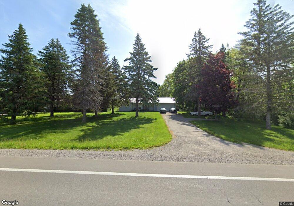
This home is located at 4446 M 65, Hale, MI 48739 and is currently estimated at $159,647, approximately $120 per square foot. 4446 M 65 is a home located in Iosco County with nearby schools including Hale Elementary/Middle School, Hale High School, and Pinecrest School.
Ownership History
Date
Name
Owned For
Owner Type
Purchase Details
Closed on
Aug 19, 2020
Sold by
Mitchell Robert Lee Est
Bought by
Katterman Daniel J
Current Estimated Value
Home Financials for this Owner
Home Financials are based on the most recent Mortgage that was taken out on this home.
Original Mortgage
$56,050
Outstanding Balance
$49,628
Interest Rate
2.9%
Mortgage Type
New Conventional
Estimated Equity
$110,019
Purchase Details
Closed on
Jan 10, 2011
Sold by
Flagstar Bank Fsb
Bought by
Mitchell Robert and Delbridge Barbara
Purchase Details
Closed on
Apr 2, 2010
Sold by
Mers Inc
Bought by
Flagstar Bank Fsb
Purchase Details
Closed on
Mar 25, 2009
Sold by
Iosco County Sheriff Department
Bought by
Mers Inc
Purchase Details
Closed on
Nov 17, 2006
Sold by
John J R Stansfield and John Gertrude E Stans
Bought by
Hart Bryan A and Sweet Ashley M
Home Financials for this Owner
Home Financials are based on the most recent Mortgage that was taken out on this home.
Original Mortgage
$89,400
Interest Rate
6.47%
Create a Home Valuation Report for This Property
The Home Valuation Report is an in-depth analysis detailing your home's value as well as a comparison with similar homes in the area
Purchase History
| Date | Buyer | Sale Price | Title Company |
|---|---|---|---|
| Katterman Daniel J | $59,000 | None Available | |
| Mitchell Robert | -- | -- | |
| Flagstar Bank Fsb | -- | -- | |
| Mers Inc | $93,535 | -- | |
| Hart Bryan A | $83,900 | -- |
Source: Public Records
Mortgage History
| Date | Status | Borrower | Loan Amount |
|---|---|---|---|
| Open | Katterman Daniel J | $56,050 | |
| Previous Owner | Hart Bryan A | $89,400 |
Source: Public Records
Tax History
| Year | Tax Paid | Tax Assessment Tax Assessment Total Assessment is a certain percentage of the fair market value that is determined by local assessors to be the total taxable value of land and additions on the property. | Land | Improvement |
|---|---|---|---|---|
| 2025 | $493 | $56,900 | $56,900 | $0 |
| 2024 | $839 | $50,400 | $0 | $0 |
| 2023 | $400 | $44,900 | $44,900 | $0 |
| 2022 | $772 | $38,700 | $38,700 | $0 |
| 2021 | $835 | $36,800 | $36,800 | $0 |
| 2020 | $1,315 | $36,800 | $36,800 | $0 |
| 2019 | $1,251 | $34,500 | $34,500 | $0 |
| 2018 | $1,226 | $30,700 | $30,700 | $0 |
| 2017 | $1,162 | $30,500 | $30,500 | $0 |
| 2016 | $1,133 | $30,500 | $0 | $0 |
| 2015 | -- | $29,600 | $0 | $0 |
| 2014 | -- | $29,500 | $0 | $0 |
| 2013 | -- | $33,000 | $0 | $0 |
Source: Public Records
Map
Nearby Homes
- 0 O'Connor Rd
- 0000 E M-55
- 00 Wild Cherry Ln
- 7527 Cove Rd
- 7641 Hillsdale Dr
- 6230 Shellenbarger Rd
- 7797 Lakeside Blvd
- 6131 Shellenbarger Rd
- 301 E Main St
- 316 E Main St
- 208 E Main St
- 7388 W Esmond Rd
- 7924 Campbell Ave
- 00 Runyon Ln
- 4875 Loos Ave
- 5491 E Esmond Rd
- 8470 Ora Lake Rd
- 6595 Wickert Rd
- 6970 Wickert Rd
- 3665 Mill Station Rd
Your Personal Tour Guide
Ask me questions while you tour the home.