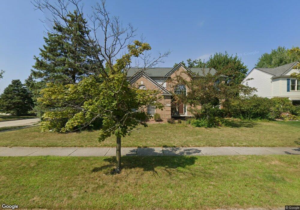
44477 Fenwick Dr Unit Bldg-Unit Canton, MI 48188
Estimated Value: $562,002 - $599,000
--
Bed
3
Baths
2,525
Sq Ft
$231/Sq Ft
Est. Value
About This Home
This home is located at 44477 Fenwick Dr Unit Bldg-Unit, Canton, MI 48188 and is currently estimated at $582,251, approximately $230 per square foot. 44477 Fenwick Dr Unit Bldg-Unit is a home located in Wayne County with nearby schools including Bentley Elementary School, Canton High School, and Plymouth High School.
Ownership History
Date
Name
Owned For
Owner Type
Purchase Details
Closed on
Jun 8, 2018
Sold by
Coogan Daniel R and Coogan Yvonne L
Bought by
Xing Yun
Current Estimated Value
Home Financials for this Owner
Home Financials are based on the most recent Mortgage that was taken out on this home.
Original Mortgage
$302,400
Outstanding Balance
$261,525
Interest Rate
4.5%
Mortgage Type
New Conventional
Estimated Equity
$320,726
Create a Home Valuation Report for This Property
The Home Valuation Report is an in-depth analysis detailing your home's value as well as a comparison with similar homes in the area
Home Values in the Area
Average Home Value in this Area
Purchase History
| Date | Buyer | Sale Price | Title Company |
|---|---|---|---|
| Xing Yun | $380,000 | Title Solutons Agency Llc |
Source: Public Records
Mortgage History
| Date | Status | Borrower | Loan Amount |
|---|---|---|---|
| Open | Xing Yun | $302,400 |
Source: Public Records
Tax History Compared to Growth
Tax History
| Year | Tax Paid | Tax Assessment Tax Assessment Total Assessment is a certain percentage of the fair market value that is determined by local assessors to be the total taxable value of land and additions on the property. | Land | Improvement |
|---|---|---|---|---|
| 2025 | $3,838 | $268,200 | $0 | $0 |
| 2024 | $3,838 | $237,500 | $0 | $0 |
| 2023 | $3,659 | $221,000 | $0 | $0 |
| 2022 | $7,895 | $198,300 | $0 | $0 |
| 2021 | $7,659 | $193,300 | $0 | $0 |
| 2020 | $7,563 | $186,600 | $0 | $0 |
| 2019 | $7,424 | $180,780 | $0 | $0 |
| 2018 | $2,679 | $170,360 | $0 | $0 |
| 2017 | $6,471 | $166,000 | $0 | $0 |
| 2016 | $5,830 | $160,700 | $0 | $0 |
| 2015 | $14,720 | $155,450 | $0 | $0 |
| 2013 | $14,260 | $148,700 | $0 | $0 |
| 2010 | -- | $135,600 | $63,765 | $71,835 |
Source: Public Records
Map
Nearby Homes
- 45242 Thornhill Rd
- 45400 William Ct
- 45030 Glengarry Rd
- 43871 Yorktown St
- 1619 Nowland Ct
- 46509 Killarney Cir
- 46502 Killarney Cir Unit 191
- 2210 Woodmont Dr W
- 43661 Antietam Ct
- 46449 Killarney Ct Unit Bldg-Unit160
- 1700 Thistle Dr
- 45179 Rudgate Rd
- 1709 Thistle Dr Unit 51
- 43592 Champlain Ct
- 1937 S Cavalier Dr
- 288 Edington Cir Unit 61
- 345 Canton Center Rd
- 43664 Appomattox Ct
- 2562 Woodmont Dr E
- 44322 Vassar St
- 44477 Fenwick Dr
- 44493 Fenwick Dr
- 45107 Thornhill Ct
- 44509 Fenwick Dr
- 45089 Thornhill Ct
- 45069 Thornhill Ct
- 44484 Fenwick Dr
- 1302 Glengarry Blvd
- 1330 Glengarry Blvd
- 44525 Fenwick Dr
- 44500 Fenwick Dr
- 45165 Thornhill Rd
- 1358 Glengarry Blvd
- 45049 Thornhill Ct
- 44516 Fenwick Dr
- 1376 Glengarry Blvd
- 45191 Thornhill Rd
- 1425 Glengarry Blvd
- 44532 Fenwick Dr
- 45108 Thornhill Ct