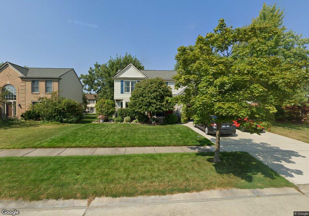
44493 Fenwick Dr Canton, MI 48188
Estimated Value: $487,209 - $584,000
Studio
3
Baths
2,502
Sq Ft
$220/Sq Ft
Est. Value
About This Home
This home is located at 44493 Fenwick Dr, Canton, MI 48188 and is currently estimated at $551,552, approximately $220 per square foot. 44493 Fenwick Dr is a home located in Wayne County with nearby schools including Bentley Elementary School, Canton High School, and Plymouth High School.
Ownership History
Date
Name
Owned For
Owner Type
Purchase Details
Closed on
Dec 31, 2012
Sold by
Russell Lon J and Russell Lynne M
Bought by
Russell Lon J and Russell Lynne M
Current Estimated Value
Home Financials for this Owner
Home Financials are based on the most recent Mortgage that was taken out on this home.
Original Mortgage
$140,600
Interest Rate
3.31%
Mortgage Type
New Conventional
Create a Home Valuation Report for This Property
The Home Valuation Report is an in-depth analysis detailing your home's value as well as a comparison with similar homes in the area
Home Values in the Area
Average Home Value in this Area
Purchase History
| Date | Buyer | Sale Price | Title Company |
|---|---|---|---|
| Russell Lon J | -- | First American Title Ins Co |
Source: Public Records
Mortgage History
| Date | Status | Borrower | Loan Amount |
|---|---|---|---|
| Closed | Russell Lon J | $140,600 |
Source: Public Records
Tax History
| Year | Tax Paid | Tax Assessment Tax Assessment Total Assessment is a certain percentage of the fair market value that is determined by local assessors to be the total taxable value of land and additions on the property. | Land | Improvement |
|---|---|---|---|---|
| 2025 | $3,134 | $243,600 | $0 | $0 |
| 2024 | $3,045 | $224,600 | $0 | $0 |
| 2023 | $2,903 | $202,600 | $0 | $0 |
| 2022 | $6,297 | $180,300 | $0 | $0 |
| 2021 | $6,108 | $175,700 | $0 | $0 |
| 2020 | $6,032 | $170,200 | $0 | $0 |
| 2019 | $5,921 | $165,350 | $0 | $0 |
| 2018 | $2,467 | $155,900 | $0 | $0 |
| 2017 | $5,980 | $152,000 | $0 | $0 |
| 2016 | $5,380 | $147,800 | $0 | $0 |
| 2015 | $13,556 | $143,250 | $0 | $0 |
| 2013 | $13,132 | $137,120 | $0 | $0 |
| 2010 | -- | $120,370 | $52,596 | $67,774 |
Source: Public Records
Map
Nearby Homes
- 45169 Middlebury Ln
- 43935 Marne Ct
- 1550 Valentine Ct
- 43761 Yorktown St
- 407 Fairfield Ct
- 45246 Gerald Ct
- 46501 Killarney Cir
- 2210 Woodmont Dr W
- 43674 Christopher Ct
- 43552 Karli Ln
- 1632 Bennington Ct Unit 1632
- 2053 Brookfield St
- 43880 Cherry Grove Ct W
- 802 Cherry Stone Dr
- 321 Cherry Grove Rd
- 610 Cherry Grove Rd
- 43486 Fredericksburg St
- 290 Edington Cir Unit 62
- 298 Edington Cir Unit 32
- 2545 Woodmont Dr E
- 44509 Fenwick Dr
- 44477 Fenwick Dr Unit Bldg-Unit
- 44477 Fenwick Dr
- 45089 Thornhill Ct
- 44525 Fenwick Dr
- 45069 Thornhill Ct
- 45107 Thornhill Ct
- 45049 Thornhill Ct
- 44500 Fenwick Dr
- 44484 Fenwick Dr
- 44516 Fenwick Dr
- 44532 Fenwick Dr
- 45027 Thornhill Ct
- 44557 Fenwick Dr
- 1302 Glengarry Blvd
- 1330 Glengarry Blvd
- 45165 Thornhill Rd
- 1425 Glengarry Blvd
- 1358 Glengarry Blvd
- 44548 Fenwick Dr
Your Personal Tour Guide
Ask me questions while you tour the home.