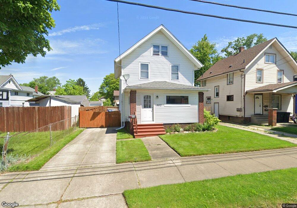
445 Cole Ave Akron, OH 44301
South Akron NeighborhoodEstimated Value: $87,970 - $104,000
3
Beds
3
Baths
1,336
Sq Ft
$73/Sq Ft
Est. Value
About This Home
This home is located at 445 Cole Ave, Akron, OH 44301 and is currently estimated at $96,993, approximately $72 per square foot. 445 Cole Ave is a home located in Summit County with nearby schools including McEbright Elementary School, Kenmore Garfield Community Learning Center, and Main Preparatory Academy.
Ownership History
Date
Name
Owned For
Owner Type
Purchase Details
Closed on
Nov 3, 1998
Sold by
Rice Sharon I
Bought by
Shepler Jeffrey R and Shepler Brigette R
Current Estimated Value
Home Financials for this Owner
Home Financials are based on the most recent Mortgage that was taken out on this home.
Original Mortgage
$48,450
Interest Rate
6.72%
Create a Home Valuation Report for This Property
The Home Valuation Report is an in-depth analysis detailing your home's value as well as a comparison with similar homes in the area
Home Values in the Area
Average Home Value in this Area
Purchase History
| Date | Buyer | Sale Price | Title Company |
|---|---|---|---|
| Shepler Jeffrey R | $45,850 | -- |
Source: Public Records
Mortgage History
| Date | Status | Borrower | Loan Amount |
|---|---|---|---|
| Closed | Shepler Jeffrey R | $48,450 |
Source: Public Records
Tax History
| Year | Tax Paid | Tax Assessment Tax Assessment Total Assessment is a certain percentage of the fair market value that is determined by local assessors to be the total taxable value of land and additions on the property. | Land | Improvement |
|---|---|---|---|---|
| 2024 | $1,141 | $20,773 | $4,151 | $16,622 |
| 2023 | $1,141 | $20,773 | $4,151 | $16,622 |
| 2022 | $951 | $13,402 | $2,678 | $10,724 |
| 2021 | $952 | $13,402 | $2,678 | $10,724 |
| 2020 | $938 | $13,400 | $2,680 | $10,720 |
| 2019 | $1,433 | $19,180 | $5,060 | $14,120 |
| 2018 | $1,414 | $19,180 | $5,060 | $14,120 |
| 2017 | $1,458 | $19,180 | $5,060 | $14,120 |
| 2016 | $1,459 | $19,490 | $5,060 | $14,430 |
| 2015 | $1,458 | $19,490 | $5,060 | $14,430 |
| 2014 | $1,446 | $19,490 | $5,060 | $14,430 |
| 2013 | $1,481 | $20,420 | $5,060 | $15,360 |
Source: Public Records
Map
Nearby Homes
- 436 Cole Ave
- 1100 Beardsley St
- 1203 Atwood Ave
- 1241 Wilbur Ave
- 413 Stanton Ave
- 1215 Sherman St
- 1212 Tulip St
- 1094 Dietz Ave
- 1051 Brown St
- 1012 Kling St
- 1240 Tulip St
- 568 Stanton Ave
- 1268 Brown St
- 0 Beardsley St
- 1243 Dietz Ave
- 485 E Archwood Ave
- 1133 Bellows St
- 1235 Bellows St
- 1243 Herberich Ave
- 1208 Bellows St Unit 1210
- 449 Cole Ave Unit 1
- 449 Cole Ave
- 1121 Beardsley St
- 453 Cole Ave
- 1125 Beardsley St
- 1115 Beardsley St
- 454 Adkins Ave
- 458 Adkins Ave
- 1109 Beardsley St
- 457 Cole Ave
- 462 Adkins Ave
- 1105 Beardsley St
- 461 Cole Ave
- 466 Adkins Ave
- 444 Cole Ave
- 448 Cole Ave
- 440 Cole Ave
- 454 Cole Ave
- 470 Adkins Ave
- 465 Cole Ave
Your Personal Tour Guide
Ask me questions while you tour the home.