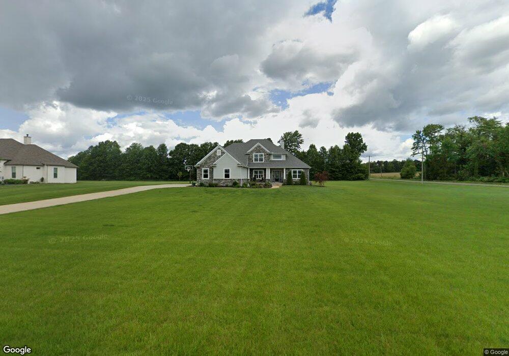
445 Madison Trail Doylestown, OH 44230
Estimated Value: $728,000 - $879,000
3
Beds
3
Baths
3,245
Sq Ft
$239/Sq Ft
Est. Value
About This Home
This home is located at 445 Madison Trail, Doylestown, OH 44230 and is currently estimated at $776,281, approximately $239 per square foot. 445 Madison Trail is a home with nearby schools including Franklin Elementary School, Wadsworth Middle School, and Central Intermediate School.
Ownership History
Date
Name
Owned For
Owner Type
Purchase Details
Closed on
Jan 17, 2017
Sold by
Eastern Sales Development Inc
Bought by
Gonser Courtney B
Current Estimated Value
Home Financials for this Owner
Home Financials are based on the most recent Mortgage that was taken out on this home.
Original Mortgage
$70,320
Outstanding Balance
$48,338
Interest Rate
5.15%
Mortgage Type
Adjustable Rate Mortgage/ARM
Estimated Equity
$727,943
Create a Home Valuation Report for This Property
The Home Valuation Report is an in-depth analysis detailing your home's value as well as a comparison with similar homes in the area
Home Values in the Area
Average Home Value in this Area
Purchase History
| Date | Buyer | Sale Price | Title Company |
|---|---|---|---|
| Gonser Courtney B | $87,900 | None Available |
Source: Public Records
Mortgage History
| Date | Status | Borrower | Loan Amount |
|---|---|---|---|
| Open | Gonser Courtney B | $70,320 |
Source: Public Records
Tax History
| Year | Tax Paid | Tax Assessment Tax Assessment Total Assessment is a certain percentage of the fair market value that is determined by local assessors to be the total taxable value of land and additions on the property. | Land | Improvement |
|---|---|---|---|---|
| 2024 | $8,716 | $188,710 | $35,700 | $153,010 |
| 2023 | $8,209 | $188,710 | $35,700 | $153,010 |
| 2022 | $8,263 | $188,710 | $35,700 | $153,010 |
| 2021 | $8,164 | $157,260 | $29,750 | $127,510 |
| 2020 | $7,424 | $157,260 | $29,750 | $127,510 |
| 2019 | $7,437 | $157,260 | $29,750 | $127,510 |
| 2018 | $1,457 | $28,110 | $28,110 | $0 |
| 2017 | $1,457 | $28,110 | $28,110 | $0 |
| 2016 | $1,487 | $28,110 | $28,110 | $0 |
| 2015 | $1,457 | $26,270 | $26,270 | $0 |
| 2014 | $1,465 | $26,270 | $26,270 | $0 |
| 2013 | $1,467 | $26,270 | $26,270 | $0 |
Source: Public Records
Map
Nearby Homes
- 442 Madison Trail
- 9894 Silvercreek Rd
- V/L approx 67.56ac Gates St
- 970 Eastern Rd
- 15500 Freedom Dr
- 497 Gates St
- 593 Silvercrest Rd
- 233 Homan Dr
- V/L 1050 Melanie Ln
- 500 W Clinton St
- VL 1067 Homan Dr
- 14761 Calaboone Rd
- 0 Akron Rd Unit 5123781
- 247 Hillside Dr
- 1014 Marissa Dr
- 436 N Portage St
- 695 Hillcrest Dr
- 680 Thorn Way
- 620 Thorn Way
- 344 3rd St
- 472 Madison Trail
- 465 Madison Trail
- 485 Madison Trail
- 10315 Thicket Trail
- 505 Madison Trail
- 10335 Thicket Trail
- 10340 Silvercreek Rd
- 525 Madison Trail
- 10320 Thicket Trail
- 10355 Thicket Trail
- 10366 Silvercreek Rd
- 10242 Silvercreek Rd
- 10340 Thicket Trail
- 545 Madison Trail
- 492 Wall Rd
- 10375 Thicket Trail
- 10226 Silvercreek Rd
- 565 Madison Trail
- 10388 Silvercreek Rd
- 705 S/L 34 Madison Trail
Your Personal Tour Guide
Ask me questions while you tour the home.