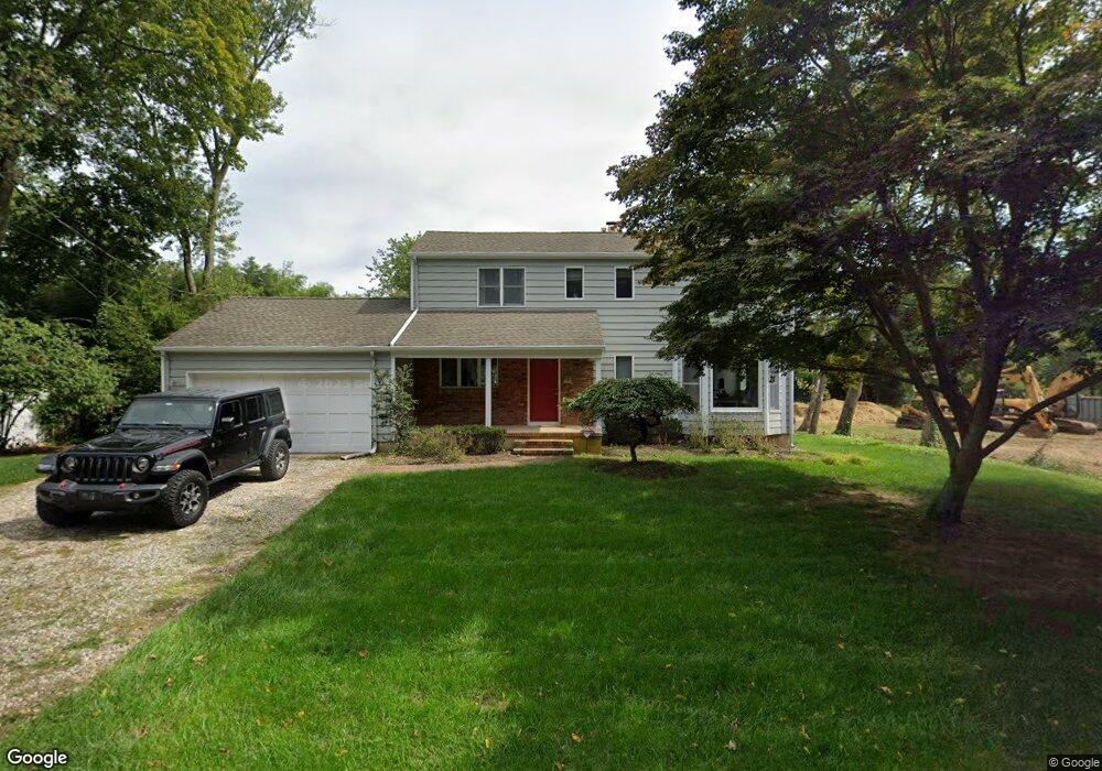
445 Monmouth Place Long Branch, NJ 07740
Estimated Value: $1,232,008 - $1,426,000
3
Beds
3
Baths
2,013
Sq Ft
$670/Sq Ft
Est. Value
About This Home
This home is located at 445 Monmouth Place, Long Branch, NJ 07740 and is currently estimated at $1,349,002, approximately $670 per square foot. 445 Monmouth Place is a home located in Monmouth County with nearby schools including Long Branch High School, Holy Trinity School, and Bet Yaakov of the Jersey Shore.
Ownership History
Date
Name
Owned For
Owner Type
Purchase Details
Closed on
Oct 19, 2017
Sold by
Iantosca Michael and Iantosca Isabella
Bought by
Iantosca Trust
Current Estimated Value
Purchase Details
Closed on
Apr 24, 2006
Sold by
Raftery Roger T
Bought by
Iantosca Michael and Iantosca Isabella
Home Financials for this Owner
Home Financials are based on the most recent Mortgage that was taken out on this home.
Original Mortgage
$528,000
Interest Rate
6.12%
Mortgage Type
Adjustable Rate Mortgage/ARM
Create a Home Valuation Report for This Property
The Home Valuation Report is an in-depth analysis detailing your home's value as well as a comparison with similar homes in the area
Home Values in the Area
Average Home Value in this Area
Purchase History
| Date | Buyer | Sale Price | Title Company |
|---|---|---|---|
| Iantosca Trust | -- | -- | |
| Iantosca Michael | $660,000 | -- |
Source: Public Records
Mortgage History
| Date | Status | Borrower | Loan Amount |
|---|---|---|---|
| Previous Owner | Iantosca Michael | $528,000 |
Source: Public Records
Tax History Compared to Growth
Tax History
| Year | Tax Paid | Tax Assessment Tax Assessment Total Assessment is a certain percentage of the fair market value that is determined by local assessors to be the total taxable value of land and additions on the property. | Land | Improvement |
|---|---|---|---|---|
| 2025 | $14,486 | $1,184,300 | $819,600 | $364,700 |
| 2024 | $13,847 | $942,500 | $593,600 | $348,900 |
| 2023 | $13,847 | $891,600 | $558,600 | $333,000 |
| 2022 | $12,060 | $683,200 | $366,600 | $316,600 |
| 2021 | $11,620 | $602,700 | $306,600 | $296,100 |
| 2020 | $11,620 | $556,000 | $261,600 | $294,400 |
| 2019 | $10,138 | $482,300 | $201,600 | $280,700 |
| 2018 | $9,767 | $462,000 | $191,600 | $270,400 |
| 2017 | $9,272 | $449,900 | $184,600 | $265,300 |
| 2016 | $9,196 | $455,000 | $196,600 | $258,400 |
| 2015 | $8,701 | $390,700 | $158,600 | $232,100 |
| 2014 | $9,348 | $442,400 | $219,600 | $222,800 |
Source: Public Records
Map
Nearby Homes
- 448 Monmouth Place
- 673 Westwood Ave
- 388 Brookdale Ave
- 369 Norwood Ave
- 345 Hollywood Ave
- 552 Westwood Ave
- 497 Marvin Dr
- 497 Norwood Ave
- 8 Norwood Ct
- 595 Woodgate Ave
- 525 Marvin Dr
- 294 Brighton Ave
- 522 Hoey St
- 266 Lenox Ave
- 440 W End Ave
- 279 W West End Ave
- 264 Norwood Ave
- 367 Kirby Ave
- 211 Cedar Ave
- 316 Oakley Ave
- 433 Monmouth Place
- 0 Monmouth Place
- 634 Westwood Ave
- 644 Westwood Ave
- 628 Westwood Ave
- 450 Monmouth Place
- 412 Hollywood Ave
- 408 Hollywood Ave
- 654 Westwood Ave
- 475 Monmouth Place
- 404 Hollywood Ave
- 470 Monmouth Place
- 620 Westwood Ave
- 660 Westwood Ave
- 483 Monmouth Place
- 441 Norwood Ave
- 449 Norwood Ave
- 433 Norwood Ave
- 473 Marvin Dr
- 668 Westwood Ave