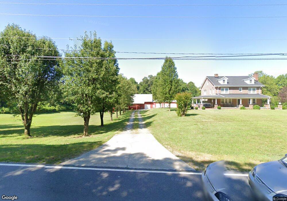
4450 High Point Rd Kernersville, NC 27284
Yorktown NeighborhoodEstimated Value: $301,000 - $367,000
10
Beds
2
Baths
3,675
Sq Ft
$92/Sq Ft
Est. Value
About This Home
This home is located at 4450 High Point Rd, Kernersville, NC 27284 and is currently estimated at $336,330, approximately $91 per square foot. 4450 High Point Rd is a home located in Forsyth County with nearby schools including Union Cross Elementary School, Southeast Middle School, and R.B. Glenn High School.
Ownership History
Date
Name
Owned For
Owner Type
Purchase Details
Closed on
Nov 15, 2024
Sold by
Robertson Kimberly Sharr
Bought by
Robertson Steven Ray
Current Estimated Value
Purchase Details
Closed on
Sep 23, 2022
Sold by
Steven Robertson Kenneth
Bought by
Robertson Steven Ray
Purchase Details
Closed on
Apr 29, 1997
Bought by
Robertson
Create a Home Valuation Report for This Property
The Home Valuation Report is an in-depth analysis detailing your home's value as well as a comparison with similar homes in the area
Home Values in the Area
Average Home Value in this Area
Purchase History
| Date | Buyer | Sale Price | Title Company |
|---|---|---|---|
| Robertson Steven Ray | -- | None Listed On Document | |
| Robertson Steven Ray | -- | None Listed On Document | |
| Robertson Steven Ray | -- | -- | |
| Robertson Steven Ray | -- | None Listed On Document | |
| Robertson | $100,000 | -- |
Source: Public Records
Tax History Compared to Growth
Tax History
| Year | Tax Paid | Tax Assessment Tax Assessment Total Assessment is a certain percentage of the fair market value that is determined by local assessors to be the total taxable value of land and additions on the property. | Land | Improvement |
|---|---|---|---|---|
| 2025 | $1,445 | $346,700 | $101,300 | $245,400 |
| 2024 | $1,445 | $176,900 | $76,400 | $100,500 |
| 2023 | $1,445 | $176,900 | $76,400 | $100,500 |
| 2022 | $1,445 | $176,900 | $76,400 | $100,500 |
| 2021 | $1,418 | $176,900 | $76,400 | $100,500 |
| 2020 | $1,385 | $159,100 | $64,000 | $95,100 |
| 2019 | $1,401 | $159,100 | $64,000 | $95,100 |
| 2018 | $1,348 | $159,100 | $64,000 | $95,100 |
| 2016 | $1,437 | $168,870 | $62,559 | $106,311 |
| 2015 | -- | $168,870 | $62,559 | $106,311 |
| 2014 | $1,380 | $168,870 | $62,559 | $106,311 |
Source: Public Records
Map
Nearby Homes
- 7554 Buckhaven Forest Dr
- 7549 Buckhaven Forest Dr
- 7167 Watkins Landing Ct
- 7267 Huntgate Dr
- 7553 Buckhaven Forest Dr
- 7567 Buckhaven Forest Dr
- 4514 Woodway Dr
- 1967 Kippen Dr
- The Columbia Plan at Brunswick Crossing
- The Cameron Plan at Brunswick Crossing
- The Stoddard Plan at Brunswick Crossing
- The Lexington Plan at Brunswick Crossing
- 4697 Deveron Dr
- 1837 Deveron Ct
- 6031 Hickory Creek Rd
- 6008 Forest Trails Dr
- 0 Hayes Dr
- 4201 High Point Rd
- 0 Sells Farm Rd
- 1786 Mallard Dr
- 4451 High Point Rd
- 4475 High Point Rd
- 4461 High Point Rd
- 7240 Watkins Ford Rd
- 7221 Watkins Ford Rd
- 7215 Watkins Ford Rd
- 7246 Watkins Ford Rd
- 7252 Watkins Ford Rd
- 7239 Watkins Ford Rd
- 7256 Watkins Ford Rd
- 4395 High Point Rd
- 7245 Watkins Ford Rd
- 4390 High Point Rd
- 7264 Watkins Ford Rd
- 4385 High Point Rd
- 4386 High Point Rd
- 7249 Watkins Ford Rd
- 4380 High Point Rd
- 4377 High Point Rd
- 7280 Watkins Ford Rd