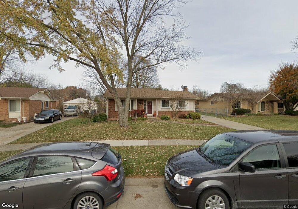
44514 Whitman Ave Canton, MI 48187
Estimated Value: $330,601 - $358,000
Studio
2
Baths
1,213
Sq Ft
$286/Sq Ft
Est. Value
About This Home
This home is located at 44514 Whitman Ave, Canton, MI 48187 and is currently estimated at $347,400, approximately $286 per square foot. 44514 Whitman Ave is a home located in Wayne County with nearby schools including Canton High School, Discovery Middle School, and Salem High School.
Ownership History
Date
Name
Owned For
Owner Type
Purchase Details
Closed on
Jul 22, 1998
Sold by
Harris Dana K and Harris David A
Bought by
Inaughton Theresa
Current Estimated Value
Purchase Details
Closed on
Jul 20, 1994
Sold by
Kussy Nicholas
Bought by
Wnorowski Michael and Wnorowski Kimberly
Home Financials for this Owner
Home Financials are based on the most recent Mortgage that was taken out on this home.
Original Mortgage
$85,900
Interest Rate
8.53%
Mortgage Type
New Conventional
Create a Home Valuation Report for This Property
The Home Valuation Report is an in-depth analysis detailing your home's value as well as a comparison with similar homes in the area
Home Values in the Area
Average Home Value in this Area
Purchase History
| Date | Buyer | Sale Price | Title Company |
|---|---|---|---|
| Inaughton Theresa | $148,500 | -- | |
| Wnorowski Michael | $94,000 | -- |
Source: Public Records
Mortgage History
| Date | Status | Borrower | Loan Amount |
|---|---|---|---|
| Previous Owner | Wnorowski Michael | $85,900 |
Source: Public Records
Tax History
| Year | Tax Paid | Tax Assessment Tax Assessment Total Assessment is a certain percentage of the fair market value that is determined by local assessors to be the total taxable value of land and additions on the property. | Land | Improvement |
|---|---|---|---|---|
| 2025 | $1,387 | $155,900 | $0 | $0 |
| 2024 | $1,348 | $139,000 | $0 | $0 |
| 2023 | $1,285 | $123,300 | $0 | $0 |
| 2022 | $2,879 | $110,200 | $0 | $0 |
| 2021 | $2,793 | $102,800 | $0 | $0 |
| 2020 | $2,756 | $102,300 | $0 | $0 |
| 2019 | $2,709 | $100,930 | $0 | $0 |
| 2018 | $1,092 | $96,920 | $0 | $0 |
| 2017 | $2,818 | $92,900 | $0 | $0 |
| 2016 | $2,468 | $90,600 | $0 | $0 |
| 2015 | $6,002 | $72,470 | $0 | $0 |
| 2013 | $5,814 | $59,320 | $0 | $0 |
| 2010 | -- | $71,300 | $35,354 | $35,946 |
Source: Public Records
Map
Nearby Homes
- 1822 N Sheldon Rd
- 44447 Savery Dr Unit 126
- 1995 Peerce Ct Unit 2
- 1399 Elmhurst St
- 58560 Stuart Dr
- 1211 W Franciscan Ct
- 45005 Saltz Rd
- 1584 Commodore Cir Unit 33
- 0000 Ford
- 45645 Graystone Ln Unit 100
- 45874 S Stonewood Rd Unit 221
- 45678 Aragon Ln
- 1276 W Crystal Cir Unit 202
- 1244 W Crystal Cir
- 43818 Palisades Dr
- 241 Edington Cir
- 1289 Old Colony Ln Unit 232
- 1632 Peninsula Ct Unit 159
- 215 Edington Cir
- 49772 Shoreline Dr
- 44528 Whitman Ave
- 44500 Whitman Ave
- 44542 Whitman Ave
- 1762 Whittier Dr
- 44505 Whitman Ave
- 44600 Whitman Ave
- 44531 Whitman Ave
- 1750 Whittier Dr
- 44437 Savery Dr Unit 127
- 44545 Whitman Ave
- 1735 Whittier Dr
- 44614 Whitman Ave
- 1736 Whittier Dr
- 44605 Whitman Ave
- 44536 Lowell Ave
- 44475 Savery Dr
- 44630 Whitman Ave
- 1715 Whittier Dr
- 44550 Lowell Ave
- 1722 Whittier Dr
Your Personal Tour Guide
Ask me questions while you tour the home.