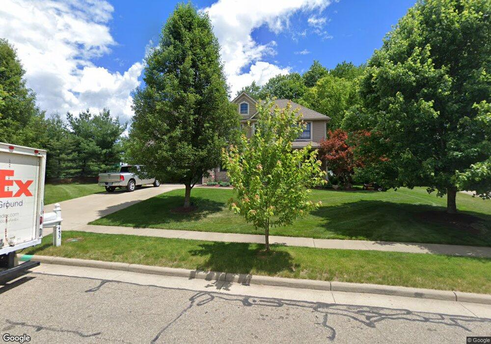
4453 Castlegate Blvd Uniontown, OH 44685
Estimated Value: $442,000 - $507,000
4
Beds
3
Baths
2,598
Sq Ft
$185/Sq Ft
Est. Value
About This Home
This home is located at 4453 Castlegate Blvd, Uniontown, OH 44685 and is currently estimated at $479,620, approximately $184 per square foot. 4453 Castlegate Blvd is a home located in Summit County with nearby schools including Greenwood Elementary School, Green Intermediate Elementary School, and Green Primary School.
Ownership History
Date
Name
Owned For
Owner Type
Purchase Details
Closed on
Apr 27, 2005
Sold by
Green Land Trust Ltd
Bought by
Payne Daniel J and Payne Susan A
Current Estimated Value
Home Financials for this Owner
Home Financials are based on the most recent Mortgage that was taken out on this home.
Original Mortgage
$194,824
Interest Rate
6.06%
Mortgage Type
Fannie Mae Freddie Mac
Create a Home Valuation Report for This Property
The Home Valuation Report is an in-depth analysis detailing your home's value as well as a comparison with similar homes in the area
Purchase History
| Date | Buyer | Sale Price | Title Company |
|---|---|---|---|
| Payne Daniel J | $45,000 | Cornerstone Real Estate Titl |
Source: Public Records
Mortgage History
| Date | Status | Borrower | Loan Amount |
|---|---|---|---|
| Closed | Payne Daniel J | $194,824 | |
| Closed | Payne Daniel J | $36,379 |
Source: Public Records
Tax History
| Year | Tax Paid | Tax Assessment Tax Assessment Total Assessment is a certain percentage of the fair market value that is determined by local assessors to be the total taxable value of land and additions on the property. | Land | Improvement |
|---|---|---|---|---|
| 2025 | $6,772 | $141,960 | $44,366 | $97,594 |
| 2024 | $6,772 | $141,960 | $44,366 | $97,594 |
| 2023 | $6,772 | $141,960 | $44,366 | $97,594 |
| 2022 | $5,720 | $107,545 | $33,611 | $73,934 |
| 2021 | $5,364 | $107,545 | $33,611 | $73,934 |
| 2020 | $5,266 | $107,540 | $33,610 | $73,930 |
| 2019 | $4,338 | $82,620 | $22,090 | $60,530 |
| 2018 | $4,432 | $82,620 | $22,090 | $60,530 |
| 2017 | $4,234 | $82,620 | $22,090 | $60,530 |
| 2016 | $4,212 | $73,890 | $22,090 | $51,800 |
| 2015 | $4,234 | $73,890 | $22,090 | $51,800 |
| 2014 | $4,205 | $73,890 | $22,090 | $51,800 |
| 2013 | $4,452 | $77,930 | $22,090 | $55,840 |
Source: Public Records
Map
Nearby Homes
- 4472 Broadley Cir
- 4522-4526 Camelot Cir
- 4529-4533 Camelot Cir
- 4710 Pinecrest Dr
- 4769 Cherimoya Ave
- 0 Kenway Blvd Unit 5162986
- 1294 Cherry Ln
- 866 Somerby Cir
- 3680 Kenway Blvd
- S/L 144 Kenway
- 971 Montford Cir
- 3630 Great Windsor Ln
- 3672 Kenway Blvd
- 3624 Great Windsor Ln
- 3618 Great Windsor Ln
- 3612 Great Windsor Ln
- 3639 Great Windsor Ln
- 3683 Kenway Blvd
- 3633 Great Windsor Ln
- 3621 Great Windsor Ln
- 4465 Castlegate Blvd
- TBD Castlegate
- 712 Chilham Cir
- 685 Bloomsbury Dr
- 711 Chilham Cir
- 4428 Folkstone Cir
- 4438 Folkstone Cir
- 695 Bloomsbury Dr
- 4418 Folkstone Cir
- 4476 Castlegate Blvd
- 4437 Castlegate Blvd
- 700 Chilham Cir
- 705 Bloomsbury Dr
- 699 Chilham Cir
- 4427 Castlegate Blvd
- 4484 Castlegate Blvd
- 0 Folkstone Cir Unit 76 3237554
- 0 Folkstone Cir Unit 3232982
- 0 Folkstone Cir Unit 3237551
- 0 Folkstone Cir Unit 3710784
Your Personal Tour Guide
Ask me questions while you tour the home.