Estimated Value: $225,000 - $312,000
3
Beds
1
Bath
2,156
Sq Ft
$125/Sq Ft
Est. Value
About This Home
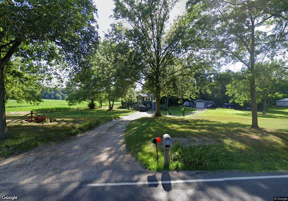
This home is located at 4453 Sherman Rd, Kent, OH 44240 and is currently estimated at $268,769, approximately $124 per square foot. 4453 Sherman Rd is a home located in Portage County with nearby schools including Brimfield Elementary School, Field Middle School, and Field High School.
Ownership History
Date
Name
Owned For
Owner Type
Purchase Details
Closed on
May 20, 2002
Sold by
Oates Zachary B
Bought by
Montgomery Charles E and Montgomery Stacey L
Current Estimated Value
Home Financials for this Owner
Home Financials are based on the most recent Mortgage that was taken out on this home.
Original Mortgage
$118,750
Outstanding Balance
$50,637
Interest Rate
7.07%
Estimated Equity
$218,132
Purchase Details
Closed on
Nov 16, 2000
Sold by
Dunford Vickie L
Bought by
Oates Zachary B
Home Financials for this Owner
Home Financials are based on the most recent Mortgage that was taken out on this home.
Original Mortgage
$121,500
Interest Rate
7.87%
Purchase Details
Closed on
May 4, 1992
Bought by
Dunford Vickie L
Create a Home Valuation Report for This Property
The Home Valuation Report is an in-depth analysis detailing your home's value as well as a comparison with similar homes in the area
Home Values in the Area
Average Home Value in this Area
Purchase History
| Date | Buyer | Sale Price | Title Company |
|---|---|---|---|
| Montgomery Charles E | $125,000 | Title Professionals Inc | |
| Oates Zachary B | $135,000 | -- | |
| Dunford Vickie L | -- | -- |
Source: Public Records
Mortgage History
| Date | Status | Borrower | Loan Amount |
|---|---|---|---|
| Open | Montgomery Charles E | $118,750 | |
| Previous Owner | Oates Zachary B | $121,500 |
Source: Public Records
Tax History Compared to Growth
Tax History
| Year | Tax Paid | Tax Assessment Tax Assessment Total Assessment is a certain percentage of the fair market value that is determined by local assessors to be the total taxable value of land and additions on the property. | Land | Improvement |
|---|---|---|---|---|
| 2024 | $4,213 | $88,480 | $18,270 | $70,210 |
| 2023 | $3,586 | $60,450 | $11,450 | $49,000 |
| 2022 | $3,596 | $60,450 | $11,450 | $49,000 |
| 2021 | $3,506 | $60,450 | $11,450 | $49,000 |
| 2020 | $3,087 | $48,030 | $11,450 | $36,580 |
| 2019 | $3,047 | $48,030 | $11,450 | $36,580 |
| 2018 | $2,190 | $40,430 | $11,450 | $28,980 |
| 2017 | $2,190 | $40,430 | $11,450 | $28,980 |
| 2016 | $2,102 | $39,240 | $11,450 | $27,790 |
| 2015 | $2,057 | $39,240 | $11,450 | $27,790 |
| 2014 | $1,959 | $39,240 | $11,450 | $27,790 |
| 2013 | $1,949 | $39,240 | $11,450 | $27,790 |
Source: Public Records
Map
Nearby Homes
- 1354 Brimfield Dr
- 4088 Lynwood Dr
- 4837 King Meadow Trail
- 4891 Edson Rd
- 4682 State Route 43
- 1755 Honeychuck Ln
- 2092 Sugar Maple Dr
- 2105 Sugar Maple Dr
- 3868 Willow Way
- 2182 Sugar Maple Dr
- 1523 Queenstown Rd
- 3793 Ranfield Rd
- 5123 Troyer Dr
- Poplar Plan at Woodland Reserve
- Nassau Cove Plan at Woodland Reserve
- 4938 Brower Tree Ln
- V/L Sherman Rd
- 3672 Elmhurst Ct
- 3579 Elmhurst Ct
- 3658 Elmhurst Ct