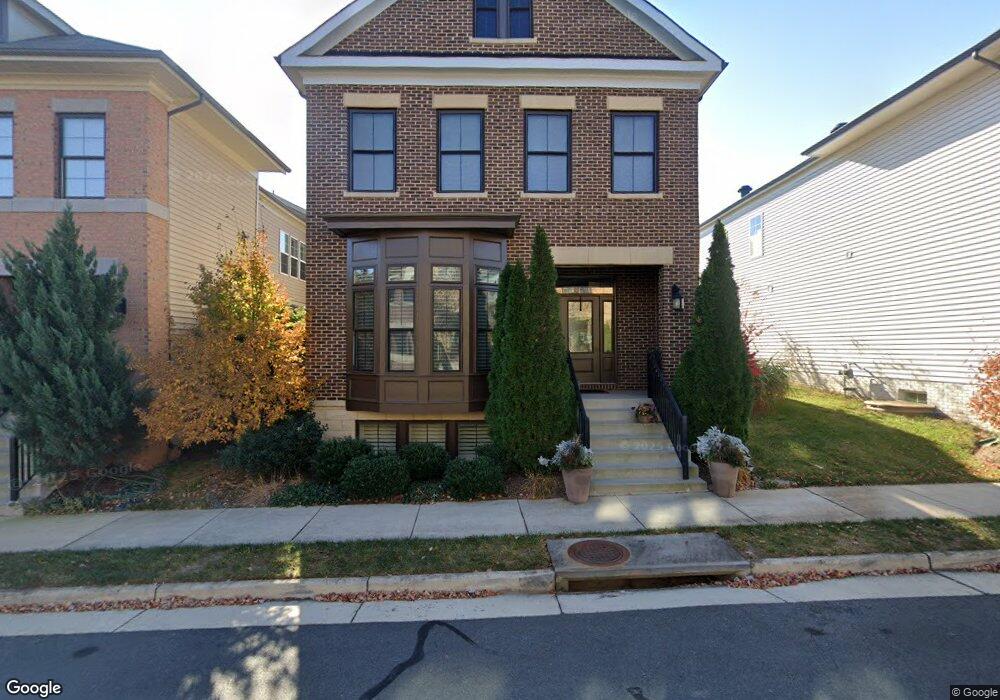
44557 Yarmouth Dr Ashburn, VA 20147
Estimated Value: $1,146,000 - $1,302,000
4
Beds
5
Baths
2,943
Sq Ft
$408/Sq Ft
Est. Value
About This Home
This home is located at 44557 Yarmouth Dr, Ashburn, VA 20147 and is currently estimated at $1,200,443, approximately $407 per square foot. 44557 Yarmouth Dr is a home located in Loudoun County with nearby schools including Steuart W. Weller Elementary School, Belmont Ridge Middle, and Riverside High.
Ownership History
Date
Name
Owned For
Owner Type
Purchase Details
Closed on
May 29, 2013
Sold by
One Loudoun Home Building Llc
Bought by
Jeffrey Alexander Crystal
Current Estimated Value
Home Financials for this Owner
Home Financials are based on the most recent Mortgage that was taken out on this home.
Original Mortgage
$503,488
Outstanding Balance
$357,513
Interest Rate
3.45%
Mortgage Type
New Conventional
Estimated Equity
$842,930
Create a Home Valuation Report for This Property
The Home Valuation Report is an in-depth analysis detailing your home's value as well as a comparison with similar homes in the area
Home Values in the Area
Average Home Value in this Area
Purchase History
| Date | Buyer | Sale Price | Title Company |
|---|---|---|---|
| Jeffrey Alexander Crystal | $629,360 | -- |
Source: Public Records
Mortgage History
| Date | Status | Borrower | Loan Amount |
|---|---|---|---|
| Open | Jeffrey Alexander Crystal | $503,488 |
Source: Public Records
Tax History Compared to Growth
Tax History
| Year | Tax Paid | Tax Assessment Tax Assessment Total Assessment is a certain percentage of the fair market value that is determined by local assessors to be the total taxable value of land and additions on the property. | Land | Improvement |
|---|---|---|---|---|
| 2025 | $9,383 | $1,165,630 | $330,300 | $835,330 |
| 2024 | $9,368 | $1,083,030 | $330,300 | $752,730 |
| 2023 | $8,372 | $956,790 | $330,300 | $626,490 |
| 2022 | $7,796 | $876,010 | $304,100 | $571,910 |
| 2021 | $7,682 | $783,880 | $283,100 | $500,780 |
| 2020 | $7,908 | $764,020 | $262,100 | $501,920 |
| 2019 | $7,815 | $747,840 | $249,600 | $498,240 |
| 2018 | $7,537 | $694,620 | $208,800 | $485,820 |
| 2017 | $7,652 | $680,170 | $208,800 | $471,370 |
| 2016 | $7,645 | $667,710 | $0 | $0 |
| 2015 | $7,398 | $443,030 | $0 | $443,030 |
| 2014 | $7,161 | $443,990 | $0 | $443,990 |
Source: Public Records
Map
Nearby Homes
- 44532 Stepney Dr
- 20379 Codman Dr
- 20396 Roslindale Dr
- 20305 Savin Hill Dr
- 20432 Island West Square
- 44614 Wolfhound Square
- 44531 Wolfhound Square
- 44501 Wolfhound Square
- 20328 Newfoundland Square
- 44420 Sunset Maple Dr
- 20254 Northpark Dr
- 20389 Oyster Reef Place
- 44385 Maltese Falcon Square
- 44529 Blueridge Meadows Dr
- 44848 Tiverton Square
- 44852 Tiverton Square
- 20183 Northpark Dr
- HOMESITE 52 Strabane Terrace
- HOMESITE 43 Strabane Terrace
- 44591 Strabane Terrace
- 44561 Yarmouth Dr
- 44553 Yarmouth Dr
- 44565 Yarmouth Dr
- 44569 Yarmouth Dr
- 44596 Wellsboro Dr
- 44573 Yarmouth Dr
- 44564 Yarmouth Dr
- 44592 Wellsboro Dr
- 20428 Codman Dr
- 20438 Codman Dr
- 44600 Wellsboro Dr
- 20434 Codman Dr
- 44560 Yarmouth Dr
- 44604 Wellsboro Dr
- 44556 Yarmouth Dr
- 20426 Codman Dr
- 20442 Codman Dr
- 20424 Codman Dr
- 44577 Yarmouth Dr
- 20430 Codman Dr Unit 417