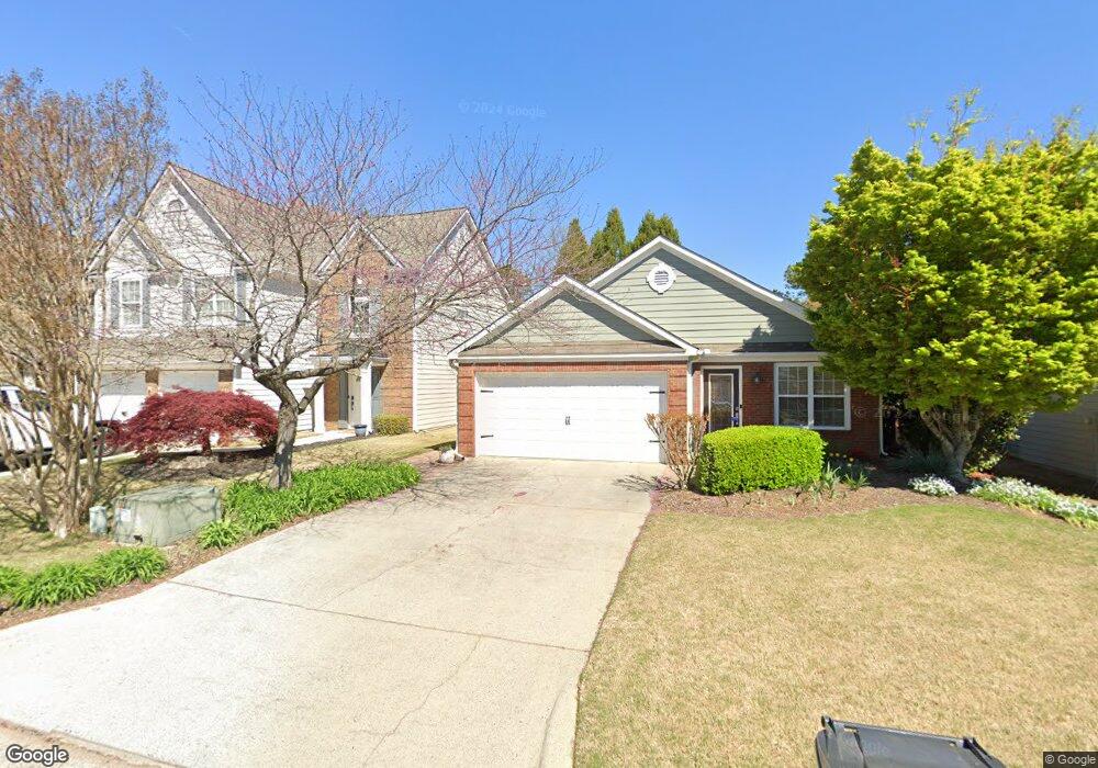
4456 Orchard Trace Roswell, GA 30076
Estimated Value: $451,000 - $478,000
2
Beds
2
Baths
1,307
Sq Ft
$353/Sq Ft
Est. Value
About This Home
This home is located at 4456 Orchard Trace, Roswell, GA 30076 and is currently estimated at $461,870, approximately $353 per square foot. 4456 Orchard Trace is a home located in Fulton County with nearby schools including Sweet Apple Elementary School, Elkins Pointe Middle School, and Milton High School.
Ownership History
Date
Name
Owned For
Owner Type
Purchase Details
Closed on
Sep 8, 2022
Sold by
Woodall William J
Bought by
Clark Myra Lorainne and Brandt Cassandra M
Current Estimated Value
Purchase Details
Closed on
Feb 1, 2006
Sold by
Floyd William R and Floyd Joyce H
Bought by
Guidry Monica K
Home Financials for this Owner
Home Financials are based on the most recent Mortgage that was taken out on this home.
Original Mortgage
$97,000
Interest Rate
6.21%
Mortgage Type
New Conventional
Purchase Details
Closed on
May 17, 2002
Sold by
Burns William C
Bought by
Floyd William R and Floyd Joyce H
Home Financials for this Owner
Home Financials are based on the most recent Mortgage that was taken out on this home.
Original Mortgage
$162,000
Interest Rate
6.85%
Mortgage Type
New Conventional
Purchase Details
Closed on
Mar 23, 1999
Sold by
Orchards Development
Bought by
Burns Charles R and Burns William C
Create a Home Valuation Report for This Property
The Home Valuation Report is an in-depth analysis detailing your home's value as well as a comparison with similar homes in the area
Home Values in the Area
Average Home Value in this Area
Purchase History
| Date | Buyer | Sale Price | Title Company |
|---|---|---|---|
| Clark Myra Lorainne | $397,500 | -- | |
| Guidry Monica K | $217,000 | -- | |
| Floyd William R | $202,500 | -- | |
| Burns Charles R | -- | -- |
Source: Public Records
Mortgage History
| Date | Status | Borrower | Loan Amount |
|---|---|---|---|
| Previous Owner | Guidry Monica K | $97,000 | |
| Previous Owner | Floyd William R | $162,000 |
Source: Public Records
Tax History Compared to Growth
Tax History
| Year | Tax Paid | Tax Assessment Tax Assessment Total Assessment is a certain percentage of the fair market value that is determined by local assessors to be the total taxable value of land and additions on the property. | Land | Improvement |
|---|---|---|---|---|
| 2025 | $538 | $185,000 | $17,240 | $167,760 |
| 2023 | $4,314 | $152,840 | $22,480 | $130,360 |
| 2022 | $675 | $139,120 | $19,040 | $120,080 |
| 2021 | $970 | $125,240 | $24,160 | $101,080 |
| 2020 | $975 | $112,920 | $21,160 | $91,760 |
| 2019 | $339 | $116,880 | $14,160 | $102,720 |
| 2018 | $1,653 | $102,880 | $19,280 | $83,600 |
| 2017 | $1,377 | $84,240 | $10,480 | $73,760 |
| 2016 | $1,372 | $84,240 | $10,480 | $73,760 |
| 2015 | $1,722 | $84,240 | $10,480 | $73,760 |
| 2014 | $901 | $76,920 | $9,320 | $67,600 |
Source: Public Records
Map
Nearby Homes
- 4404 Orchard Trace
- 2230 Ashton Dr
- 406 Sweet Apple Cir
- 1115 Primrose Dr
- 640 Mae Ln
- 290 Rucker Rd
- 530 Camber Woods Dr
- 285 N Farm Dr
- 565 Camber Woods Dr
- 1040 Jordan Ln
- 600 Rounsaville Rd
- 1565 Parkside Dr
- 666 Abbey Ct
- 105 Kensington Pond Ct
- 161 Brook Ln
- 113 Quinn Way
- 580 Stillhouse Ln Unit 2
- 127 Quinn Way
- 515 Kent Rd
- 4450 Orchard Trace Unit 10D
- 4454 Orchard Trace Unit 10B
- 4452 Orchard Trace
- 4458 Orchard Trace Unit 4458
- 4460 Orchard Trace
- 4464 Orchard Trace
- 2465 Ashton Dr
- 2475 Ashton Dr
- 2455 Ashton Dr
- 4462 Orchard Trace Unit 4462
- 2485 Ashton Dr
- 0 Ashton Dr Unit 8712198
- 0 Ashton Dr Unit 8661240
- 0 Ashton Dr Unit 8588462
- 0 Ashton Dr Unit 8683956
- 0 Ashton Dr Unit 3255690
- 0 Ashton Dr Unit 8681194
- 0 Ashton Dr Unit 8221328
- 0 Ashton Dr Unit 9002638
- 0 Ashton Dr Unit 9002252