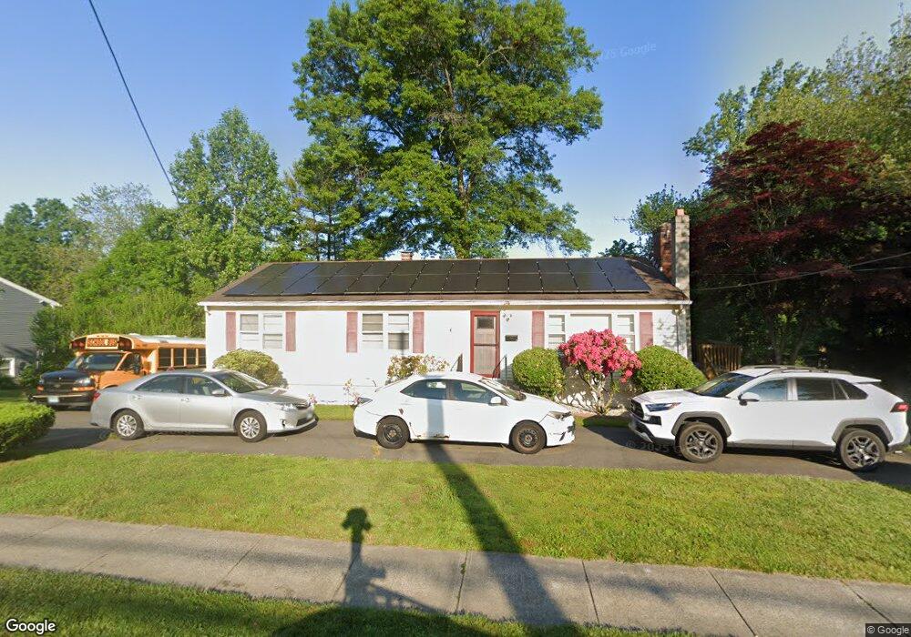
445A Pond Point Ave Milford, CT 06460
East Milford NeighborhoodEstimated Value: $481,000 - $574,000
3
Beds
3
Baths
1,650
Sq Ft
$322/Sq Ft
Est. Value
About This Home
This home is located at 445A Pond Point Ave, Milford, CT 06460 and is currently estimated at $531,427, approximately $322 per square foot. 445A Pond Point Ave is a home located in New Haven County with nearby schools including Orchard Hills School, East Shore Middle School, and Joseph A. Foran High School.
Ownership History
Date
Name
Owned For
Owner Type
Purchase Details
Closed on
Mar 1, 2016
Sold by
Brown Anna
Bought by
Brown Anna S and Brown Dennis J
Current Estimated Value
Home Financials for this Owner
Home Financials are based on the most recent Mortgage that was taken out on this home.
Original Mortgage
$203,250
Outstanding Balance
$156,846
Interest Rate
3%
Mortgage Type
Adjustable Rate Mortgage/ARM
Estimated Equity
$374,581
Create a Home Valuation Report for This Property
The Home Valuation Report is an in-depth analysis detailing your home's value as well as a comparison with similar homes in the area
Home Values in the Area
Average Home Value in this Area
Purchase History
| Date | Buyer | Sale Price | Title Company |
|---|---|---|---|
| Brown Anna S | -- | -- | |
| Brown Anna S | -- | -- | |
| Brown Anna | $112,013 | -- | |
| Brown Anna | $112,013 | -- |
Source: Public Records
Mortgage History
| Date | Status | Borrower | Loan Amount |
|---|---|---|---|
| Open | Brown Anna | $203,250 | |
| Closed | Brown Anna | $203,250 |
Source: Public Records
Tax History Compared to Growth
Tax History
| Year | Tax Paid | Tax Assessment Tax Assessment Total Assessment is a certain percentage of the fair market value that is determined by local assessors to be the total taxable value of land and additions on the property. | Land | Improvement |
|---|---|---|---|---|
| 2025 | $6,977 | $236,110 | $104,060 | $132,050 |
| 2024 | $6,880 | $236,110 | $104,060 | $132,050 |
| 2023 | $6,415 | $236,110 | $104,060 | $132,050 |
| 2022 | $6,292 | $236,110 | $104,060 | $132,050 |
| 2021 | $5,709 | $206,490 | $71,960 | $134,530 |
| 2020 | $5,716 | $206,490 | $71,960 | $134,530 |
| 2019 | $5,722 | $206,490 | $71,960 | $134,530 |
| 2018 | $5,728 | $206,490 | $71,960 | $134,530 |
| 2017 | $5,738 | $206,490 | $71,960 | $134,530 |
| 2016 | $5,808 | $208,630 | $71,960 | $136,670 |
| 2015 | $5,817 | $208,630 | $71,960 | $136,670 |
| 2014 | $5,679 | $208,630 | $71,960 | $136,670 |
Source: Public Records
Map
Nearby Homes
- 470 Pond Point Ave
- 25 Carmen Rd
- 565 Pond Point Ave
- 571 Pond Point Ave
- 105 Carriage Path S Unit 105 Carriage Path So
- 180 Melba St Unit 205
- 71 Platt St
- 126 Baxter Ln
- 43 Ridgewood Dr
- 44 Chester St
- 5 Vine St
- 30 Gerard St
- 34 Orchard Rd
- 44 Beachland Ave
- 12 Norwood Ave
- 38 Elaine Rd
- 32 Morehouse Ave
- 22 Hillside Ave
- 32 Burwell Ave
- 13 Richard St
- 445 Pond Point Ave
- 433 Pond Point Ave
- 455 Pond Point Ave
- 60 Lance Ln
- 427 Pond Point Ave
- 448 Pond Point Ave
- 50 Lance Ln
- 444 Pond Point Ave
- 70 Lance Ln
- 452 Pond Point Ave
- 421 Pond Point Ave
- 456 Pond Point Ave
- 465 Pond Point Ave
- 440 Pond Point Ave
- 415 Pond Point Ave
- 434 Pond Point Ave
- 462 Pond Point Ave
- 80 Lance Ln
- 409 Pond Point Ave
- 40 Lance Ln