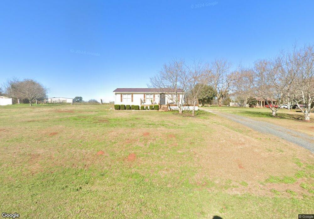
446 Bunn Rd Forsyth, GA 31029
Estimated Value: $146,000 - $283,000
2
Beds
2
Baths
1,000
Sq Ft
$195/Sq Ft
Est. Value
About This Home
This home is located at 446 Bunn Rd, Forsyth, GA 31029 and is currently estimated at $194,770, approximately $194 per square foot. 446 Bunn Rd is a home located in Monroe County with nearby schools including T.G. Scott Elementary School, Mary Persons High School, and Monroe Academy.
Ownership History
Date
Name
Owned For
Owner Type
Purchase Details
Closed on
Feb 20, 2020
Sold by
Ezelle Joshua Ryan
Bought by
Cobb Michael
Current Estimated Value
Home Financials for this Owner
Home Financials are based on the most recent Mortgage that was taken out on this home.
Original Mortgage
$103,098
Outstanding Balance
$91,321
Interest Rate
3.62%
Mortgage Type
FHA
Estimated Equity
$103,449
Purchase Details
Closed on
Sep 28, 2018
Sold by
Giddens Donna
Bought by
Ezelle Joshua Ryan
Home Financials for this Owner
Home Financials are based on the most recent Mortgage that was taken out on this home.
Original Mortgage
$85,858
Interest Rate
4.5%
Mortgage Type
New Conventional
Purchase Details
Closed on
Aug 24, 2016
Sold by
Janie
Bought by
Giddens Donna
Purchase Details
Closed on
Jan 1, 1901
Bought by
Mays Janie C Mrs
Create a Home Valuation Report for This Property
The Home Valuation Report is an in-depth analysis detailing your home's value as well as a comparison with similar homes in the area
Home Values in the Area
Average Home Value in this Area
Purchase History
| Date | Buyer | Sale Price | Title Company |
|---|---|---|---|
| Cobb Michael | $105,000 | -- | |
| Ezelle Joshua Ryan | $85,000 | -- | |
| Giddens Donna | $56,200 | -- | |
| Mays Janie C Mrs | -- | -- |
Source: Public Records
Mortgage History
| Date | Status | Borrower | Loan Amount |
|---|---|---|---|
| Open | Cobb Michael | $103,098 | |
| Previous Owner | Ezelle Joshua Ryan | $85,858 |
Source: Public Records
Tax History Compared to Growth
Tax History
| Year | Tax Paid | Tax Assessment Tax Assessment Total Assessment is a certain percentage of the fair market value that is determined by local assessors to be the total taxable value of land and additions on the property. | Land | Improvement |
|---|---|---|---|---|
| 2024 | $1,233 | $43,784 | $7,960 | $35,824 |
| 2023 | $1,183 | $38,344 | $7,960 | $30,384 |
| 2022 | $1,038 | $38,344 | $7,960 | $30,384 |
| 2021 | $1,028 | $36,668 | $7,960 | $28,708 |
| 2020 | $696 | $36,228 | $7,960 | $28,268 |
| 2019 | $526 | $30,172 | $7,960 | $22,212 |
| 2018 | $0 | $22,480 | $7,960 | $14,520 |
| 2017 | $653 | $22,480 | $7,960 | $14,520 |
| 2016 | $621 | $22,480 | $7,960 | $14,520 |
| 2015 | -- | $22,480 | $7,960 | $14,520 |
| 2014 | -- | $22,480 | $7,960 | $14,520 |
Source: Public Records
Map
Nearby Homes
- 1550 Charlie Benson Rd
- 153 Jackson Dr
- TRACTS 1 & 5 Old Rumble Rd
- TRACTS 2-4 Old Rumble Rd
- 22 Rabon Dr
- 100 Gardens
- 104 Gardens
- 131 Hawthorne Ln
- 125 Hawthorne Ln
- 155 Hawthorne Ln
- 122 Laurel Ridge
- 311 Clover Pass
- 312 Clover Pass
- 243 Copper Crossing
- 0 Benson Ham Rd Unit OUTPARCEL 1 10551782
- 0 Benson Ham Rd Unit OUTPARCEL 2 10558340
- 34 Kyndall Ln
- 98 Adam Dr
- 88 Adam Dr
- 2022 Highway 41 N