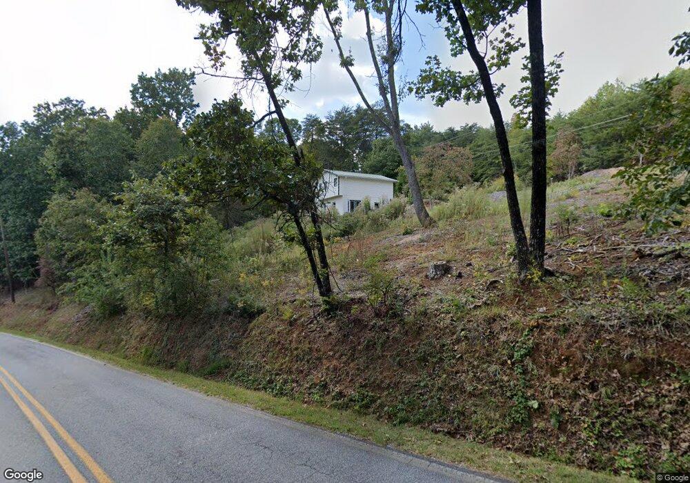
446 Crown Mountain Dr Dahlonega, GA 30533
Estimated Value: $353,495 - $522,000
--
Bed
3
Baths
2,236
Sq Ft
$186/Sq Ft
Est. Value
About This Home
This home is located at 446 Crown Mountain Dr, Dahlonega, GA 30533 and is currently estimated at $416,374, approximately $186 per square foot. 446 Crown Mountain Dr is a home located in Lumpkin County with nearby schools including Clay County Middle School and Lumpkin County High School.
Ownership History
Date
Name
Owned For
Owner Type
Purchase Details
Closed on
Apr 19, 2018
Sold by
Daniel James E
Bought by
Daniel Jacqueline R
Current Estimated Value
Purchase Details
Closed on
Apr 29, 2003
Sold by
Kidd Caroline
Bought by
Daniel James E
Purchase Details
Closed on
Aug 14, 2000
Sold by
Link Eric Carl
Bought by
Kidd Caroline
Purchase Details
Closed on
Aug 18, 1998
Sold by
Tanya Rhae
Bought by
Link Eric Carl
Purchase Details
Closed on
Jan 1, 1997
Sold by
Josie
Bought by
Sanders Charles W
Create a Home Valuation Report for This Property
The Home Valuation Report is an in-depth analysis detailing your home's value as well as a comparison with similar homes in the area
Home Values in the Area
Average Home Value in this Area
Purchase History
| Date | Buyer | Sale Price | Title Company |
|---|---|---|---|
| Daniel Jacqueline R | -- | -- | |
| Daniel James E | $132,000 | -- | |
| Kidd Caroline | $120,000 | -- | |
| Link Eric Carl | $105,500 | -- | |
| Link Eric Carl | -- | -- | |
| Sanders Charles W | -- | -- |
Source: Public Records
Tax History Compared to Growth
Tax History
| Year | Tax Paid | Tax Assessment Tax Assessment Total Assessment is a certain percentage of the fair market value that is determined by local assessors to be the total taxable value of land and additions on the property. | Land | Improvement |
|---|---|---|---|---|
| 2024 | $2,567 | $93,435 | $21,168 | $72,267 |
| 2023 | $2,559 | $88,773 | $21,168 | $67,605 |
| 2022 | $2,408 | $78,834 | $17,649 | $61,185 |
| 2021 | $2,240 | $68,650 | $17,649 | $51,001 |
| 2020 | $2,256 | $66,556 | $16,909 | $49,647 |
| 2019 | $2,267 | $66,556 | $16,909 | $49,647 |
| 2018 | $2,147 | $60,635 | $16,909 | $43,726 |
| 2017 | $2,144 | $59,584 | $16,909 | $42,675 |
| 2016 | $2,058 | $56,042 | $16,909 | $39,133 |
| 2015 | $1,774 | $56,042 | $16,909 | $39,133 |
| 2014 | $1,774 | $56,531 | $16,909 | $39,622 |
| 2013 | -- | $57,019 | $16,908 | $40,110 |
Source: Public Records
Map
Nearby Homes
- 0 Alicia Ln
- 0 Calhoun Rd Unit 7643314
- 0 Calhoun Rd Unit 10598012
- 00 Calhoun Rd
- 0 Crown Mountain Unit 7682225
- 0 Crown Mountain Unit 10644759
- Lot 20 Crown Mountain Way
- 0 Crown Mountain Way Unit 7666031
- LOT 13 Crown Mountain Way
- Lot 28 Crown Mountain Way
- Lot 30 Crown Mountain Way
- 0 Deer Run Unit 10437845
- 0 Highway 9 S Unit 10487179
- 0 Highway 9 S Unit 7548614
- 567 Crown Mountain Way
- 490 Golden Ave
- 99 Madeline Anthony Rd
- 99 Madeline Anthony Road Lots 44 and 45
- 0 Highway 60 Unit 7241582
- 735 Calhoun Rd
- 32 Crown Mountain Dr Unit LOT 32
- 32 Crown Mountain Dr
- Lot 2 Crown Mountain Dr
- 402 Crown Mountain Dr
- 4 Golden Ave
- 13 Golden Ave
- 0 Golden Ave Unit 8347080
- 0 Golden Ave Unit 4 8281461
- 0 Golden Ave Unit 5874411
- 0 Golden Ave Unit 8219284
- 0 Golden Ave Unit 7299847
- 0 Golden Ave Unit 7431759
- 0 Golden Ave Unit 8134300
- 0 Golden Ave Unit 24 8146550
- 0 Golden Ave
- 0 Golden Ave Unit 9042063
- 0 Golden Ave Unit 8826861
- 0 Golden Ave Unit 8930866
- 0 Golden Ave Unit 6842673
- 0 Golden Ave Unit 5314961