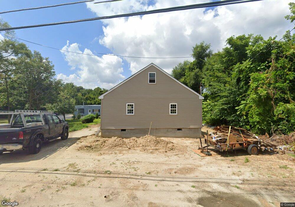
446 Main St Mantua, NJ 08051
Mantua Township NeighborhoodEstimated Value: $269,000 - $345,000
--
Bed
--
Bath
980
Sq Ft
$305/Sq Ft
Est. Value
About This Home
This home is located at 446 Main St, Mantua, NJ 08051 and is currently estimated at $298,876, approximately $304 per square foot. 446 Main St is a home with nearby schools including Centre City School, Clearview Regional Middle School, and Clearview Regional High School.
Ownership History
Date
Name
Owned For
Owner Type
Purchase Details
Closed on
Mar 17, 2021
Sold by
Polidoro Michael and Soli Anthony
Bought by
Soli Anthony J
Current Estimated Value
Home Financials for this Owner
Home Financials are based on the most recent Mortgage that was taken out on this home.
Original Mortgage
$90,000
Outstanding Balance
$80,679
Interest Rate
2.7%
Mortgage Type
Commercial
Estimated Equity
$218,197
Purchase Details
Closed on
Sep 25, 2018
Sold by
Polidoro Michael and Soli Anthony
Bought by
Soli Anthony J
Home Financials for this Owner
Home Financials are based on the most recent Mortgage that was taken out on this home.
Interest Rate
4.65%
Purchase Details
Closed on
Sep 30, 2015
Sold by
Steffen Michael David and Estate Of Michael Steffen
Bought by
Citizens Bank Of Pennslyvania
Purchase Details
Closed on
Jul 21, 2005
Sold by
Steffen Michael and Dickinson Susan
Bought by
Steffen Michael
Create a Home Valuation Report for This Property
The Home Valuation Report is an in-depth analysis detailing your home's value as well as a comparison with similar homes in the area
Home Values in the Area
Average Home Value in this Area
Purchase History
| Date | Buyer | Sale Price | Title Company |
|---|---|---|---|
| Soli Anthony J | $25,000 | Elkins Park Abstract Co | |
| Soli Anthony J | $25,000 | -- | |
| Citizens Bank Of Pennslyvania | $13,602 | Attorney | |
| Steffen Michael | $7,500 | -- |
Source: Public Records
Mortgage History
| Date | Status | Borrower | Loan Amount |
|---|---|---|---|
| Open | Soli Anthony J | $90,000 | |
| Previous Owner | Soli Anthony J | -- |
Source: Public Records
Tax History Compared to Growth
Tax History
| Year | Tax Paid | Tax Assessment Tax Assessment Total Assessment is a certain percentage of the fair market value that is determined by local assessors to be the total taxable value of land and additions on the property. | Land | Improvement |
|---|---|---|---|---|
| 2025 | $4,123 | $160,100 | $55,700 | $104,400 |
| 2024 | $4,079 | $160,100 | $55,700 | $104,400 |
| 2023 | $4,079 | $160,100 | $55,700 | $104,400 |
| 2022 | $4,159 | $118,900 | $45,700 | $73,200 |
| 2021 | $2,495 | $118,900 | $45,700 | $73,200 |
| 2020 | $3,346 | $95,700 | $45,700 | $50,000 |
| 2019 | $3,289 | $95,700 | $45,700 | $50,000 |
| 2018 | $3,242 | $95,700 | $45,700 | $50,000 |
| 2017 | $3,194 | $95,700 | $45,700 | $50,000 |
| 2016 | $3,157 | $95,700 | $45,700 | $50,000 |
| 2015 | $3,080 | $95,700 | $45,700 | $50,000 |
| 2014 | $2,976 | $95,700 | $45,700 | $50,000 |
Source: Public Records
Map
Nearby Homes
- 41 Woodbrook Dr Unit C041
- 119 Monroe Ave
- 47 New Jersey Ave
- 26 Woodstream Ct
- 17 Oakton Dr
- 325 Bridgeton Pike
- 8 Barry Dr
- 333 Jackson Rd
- 284 Columbus Dr
- 485 Harrison Ave
- 204 W Landing Rd
- 1433 Tristram Cir
- 580 Mount Royal Rd
- 1215 Tristram Cir
- 261 Tony Cir
- 36 Bluebird Rd
- 1145 Tristram Cir
- 1147 Tristram Cir Unit 1147
- 1134 Tristram Cir Unit 4
- 590 Bridgeton Pike