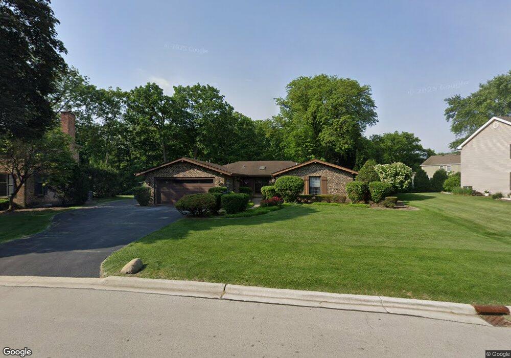
4461 Dawngate Ln Rolling Meadows, IL 60008
Creekside NeighborhoodEstimated Value: $655,000 - $736,000
3
Beds
3
Baths
2,651
Sq Ft
$260/Sq Ft
Est. Value
About This Home
This home is located at 4461 Dawngate Ln, Rolling Meadows, IL 60008 and is currently estimated at $689,540, approximately $260 per square foot. 4461 Dawngate Ln is a home located in Cook County with nearby schools including Central Road Elementary School, Plum Grove Jr High School, and William Fremd High School.
Ownership History
Date
Name
Owned For
Owner Type
Purchase Details
Closed on
May 28, 2009
Sold by
Willcox Diane J and Salvato Diane J
Bought by
Dempsey Thomas W and Dempsey Nancy J
Current Estimated Value
Home Financials for this Owner
Home Financials are based on the most recent Mortgage that was taken out on this home.
Original Mortgage
$372,000
Outstanding Balance
$231,987
Interest Rate
4.85%
Mortgage Type
Unknown
Estimated Equity
$457,553
Create a Home Valuation Report for This Property
The Home Valuation Report is an in-depth analysis detailing your home's value as well as a comparison with similar homes in the area
Home Values in the Area
Average Home Value in this Area
Purchase History
| Date | Buyer | Sale Price | Title Company |
|---|---|---|---|
| Dempsey Thomas W | $465,000 | First American Title |
Source: Public Records
Mortgage History
| Date | Status | Borrower | Loan Amount |
|---|---|---|---|
| Open | Dempsey Thomas W | $372,000 |
Source: Public Records
Tax History
| Year | Tax Paid | Tax Assessment Tax Assessment Total Assessment is a certain percentage of the fair market value that is determined by local assessors to be the total taxable value of land and additions on the property. | Land | Improvement |
|---|---|---|---|---|
| 2025 | $11,060 | $60,001 | $9,380 | $50,621 |
| 2024 | $11,060 | $41,001 | $7,937 | $33,064 |
| 2023 | $10,591 | $41,001 | $7,937 | $33,064 |
| 2022 | $10,591 | $41,001 | $7,937 | $33,064 |
| 2021 | $10,380 | $36,358 | $5,050 | $31,308 |
| 2020 | $9,671 | $37,998 | $5,050 | $32,948 |
| 2019 | $10,972 | $42,456 | $5,050 | $37,406 |
| 2018 | $9,671 | $35,069 | $4,689 | $30,380 |
| 2017 | $10,917 | $39,364 | $4,689 | $34,675 |
| 2016 | $11,575 | $42,201 | $4,689 | $37,512 |
| 2015 | $11,369 | $37,467 | $4,329 | $33,138 |
| 2014 | $11,141 | $37,467 | $4,329 | $33,138 |
| 2013 | $10,848 | $37,467 | $4,329 | $33,138 |
Source: Public Records
Map
Nearby Homes
- 3000 California Ave
- 86 Brookdale Ln
- 3 Holyoke on Auburn
- 304 E Tall Trees Ln
- 4795 Woodcliff Ln
- 2650 Brookwood Way Dr Unit 313
- 2650 Brookwood Way Dr Unit 108
- 2600 Brookwood Way Dr Unit 316
- 2600 Brookwood Way Dr Unit 305
- 2136 Linden Ln
- 399 Knollwood Ct
- 1 Harrogate on Oxford
- 123 Honeysuckle Ct
- 2 Croydon on Duxbury
- 3345 Kirchoff Rd Unit 5C
- 2333 Alumni Dr
- 2 Stuart on Oxford
- 2401 Rohlwing Rd
- 1294 Catalina Ct
- 112 Ironwood Ct
- 4471 Dawngate Ln Unit 2
- 4451 Dawngate Ln
- 3119 California Ct
- 4481 Dawngate Ln
- 4450 Dawngate Ln
- 4441 Dawngate Ln
- 4470 Shady Ct
- 4440 Dawngate Ln
- 3143 California Ct
- 3129 California Ct
- 4431 Dawngate Ln
- 4454 Shady Ct
- 3147 California Ct Unit 2
- 4466 Shady Ct
- 3139 California Ct
- 4430 Dawngate Ct
- 4462 Shady Ct
- 4501 Dawngate Ln
- 4458 Shady Ct
- 1735 S California Ave
Your Personal Tour Guide
Ask me questions while you tour the home.