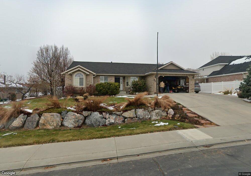
4464 W 9980 N Pleasant Grove, UT 84062
Estimated Value: $718,000 - $803,000
4
Beds
4
Baths
1,890
Sq Ft
$401/Sq Ft
Est. Value
About This Home
This home is located at 4464 W 9980 N, Pleasant Grove, UT 84062 and is currently estimated at $757,418, approximately $400 per square foot. 4464 W 9980 N is a home located in Utah County with nearby schools including Cedar Ridge Elementary School, Mountain Ridge Junior High School, and Lone Peak High School.
Ownership History
Date
Name
Owned For
Owner Type
Purchase Details
Closed on
Mar 3, 2011
Sold by
Robins Richard K and Robins Robyn B
Bought by
Robins Richard K and Robins Robyn B
Current Estimated Value
Purchase Details
Closed on
Nov 27, 2002
Sold by
Robins Richard K and Robins Robyn R
Bought by
Robins Richard K and Robins Robyn B
Home Financials for this Owner
Home Financials are based on the most recent Mortgage that was taken out on this home.
Original Mortgage
$76,000
Interest Rate
6.28%
Purchase Details
Closed on
Apr 18, 2001
Sold by
G & G Investments Lc
Bought by
Robins Richard K and Robins Robyn R
Home Financials for this Owner
Home Financials are based on the most recent Mortgage that was taken out on this home.
Original Mortgage
$84,600
Interest Rate
6.98%
Create a Home Valuation Report for This Property
The Home Valuation Report is an in-depth analysis detailing your home's value as well as a comparison with similar homes in the area
Home Values in the Area
Average Home Value in this Area
Purchase History
| Date | Buyer | Sale Price | Title Company |
|---|---|---|---|
| Robins Richard K | -- | None Available | |
| Robins Richard K | -- | Horizon Title | |
| Robins Richard K | -- | Title West Title Co |
Source: Public Records
Mortgage History
| Date | Status | Borrower | Loan Amount |
|---|---|---|---|
| Closed | Robins Richard K | $76,000 | |
| Closed | Robins Richard K | $84,600 |
Source: Public Records
Tax History Compared to Growth
Tax History
| Year | Tax Paid | Tax Assessment Tax Assessment Total Assessment is a certain percentage of the fair market value that is determined by local assessors to be the total taxable value of land and additions on the property. | Land | Improvement |
|---|---|---|---|---|
| 2025 | $2,947 | $392,700 | $251,100 | $462,900 |
| 2024 | $2,947 | $348,975 | $0 | $0 |
| 2023 | $2,684 | $341,550 | $0 | $0 |
| 2022 | $2,991 | $371,690 | $0 | $0 |
| 2021 | $2,696 | $499,100 | $152,400 | $346,700 |
| 2020 | $2,510 | $453,400 | $141,100 | $312,300 |
| 2019 | $2,359 | $442,600 | $133,700 | $308,900 |
| 2018 | $2,298 | $406,200 | $126,300 | $279,900 |
| 2017 | $2,256 | $213,180 | $0 | $0 |
| 2016 | $2,272 | $199,705 | $0 | $0 |
| 2015 | $2,201 | $192,555 | $0 | $0 |
| 2014 | $2,180 | $180,125 | $0 | $0 |
Source: Public Records
Map
Nearby Homes
- 10052 N Marigold Ln
- 10207 N Cottonwood Dr
- 4696 W Camellia Ln
- 4616 W Carriage Ln
- 9900 N Meadow Dr
- 4198 W Sage Rd N
- 4631 W Harvey Blvd
- 9681 N Peach Ct
- 4229 W Sandalwood Dr
- 4811 Pocosin Ct
- 4812 W Pocosin Ct
- 4812 Pocosin Ct
- 4816 Pocosin Ct
- 4816 W Pocosin Ct
- 4821 W Pocosin Ct Unit 751
- 4822 W Pocosin Ct
- 10087 N Torreya Dr Unit 728
- 248 N Deerfield Ln
- 9587 N 4500 W
- 10022 N Loblobby Ln Unit 713
- 4458 W 9980 N
- 4474 W 9980 N
- 4465 W 9980 N Unit P4465
- 4465 W 9980 N Unit 95
- 4465 W 9980 N
- 9966 N 4500 W
- 9691 N Chesterfield Dr
- 9966 Chesterfield Dr
- 4455 W 9980 N
- 4466 Autumn Cir
- 4502 W 9980 N
- 9952 N 4500 W
- 4545 W 9980 N
- 4503 W 9980 N
- 4460 Autumn Cir
- 9949 Dorchester Dr
- 9949 Dorchester Dr Unit 97
- 9960 Dorchester Dr
- 4512 W 9980 N
- 9957 N 4500 W