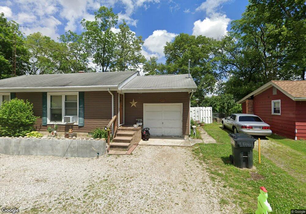
4465 Darr Rd Fremont, OH 43420
Estimated Value: $88,000 - $189,000
2
Beds
1
Bath
1,113
Sq Ft
$114/Sq Ft
Est. Value
About This Home
This home is located at 4465 Darr Rd, Fremont, OH 43420 and is currently estimated at $127,399, approximately $114 per square foot. 4465 Darr Rd is a home with nearby schools including Old Fort Elementary School Bettsville Campus and Old Fort High School.
Ownership History
Date
Name
Owned For
Owner Type
Purchase Details
Closed on
Oct 13, 2016
Sold by
Williams Renee M
Bought by
P B Rooter Rentals Llc
Current Estimated Value
Home Financials for this Owner
Home Financials are based on the most recent Mortgage that was taken out on this home.
Original Mortgage
$30,000
Outstanding Balance
$24,081
Interest Rate
3.5%
Mortgage Type
Future Advance Clause Open End Mortgage
Estimated Equity
$103,318
Purchase Details
Closed on
Oct 11, 1995
Sold by
Lawrence Paul E
Bought by
Williams Ronald E and Williams Renee M
Home Financials for this Owner
Home Financials are based on the most recent Mortgage that was taken out on this home.
Original Mortgage
$40,500
Interest Rate
7.8%
Mortgage Type
New Conventional
Purchase Details
Closed on
May 1, 1986
Sold by
Williams Ronald E and Williams Ren
Bought by
Williams Renee M
Purchase Details
Closed on
Jan 1, 1986
Bought by
Williams Renee M
Create a Home Valuation Report for This Property
The Home Valuation Report is an in-depth analysis detailing your home's value as well as a comparison with similar homes in the area
Home Values in the Area
Average Home Value in this Area
Purchase History
| Date | Buyer | Sale Price | Title Company |
|---|---|---|---|
| P B Rooter Rentals Llc | $32,500 | Assured Title Agency | |
| Williams Ronald E | $45,000 | -- | |
| Williams Renee M | $26,500 | -- | |
| Williams Renee M | -- | -- |
Source: Public Records
Mortgage History
| Date | Status | Borrower | Loan Amount |
|---|---|---|---|
| Open | P B Rooter Rentals Llc | $30,000 | |
| Previous Owner | Williams Ronald E | $40,500 |
Source: Public Records
Tax History Compared to Growth
Tax History
| Year | Tax Paid | Tax Assessment Tax Assessment Total Assessment is a certain percentage of the fair market value that is determined by local assessors to be the total taxable value of land and additions on the property. | Land | Improvement |
|---|---|---|---|---|
| 2024 | $951 | $27,830 | $4,240 | $23,590 |
| 2023 | $951 | $22,610 | $3,430 | $19,180 |
| 2022 | $927 | $22,610 | $3,430 | $19,180 |
| 2021 | $927 | $22,610 | $3,430 | $19,180 |
| 2020 | $882 | $21,040 | $2,870 | $18,170 |
| 2019 | $855 | $21,040 | $2,870 | $18,170 |
| 2018 | $825 | $21,040 | $2,870 | $18,170 |
| 2017 | $776 | $19,850 | $2,870 | $16,980 |
| 2016 | $396 | $19,850 | $2,870 | $16,980 |
| 2015 | $696 | $19,850 | $2,870 | $16,980 |
| 2014 | $700 | $19,780 | $2,910 | $16,870 |
| 2013 | $702 | $19,780 | $2,910 | $16,870 |
Source: Public Records
Map
Nearby Homes
- 855 Rambo Ln
- 132 E Township Road 152
- 2231 County Road 23
- 2595 County Road 13
- 8399 N County Road 31
- 5479 N State Route 53
- 203 Washington St
- 230 State St
- 43 Sun Valley Dr Unit 43
- 1970 Morrison Rd
- 350 Conner Dr
- 0 State Route 224 Unit 20240095
- 1818 Finley Dr
- 1832 Myrtle St
- 0 State Route 590 Unit 6136844
- 41 Brookview Dr
- 1826 Morrison Rd
- 704 County Road 126
- 104 Ken Lee Dr
- 18 Katlyn Dr
- 4461 Darr Rd
- 4475 Darr Rd
- 4466 Darr Rd
- 4454 Darr Rd
- 4476 Darr Rd
- 4469 Darr Rd
- 4484 Darr Rd
- 4415 Darr Rd
- 4319 Darr Rd
- 4454 County Road 230
- 870 County Road 9
- 8696 N Tr 73
- 4300 County Road 230
- 900 County Road 9
- 4198 Darr Rd
- 628 W County Road 173
- 564 W County Road 173
- 1014 County Road 9
- 510 W County Road 173
- 1036 County Road 9