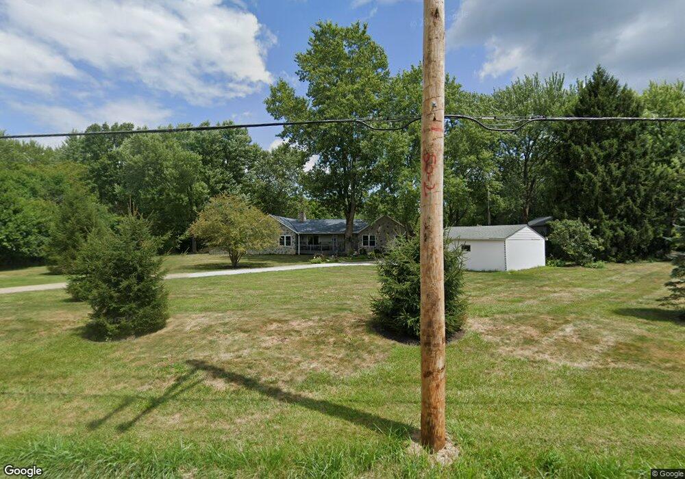
4465 Miller Paul Rd Westerville, OH 43082
Harlem NeighborhoodEstimated Value: $582,000 - $681,000
2
Beds
1
Bath
2,827
Sq Ft
$229/Sq Ft
Est. Value
About This Home
This home is located at 4465 Miller Paul Rd, Westerville, OH 43082 and is currently estimated at $647,991, approximately $229 per square foot. 4465 Miller Paul Rd is a home located in Delaware County with nearby schools including Hylen Souders Elementary School, Big Walnut Intermediate School, and Big Walnut Middle School.
Ownership History
Date
Name
Owned For
Owner Type
Purchase Details
Closed on
Jul 2, 1996
Sold by
Durbin Andrew D
Bought by
Muth Chad E
Current Estimated Value
Home Financials for this Owner
Home Financials are based on the most recent Mortgage that was taken out on this home.
Original Mortgage
$91,250
Interest Rate
8.13%
Mortgage Type
Balloon
Create a Home Valuation Report for This Property
The Home Valuation Report is an in-depth analysis detailing your home's value as well as a comparison with similar homes in the area
Home Values in the Area
Average Home Value in this Area
Purchase History
| Date | Buyer | Sale Price | Title Company |
|---|---|---|---|
| Muth Chad E | $101,400 | -- |
Source: Public Records
Mortgage History
| Date | Status | Borrower | Loan Amount |
|---|---|---|---|
| Closed | Muth Chad E | $91,250 |
Source: Public Records
Tax History Compared to Growth
Tax History
| Year | Tax Paid | Tax Assessment Tax Assessment Total Assessment is a certain percentage of the fair market value that is determined by local assessors to be the total taxable value of land and additions on the property. | Land | Improvement |
|---|---|---|---|---|
| 2024 | $7,793 | $179,410 | $65,590 | $113,820 |
| 2023 | $7,512 | $179,410 | $65,590 | $113,820 |
| 2022 | $6,853 | $139,830 | $43,860 | $95,970 |
| 2021 | $6,820 | $139,830 | $43,860 | $95,970 |
| 2020 | $6,842 | $139,830 | $43,860 | $95,970 |
| 2019 | $6,195 | $122,090 | $33,220 | $88,870 |
| 2018 | $5,853 | $122,090 | $33,220 | $88,870 |
| 2017 | $5,100 | $107,730 | $22,890 | $84,840 |
| 2016 | $4,789 | $107,730 | $22,890 | $84,840 |
| 2015 | $4,739 | $107,730 | $22,890 | $84,840 |
| 2014 | $4,898 | $107,730 | $22,890 | $84,840 |
| 2013 | $5,033 | $102,170 | $22,890 | $79,280 |
Source: Public Records
Map
Nearby Homes
- 0 Woodtown Rd Unit Tract 9 222017618
- 0 Woodtown Rd Unit Tract 7 225015946
- 0 Woodtown Rd Unit Tract 6 225015959
- 4980 Red Bank Rd
- 9568 Craigens Ct
- 5547 Red Bank Rd Unit Tract B
- 6999 Red Bank Rd
- 14859 Center Village Rd
- 11050 Fancher Rd Unit 247
- 11050 Fancher Rd Unit Lot 169
- 11050 Fancher Rd Unit 254
- 11050 Fancher Rd Unit 62
- 11050 Fancher Rd Unit 292
- 11050 Fancher Rd Unit 111
- 11050 Fancher Rd Unit 194
- 11050 Fancher Rd Unit 25
- 11050 Fancher Rd Unit 74
- 11050 Fancher Rd Unit 69
- 11050 Fancher Rd Unit 47
- 11050 Fancher Rd Unit 235
- 4513 Miller Paul Rd
- 4405 Miller Paul Rd
- 4500 Miller Paul Rd
- 4395 Miller Paul Rd
- 4583 Miller Paul Rd
- 4550 Miller Paul Rd
- 4580 Miller Paul Rd
- 4315 Miller Paul Rd
- 4609 Miller Paul Rd
- 1297 Center Village Rd
- 4660 Miller Paul Rd
- 12201 Center Village Rd
- 4701 Miller Paul Rd
- 4710 Miller Paul Rd
- 12121 Center Village Rd
- 12483 Center Village Rd
- 4721 Miller Paul Rd
- 4230 Miller Paul Rd
- 12568 Center Village Rd
- 0 Center Village Rd Unit 2606354