Estimated Value: $193,000 - $385,000
3
Beds
2
Baths
2,132
Sq Ft
$125/Sq Ft
Est. Value
About This Home
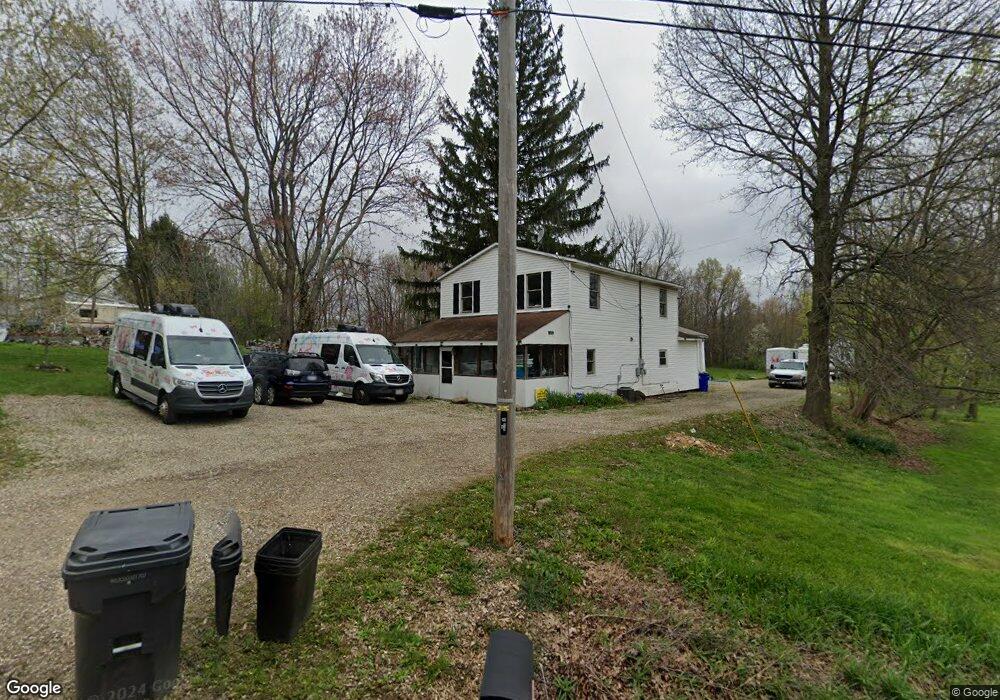
This home is located at 4469 Edson Rd, Kent, OH 44240 and is currently estimated at $266,761, approximately $125 per square foot. 4469 Edson Rd is a home located in Portage County with nearby schools including Brimfield Elementary School, Field Middle School, and Field High School.
Ownership History
Date
Name
Owned For
Owner Type
Purchase Details
Closed on
Jun 21, 2024
Sold by
Marybell Properties Llc
Bought by
Oblisk Meredith O
Current Estimated Value
Purchase Details
Closed on
May 20, 2009
Sold by
Mull Olivia M and Mull Gary W
Bought by
Marybell Properties Llc
Purchase Details
Closed on
Apr 7, 2009
Sold by
Fannie Mae
Bought by
Mull Olivia M
Purchase Details
Closed on
Jan 2, 2007
Sold by
4376 Llc
Bought by
Krummel David L and Krummel Catherine
Purchase Details
Closed on
Aug 6, 1986
Bought by
Wildman Roland E
Create a Home Valuation Report for This Property
The Home Valuation Report is an in-depth analysis detailing your home's value as well as a comparison with similar homes in the area
Home Values in the Area
Average Home Value in this Area
Purchase History
| Date | Buyer | Sale Price | Title Company |
|---|---|---|---|
| Oblisk Meredith O | -- | None Listed On Document | |
| Marybell Properties Llc | -- | Attorney | |
| Mull Olivia M | $42,500 | Accu Title Agency Inc | |
| Krummel David L | -- | None Available | |
| Wildman Roland E | $44,900 | -- |
Source: Public Records
Tax History
| Year | Tax Paid | Tax Assessment Tax Assessment Total Assessment is a certain percentage of the fair market value that is determined by local assessors to be the total taxable value of land and additions on the property. | Land | Improvement |
|---|---|---|---|---|
| 2025 | $2,910 | $58,700 | $13,340 | $45,360 |
| 2024 | $2,845 | $58,320 | $13,340 | $44,980 |
| 2023 | $2,927 | $48,370 | $8,330 | $40,040 |
| 2022 | $2,935 | $48,370 | $8,330 | $40,040 |
| 2021 | $2,860 | $48,370 | $8,330 | $40,040 |
| 2020 | $2,501 | $38,220 | $8,330 | $29,890 |
| 2019 | $2,472 | $38,220 | $8,330 | $29,890 |
| 2018 | $1,754 | $31,920 | $8,330 | $23,590 |
| 2017 | $1,754 | $31,920 | $8,330 | $23,590 |
| 2016 | $1,748 | $31,920 | $8,330 | $23,590 |
| 2015 | $1,694 | $31,920 | $8,330 | $23,590 |
| 2014 | $1,672 | $31,920 | $8,330 | $23,590 |
| 2013 | $1,635 | $31,920 | $8,330 | $23,590 |
Source: Public Records
Map
Nearby Homes
- 4360 Beal Dr
- 4545 State Route 43
- 2477 Waterford Pointe Dr
- 1676 Countryview Dr
- 1680 Countryview Dr
- 5088 Spruce Knoll Run
- 4088 Lynwood Dr
- 3834 Morley Dr
- 0 Meloy Rd Unit 5162435
- 3880 Selnik Rd
- 3890 Grace Dr
- 3910 Willow Way
- 3929 Lor Ron St
- 2092 Sugar Maple Dr
- 1233 Cedar Ridge Rd
- 5096 Spruce Knoll Run
- 1997 Sugar Maple Dr
- 410 Beryl Dr
- 3532 Gary Dr
- 4700 Gooseberry Knoll
- 4459 Edson Rd
- 4445 Edson Rd
- 4472 Sandlewood Dr
- 4474 Sandlewood Dr Unit 38F
- 4480 Sandlewood Dr
- 4484 Sandlewood Dr Unit 40F
- 4464 Edson Rd
- 1331 Cedarwood Dr Unit 44D
- 4456 Sandlewood Dr Unit 9D
- 1333 Cedarwood Dr
- 1333 Cedarwood Dr Unit 43D
- 4454 Sandlewood Dr Unit 10D
- 4452 Sandlewood Dr Unit 11E
- 4485 Edson Rd
- 1335 Cedarwood Dr Unit 42E
- 4450 Sandlewood Dr Unit 12E
- 1337 Cedarwood Dr
- 4437 Sandelwood Blvd
- 4448 Sandlewood Dr Unit 13D
- 1324 Aarons Way
Your Personal Tour Guide
Ask me questions while you tour the home.