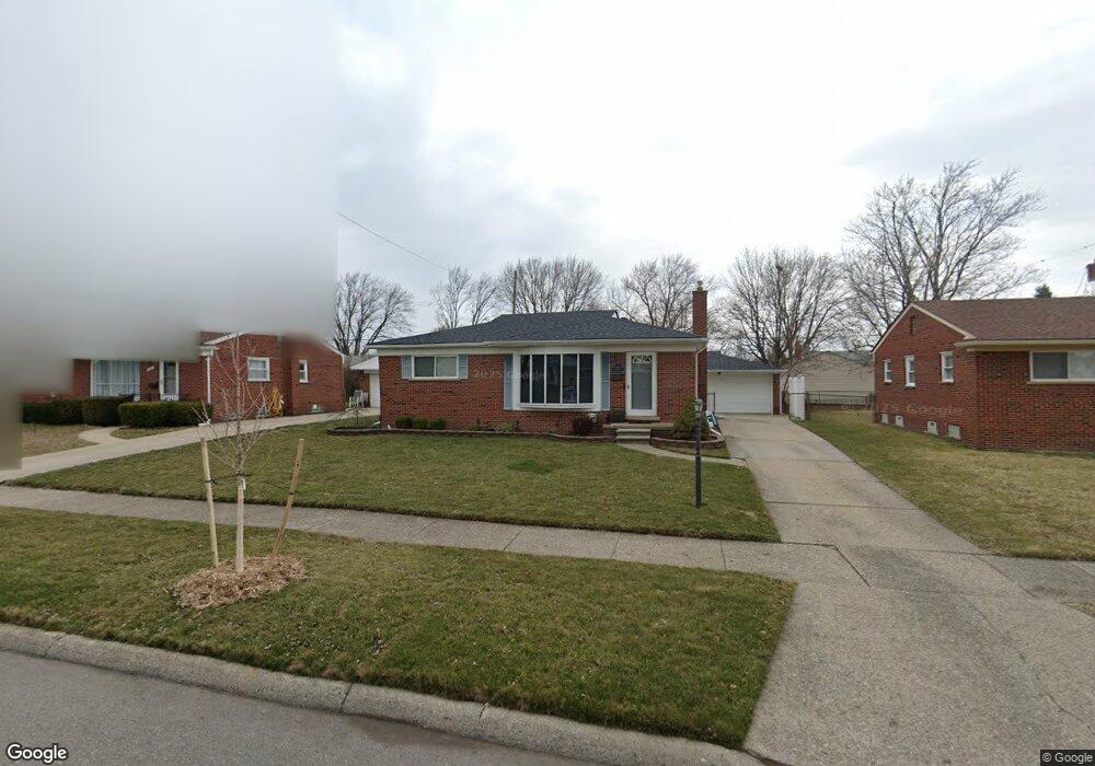
4469 Lutz Dr Warren, MI 48092
Northwest Warren NeighborhoodEstimated Value: $207,000 - $243,000
3
Beds
2
Baths
1,026
Sq Ft
$221/Sq Ft
Est. Value
About This Home
This home is located at 4469 Lutz Dr, Warren, MI 48092 and is currently estimated at $227,000, approximately $221 per square foot. 4469 Lutz Dr is a home located in Macomb County with nearby schools including Green Acres Elementary School, Beer Middle School, and Warren Mott High School.
Ownership History
Date
Name
Owned For
Owner Type
Purchase Details
Closed on
Jan 13, 2009
Sold by
Guzi Cynthia M
Bought by
Guzi Cynthia and Cynthia Guzi Trust
Current Estimated Value
Purchase Details
Closed on
Dec 19, 1997
Sold by
Schmitz M K
Bought by
Guzi C
Purchase Details
Closed on
Sep 30, 1994
Sold by
Marilyn J Simowski Est
Bought by
Schmitz Michael J
Home Financials for this Owner
Home Financials are based on the most recent Mortgage that was taken out on this home.
Original Mortgage
$70,000
Interest Rate
8.64%
Mortgage Type
New Conventional
Create a Home Valuation Report for This Property
The Home Valuation Report is an in-depth analysis detailing your home's value as well as a comparison with similar homes in the area
Home Values in the Area
Average Home Value in this Area
Purchase History
| Date | Buyer | Sale Price | Title Company |
|---|---|---|---|
| Guzi Cynthia | -- | None Available | |
| Guzi C | $117,000 | -- | |
| Schmitz Michael J | $83,000 | -- |
Source: Public Records
Mortgage History
| Date | Status | Borrower | Loan Amount |
|---|---|---|---|
| Previous Owner | Schmitz Michael J | $70,000 |
Source: Public Records
Tax History Compared to Growth
Tax History
| Year | Tax Paid | Tax Assessment Tax Assessment Total Assessment is a certain percentage of the fair market value that is determined by local assessors to be the total taxable value of land and additions on the property. | Land | Improvement |
|---|---|---|---|---|
| 2025 | $2,348 | $100,810 | $0 | $0 |
| 2024 | $2,282 | $92,660 | $0 | $0 |
| 2023 | $2,163 | $87,220 | $0 | $0 |
| 2022 | $2,090 | $76,110 | $0 | $0 |
| 2021 | $2,127 | $71,990 | $0 | $0 |
| 2020 | $2,051 | $66,190 | $0 | $0 |
| 2019 | $1,977 | $59,330 | $0 | $0 |
| 2018 | $2,008 | $54,240 | $0 | $0 |
| 2017 | $1,983 | $50,670 | $9,210 | $41,460 |
| 2016 | $1,981 | $50,670 | $0 | $0 |
| 2015 | -- | $41,660 | $0 | $0 |
| 2013 | $1,961 | $35,940 | $0 | $0 |
Source: Public Records
Map
Nearby Homes
- 4519 Reader Dr
- 4801 E 13 Mile Rd
- 4829 Buchanan Ave
- 30945 Cousino Dr Unit 14
- 5134 Canterbury Ln
- 5239 E 13 Mile Rd
- 30841 Ohmer Dr
- 3651 Chicago Rd
- 30520 Berghway Trail
- 30466 Berghway Trail
- 30475 Berghway Trail
- 3410 Girard Dr
- 29900 N Grand Oaks Dr Unit 26
- 31721 Lexington St
- 3451 Winters Dr
- 30253 Bradmore Rd
- 3834 Heavenly Ln
- 32120 Heavenly Ct Unit 14
- 32302 Ryan Rd
- 29616 S White Oak Dr Unit 87