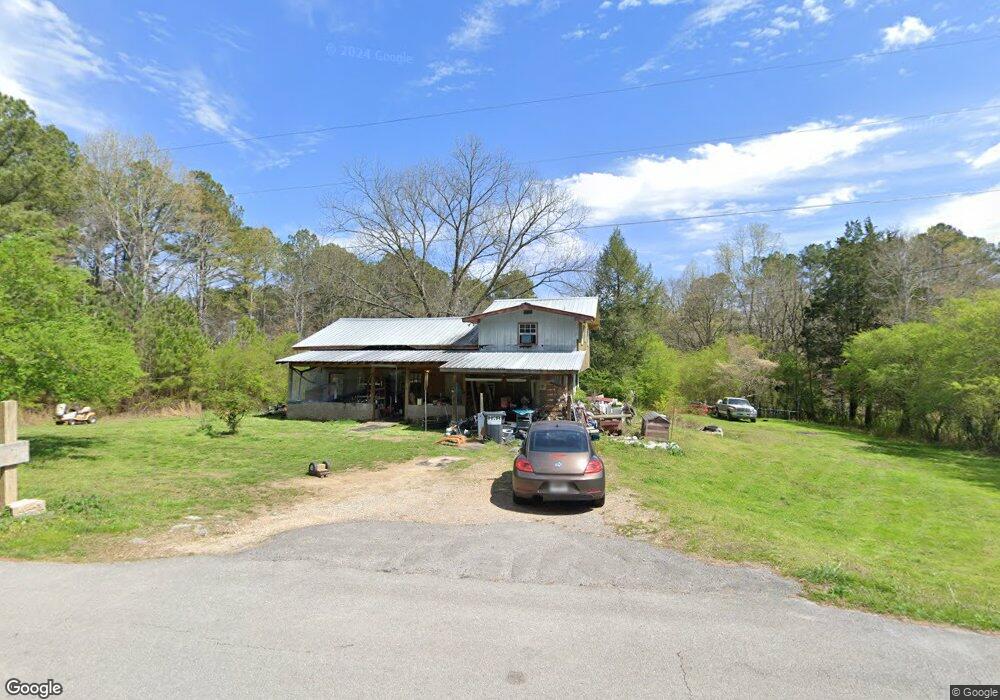
447 Cannon Rd La Fayette, GA 30728
Estimated Value: $125,000 - $264,000
2
Beds
2
Baths
1,092
Sq Ft
$183/Sq Ft
Est. Value
About This Home
This home is located at 447 Cannon Rd, La Fayette, GA 30728 and is currently estimated at $199,578, approximately $182 per square foot. 447 Cannon Rd is a home located in Walker County with nearby schools including Naomi Elementary School, Lafayette Middle School, and Lafayette High School.
Ownership History
Date
Name
Owned For
Owner Type
Purchase Details
Closed on
Jul 6, 2010
Sold by
Original Resource Inc
Bought by
Tsuruda Bratt T
Current Estimated Value
Purchase Details
Closed on
Jan 21, 2010
Sold by
Blue Spruce Entities Llc
Bought by
Stonecrest Income
Purchase Details
Closed on
Nov 7, 1987
Sold by
Thurman Edwin and Thurman Kay
Bought by
Thornton Robert E and Debra Ann
Purchase Details
Closed on
Oct 5, 1974
Sold by
Shipp Maxie R and Shipp Doris
Bought by
Thurman Edwin and Thurman Kay
Purchase Details
Closed on
Jul 24, 1968
Bought by
Shipp Maxie R and Shipp Doris
Create a Home Valuation Report for This Property
The Home Valuation Report is an in-depth analysis detailing your home's value as well as a comparison with similar homes in the area
Home Values in the Area
Average Home Value in this Area
Purchase History
| Date | Buyer | Sale Price | Title Company |
|---|---|---|---|
| Tsuruda Bratt T | $20,995 | -- | |
| Stonecrest Income | $7,500 | -- | |
| Blue Spruce Entities Llc | $3,000 | -- | |
| Thornton Robert E | $25,000 | -- | |
| Thurman Edwin | -- | -- | |
| Shipp Maxie R | -- | -- |
Source: Public Records
Tax History Compared to Growth
Tax History
| Year | Tax Paid | Tax Assessment Tax Assessment Total Assessment is a certain percentage of the fair market value that is determined by local assessors to be the total taxable value of land and additions on the property. | Land | Improvement |
|---|---|---|---|---|
| 2024 | $930 | $35,942 | $7,115 | $28,827 |
| 2023 | $883 | $32,944 | $5,647 | $27,297 |
| 2022 | $742 | $25,787 | $2,324 | $23,463 |
| 2021 | $632 | $19,023 | $2,324 | $16,699 |
| 2020 | $597 | $17,014 | $2,324 | $14,690 |
| 2019 | $425 | $10,374 | $2,324 | $8,050 |
| 2018 | $275 | $10,374 | $2,324 | $8,050 |
| 2017 | $454 | $10,374 | $2,324 | $8,050 |
| 2016 | $241 | $4,538 | $2,324 | $2,214 |
| 2015 | $454 | $12,452 | $5,408 | $7,044 |
| 2014 | $379 | $12,452 | $5,408 | $7,044 |
| 2013 | -- | $12,452 | $5,408 | $7,044 |
Source: Public Records
Map
Nearby Homes
- 218 Golden Oaks Dr
- 450 Arnold Ln
- 1934 Round Pond Rd
- 34 Winter Ln
- 4904 Ringgold Rd
- 635 Cook Rd
- 57 McGaha Rd
- 150 Ken Visage Ln
- 4384 Round Pond Rd
- 1547 Dunwoody Rd
- 1585 E Reed Rd
- 901 Dunwoody Rd
- 1186 E Reed Rd
- 0 Georgia 95
- 4941 Round Pond Rd
- 205 N Ridge Dr
- 894 896 Wheeler Unit 1 & 2
- 894 896 Wheeler
- 521 Wheeler Rd
- 0 Clyde Byrd Rd