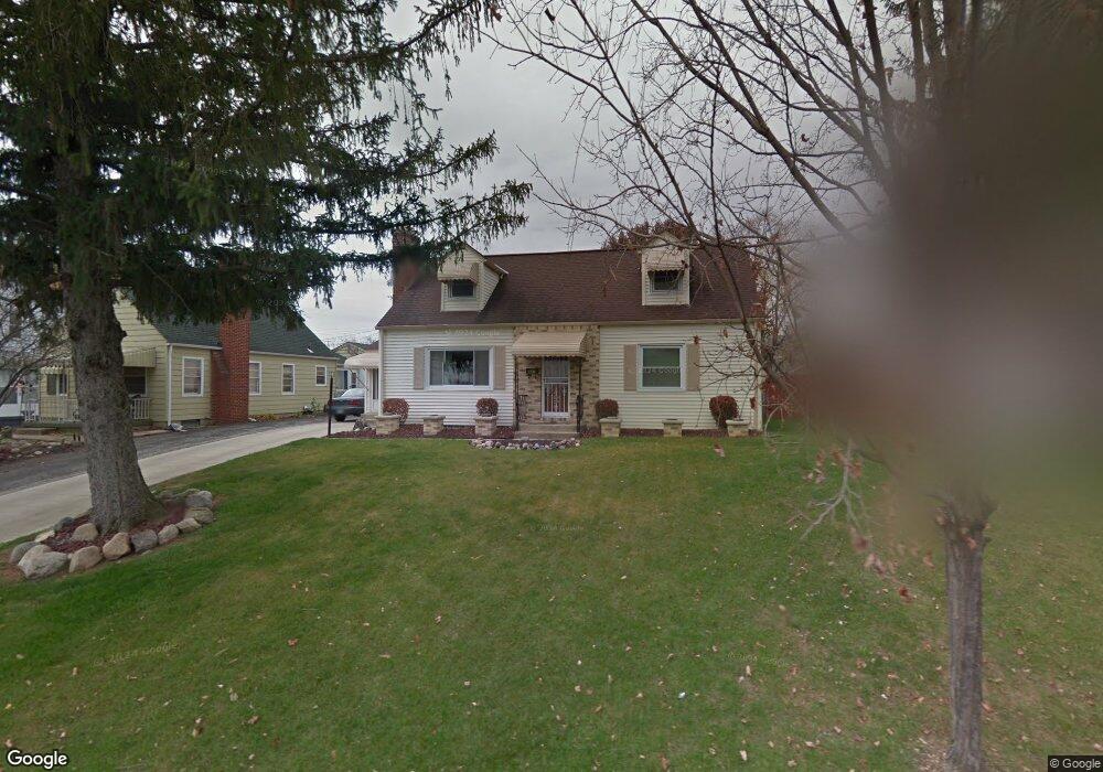
447 Demorest Rd Columbus, OH 43204
Westgate NeighborhoodEstimated Value: $271,000 - $370,000
3
Beds
3
Baths
2,484
Sq Ft
$129/Sq Ft
Est. Value
About This Home
This home is located at 447 Demorest Rd, Columbus, OH 43204 and is currently estimated at $320,288, approximately $128 per square foot. 447 Demorest Rd is a home located in Franklin County with nearby schools including Westgate Alternative Elementary School, Westmoor Middle School, and West High School.
Ownership History
Date
Name
Owned For
Owner Type
Purchase Details
Closed on
May 13, 2025
Sold by
Buckner Bailene O
Bought by
Bailene O Buckner Family Trust and Buckner
Current Estimated Value
Purchase Details
Closed on
Feb 23, 2024
Sold by
Buckner Otis L
Bought by
Buckner Bailene O
Purchase Details
Closed on
Jun 21, 1994
Sold by
Hedges Charles W
Bought by
Buckner Otis L and Buckner Bailene O
Home Financials for this Owner
Home Financials are based on the most recent Mortgage that was taken out on this home.
Original Mortgage
$88,250
Interest Rate
8.58%
Mortgage Type
New Conventional
Create a Home Valuation Report for This Property
The Home Valuation Report is an in-depth analysis detailing your home's value as well as a comparison with similar homes in the area
Home Values in the Area
Average Home Value in this Area
Purchase History
| Date | Buyer | Sale Price | Title Company |
|---|---|---|---|
| Bailene O Buckner Family Trust | -- | None Listed On Document | |
| Buckner Bailene O | -- | None Listed On Document | |
| Buckner Otis L | $92,900 | -- |
Source: Public Records
Mortgage History
| Date | Status | Borrower | Loan Amount |
|---|---|---|---|
| Previous Owner | Buckner Otis L | $88,250 |
Source: Public Records
Tax History
| Year | Tax Paid | Tax Assessment Tax Assessment Total Assessment is a certain percentage of the fair market value that is determined by local assessors to be the total taxable value of land and additions on the property. | Land | Improvement |
|---|---|---|---|---|
| 2025 | $4,536 | $101,080 | $23,170 | $77,910 |
| 2024 | $4,536 | $101,080 | $23,170 | $77,910 |
| 2023 | $4,426 | $99,890 | $23,170 | $76,720 |
| 2022 | $3,658 | $70,530 | $9,870 | $60,660 |
| 2021 | $3,665 | $70,530 | $9,870 | $60,660 |
| 2020 | $3,669 | $70,530 | $9,870 | $60,660 |
| 2019 | $3,510 | $57,860 | $8,230 | $49,630 |
| 2018 | $3,214 | $57,860 | $8,230 | $49,630 |
| 2017 | $3,365 | $57,860 | $8,230 | $49,630 |
| 2016 | $3,223 | $48,650 | $5,530 | $43,120 |
| 2015 | $2,926 | $48,650 | $5,530 | $43,120 |
| 2014 | $2,933 | $48,650 | $5,530 | $43,120 |
| 2013 | $1,607 | $54,040 | $6,125 | $47,915 |
Source: Public Records
Map
Nearby Homes
- 408 Derrer Rd
- 328 S Sylvan Ave
- 277 Josephine Ave
- 227 S Sylvan Ave
- 695 Demorest Rd
- 162 S Southampton Ave
- 139 Demorest Ave
- 6280 Renner Park Dr
- 181 S Westgate Ave
- 144 S Brinker Ave
- 814 Miriam Dr W
- 3001 Wicklow Rd
- 77 S Brinker Ave
- 840 Mark Place
- 185 S Huron Ave
- 457 Guernsey Ave
- 638 Binns Blvd
- 3866 Eakin Rd
- 3096 Ellis Place
- 3551 Glorious Rd
- 455 Demorest Rd
- 441 Demorest Rd
- 461 Demorest Rd
- 435 Demorest Ave
- 435 Demorest Rd
- 448 Derrer Rd
- 456 Derrer Rd
- 442 Derrer Rd
- 427 Demorest Ave Unit O
- 467 Demorest Rd
- 427 Demorest Rd
- 462 Derrer Rd
- 436 Derrer Rd
- 475 Demorest Rd
- 468 Derrer Rd
- 428 Derrer Rd
- 421 Demorest Rd
- 476 Derrer Rd
- 422 Derrer Rd
- 481 Demorest Rd
Your Personal Tour Guide
Ask me questions while you tour the home.