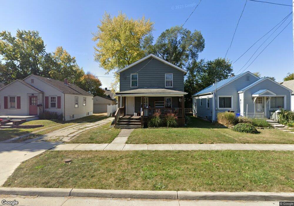
447 Oak St Marion, OH 43302
Estimated Value: $84,000 - $109,000
3
Beds
2
Baths
1,144
Sq Ft
$83/Sq Ft
Est. Value
About This Home
This home is located at 447 Oak St, Marion, OH 43302 and is currently estimated at $94,445, approximately $82 per square foot. 447 Oak St is a home located in Marion County with nearby schools including Rutherford B. Hayes Elementary School, Ulysses S. Grant Middle School, and Harding High School.
Ownership History
Date
Name
Owned For
Owner Type
Purchase Details
Closed on
Sep 1, 2015
Sold by
Lofty Living Llc
Bought by
Field Preston W
Current Estimated Value
Purchase Details
Closed on
Mar 12, 2014
Bought by
Field Preston W
Purchase Details
Closed on
Mar 4, 2014
Bought by
Field Preston W
Purchase Details
Closed on
Jul 17, 2001
Bought by
Field Preston W
Purchase Details
Closed on
May 18, 1993
Bought by
Field Preston W
Create a Home Valuation Report for This Property
The Home Valuation Report is an in-depth analysis detailing your home's value as well as a comparison with similar homes in the area
Home Values in the Area
Average Home Value in this Area
Purchase History
| Date | Buyer | Sale Price | Title Company |
|---|---|---|---|
| Field Preston W | $325,000 | Attorney | |
| Field Preston W | $23,000 | -- | |
| Field Preston W | $43,000 | -- | |
| Field Preston W | -- | -- | |
| Field Preston W | $28,500 | -- | |
| Field Preston W | $13,000 | -- |
Source: Public Records
Tax History Compared to Growth
Tax History
| Year | Tax Paid | Tax Assessment Tax Assessment Total Assessment is a certain percentage of the fair market value that is determined by local assessors to be the total taxable value of land and additions on the property. | Land | Improvement |
|---|---|---|---|---|
| 2024 | $1,514 | $19,260 | $1,590 | $17,670 |
| 2023 | $1,514 | $19,260 | $1,590 | $17,670 |
| 2022 | $1,284 | $19,260 | $1,590 | $17,670 |
| 2021 | $877 | $16,120 | $1,390 | $14,730 |
| 2020 | $1,252 | $16,120 | $1,390 | $14,730 |
| 2019 | $1,063 | $16,120 | $1,390 | $14,730 |
| 2018 | $1,033 | $13,020 | $1,380 | $11,640 |
| 2017 | $926 | $13,020 | $1,380 | $11,640 |
| 2016 | $625 | $15,660 | $1,380 | $14,280 |
| 2015 | $626 | $15,330 | $1,320 | $14,010 |
| 2014 | $640 | $15,330 | $1,320 | $14,010 |
| 2012 | $611 | $14,840 | $980 | $13,860 |
Source: Public Records
Map
Nearby Homes
- 233 Tully St
- 347 Mary St
- 395 N Main St
- 552 N Prospect St
- 343 Commercial St
- 551 Universal Ave Unit 555
- 636 Mary St
- 434 N State St
- 593 N State St
- 455 Park St
- 736 N Main St
- 178 Leader St
- 291 Patten St
- 197 Harrison St
- 468 Avondale Ave
- 316 Patten St
- 485 Avondale Ave
- 325 Holmes Place
- 520 Toledo Ave
- 286 Patterson St