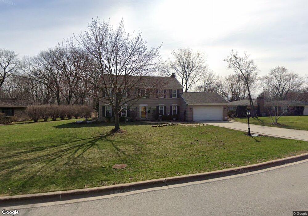
4471 Dawngate Ln Unit 2 Rolling Meadows, IL 60008
Creekside NeighborhoodEstimated Value: $587,000 - $719,000
4
Beds
4
Baths
2,389
Sq Ft
$267/Sq Ft
Est. Value
About This Home
This home is located at 4471 Dawngate Ln Unit 2, Rolling Meadows, IL 60008 and is currently estimated at $637,177, approximately $266 per square foot. 4471 Dawngate Ln Unit 2 is a home located in Cook County with nearby schools including Willow Bend Elementary School, Galatia Junior High School, and William Fremd High School.
Ownership History
Date
Name
Owned For
Owner Type
Purchase Details
Closed on
Oct 21, 2004
Sold by
Lindsey Robert A and Lindsey Judith C
Bought by
Schuld Timothy T and Schuld Julie A
Current Estimated Value
Home Financials for this Owner
Home Financials are based on the most recent Mortgage that was taken out on this home.
Original Mortgage
$385,800
Outstanding Balance
$193,113
Interest Rate
5.93%
Mortgage Type
Unknown
Estimated Equity
$444,064
Purchase Details
Closed on
Aug 15, 2002
Sold by
Lindsey Robert A and Lindsey Judith C
Bought by
Lindsey Robert A and Lindsey Judith C
Create a Home Valuation Report for This Property
The Home Valuation Report is an in-depth analysis detailing your home's value as well as a comparison with similar homes in the area
Home Values in the Area
Average Home Value in this Area
Purchase History
| Date | Buyer | Sale Price | Title Company |
|---|---|---|---|
| Schuld Timothy T | $482,500 | Ticor | |
| Lindsey Robert A | -- | -- |
Source: Public Records
Mortgage History
| Date | Status | Borrower | Loan Amount |
|---|---|---|---|
| Open | Schuld Timothy T | $385,800 |
Source: Public Records
Tax History Compared to Growth
Tax History
| Year | Tax Paid | Tax Assessment Tax Assessment Total Assessment is a certain percentage of the fair market value that is determined by local assessors to be the total taxable value of land and additions on the property. | Land | Improvement |
|---|---|---|---|---|
| 2024 | $11,266 | $39,000 | $7,293 | $31,707 |
| 2023 | $10,815 | $39,000 | $7,293 | $31,707 |
| 2022 | $10,815 | $39,000 | $7,293 | $31,707 |
| 2021 | $10,951 | $35,364 | $4,641 | $30,723 |
| 2020 | $10,854 | $35,364 | $4,641 | $30,723 |
| 2019 | $11,648 | $41,948 | $4,641 | $37,307 |
| 2018 | $10,563 | $34,984 | $4,309 | $30,675 |
| 2017 | $10,366 | $34,984 | $4,309 | $30,675 |
| 2016 | $11,665 | $40,713 | $4,309 | $36,404 |
| 2015 | $10,790 | $35,694 | $3,978 | $31,716 |
| 2014 | $10,575 | $35,694 | $3,978 | $31,716 |
| 2013 | $10,690 | $36,961 | $3,978 | $32,983 |
Source: Public Records
Map
Nearby Homes
- 200 Edgewood Ln
- 208 Brookdale Ln
- 160 E Forest Ln
- 2600 Brookwood Way Dr Unit 316
- 2600 Brookwood Way Dr Unit 305
- 2600 Brookwood Unit 314
- 2600 Brookwood Way Dr Unit 212
- 3805 Fairfax Ave
- 4941 Emerson Ave
- 123 Honeysuckle Ct
- 2 Croydon on Duxbury
- 2041 Vermont St
- 4 Eton on Oxford
- 4301 Euclid Ave
- 2401 Rohlwing Rd
- 1292 Quadrant Ln
- 3400 Wellington Ct Unit 306
- 1272 Quadrant Ln
- 3355 Kirchoff Rd Unit 6A
- 1294 Catalina Ct
- 4461 Dawngate Ln
- 4481 Dawngate Ln
- 3119 California Ct
- 4470 Shady Ct
- 4451 Dawngate Ln
- 4450 Dawngate Ln
- 3000 California Ave
- 4466 Shady Ct
- 3129 California Ct
- 4441 Dawngate Ln
- 4440 Dawngate Ln
- 4501 Dawngate Ln
- 3143 California Ct
- 4454 Shady Ct
- 4462 Shady Ct
- 1735 S California Ave
- 3139 California Ct
- 155 E Kimberly Ave
- 4431 Dawngate Ln
- 4458 Shady Ct