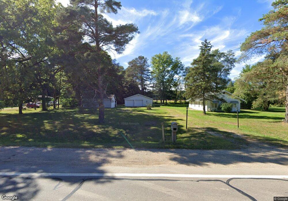
4472 S Us Highway 27 St. Johns, MI 48879
Estimated Value: $146,000 - $184,000
2
Beds
1
Bath
868
Sq Ft
$199/Sq Ft
Est. Value
About This Home
This home is located at 4472 S Us Highway 27, St. Johns, MI 48879 and is currently estimated at $172,440, approximately $198 per square foot. 4472 S Us Highway 27 is a home located in Clinton County with nearby schools including St. Johns High School and St Joseph Catholic School.
Ownership History
Date
Name
Owned For
Owner Type
Purchase Details
Closed on
Aug 10, 2023
Sold by
Dec Stanley Joseph
Bought by
Tijerina Ulysses R and Ouderkirk Katelyn
Current Estimated Value
Home Financials for this Owner
Home Financials are based on the most recent Mortgage that was taken out on this home.
Original Mortgage
$155,200
Outstanding Balance
$151,597
Interest Rate
6.71%
Mortgage Type
New Conventional
Estimated Equity
$20,843
Purchase Details
Closed on
Oct 31, 2018
Sold by
Estate Of Patricia K Robinson
Bought by
Dec Stanley Joseph
Purchase Details
Closed on
Nov 18, 2004
Sold by
Sherwood Robert and Sherwood Joyce
Bought by
Robinson Patricia K
Home Financials for this Owner
Home Financials are based on the most recent Mortgage that was taken out on this home.
Original Mortgage
$85,025
Interest Rate
5.91%
Mortgage Type
Purchase Money Mortgage
Create a Home Valuation Report for This Property
The Home Valuation Report is an in-depth analysis detailing your home's value as well as a comparison with similar homes in the area
Home Values in the Area
Average Home Value in this Area
Purchase History
| Date | Buyer | Sale Price | Title Company |
|---|---|---|---|
| Tijerina Ulysses R | $160,000 | First American Title | |
| Dec Stanley Joseph | $90,100 | Tri County Title Agency Llc | |
| Robinson Patricia K | $89,500 | Fatic |
Source: Public Records
Mortgage History
| Date | Status | Borrower | Loan Amount |
|---|---|---|---|
| Open | Tijerina Ulysses R | $155,200 | |
| Previous Owner | Robinson Patricia K | $85,025 |
Source: Public Records
Tax History Compared to Growth
Tax History
| Year | Tax Paid | Tax Assessment Tax Assessment Total Assessment is a certain percentage of the fair market value that is determined by local assessors to be the total taxable value of land and additions on the property. | Land | Improvement |
|---|---|---|---|---|
| 2025 | -- | $71,800 | $19,000 | $52,800 |
| 2024 | $694 | $58,300 | $18,800 | $39,500 |
| 2023 | $508 | $53,500 | $0 | $0 |
| 2022 | $1,145 | $48,400 | $19,000 | $29,400 |
| 2021 | $1,099 | $43,500 | $15,500 | $28,000 |
| 2020 | $1,079 | $42,700 | $14,500 | $28,200 |
| 2019 | $1,022 | $38,300 | $11,000 | $27,300 |
| 2018 | $904 | $36,100 | $10,000 | $26,100 |
| 2017 | -- | $35,500 | $9,000 | $26,500 |
| 2016 | $867 | $35,400 | $9,000 | $26,400 |
| 2015 | -- | $34,000 | $0 | $0 |
| 2011 | -- | $38,500 | $0 | $0 |
Source: Public Records
Map
Nearby Homes
- Vl S Us 27
- 0 S Us 27 Unit 287962
- 1080 Woodridge Dr
- 1060 Woodridge Dr
- 1055 Summerfield Ln
- 1180 Harvest Moon Way
- 1315 Harvest Moon Way
- 3180 S Bus 127
- 4275 S Dewitt Rd
- 1300 Superior Dr Unit 1
- 1480 Superior Dr Unit 24
- 1396 Superior Dr Unit 28
- 1398 Superior Dr Unit 27
- Integrity 2000 Plan at Woodridge Bingham - Integrity
- Integrity 1880 Plan at Woodridge Bingham - Integrity
- Integrity 2280 Plan at Woodridge Bingham - Integrity
- Elements 2100 Plan at Woodridge Bingham
- Integrity 1530 Plan at Woodridge Bingham - Integrity
- Elements 2070 Plan at Woodridge Bingham
- Integrity 2080 Plan at Woodridge Bingham - Integrity
- 4472 S Us Highway 27
- 4472 S Us Highway 27
- 4472 S Us Highway 27
- 4472 S Us 27
- 4462 S Us Highway 27
- 4462 S Us Highway 27
- 4500 S Us Highway 27
- 4467 S Us Highway 27
- 4467 S Us Highway 27
- 4422 S Us 27
- 4422 S Us Highway 27
- 4505 S Us Highway 27
- 4505 S Us27
- 4505 S Us27
- 4505 S Us27
- 4505 S Us27
- 4505 S Us 27
- 4564 S Us Highway 27
- 4564 S Us Highway 27
- 4418 S Us Highway 27