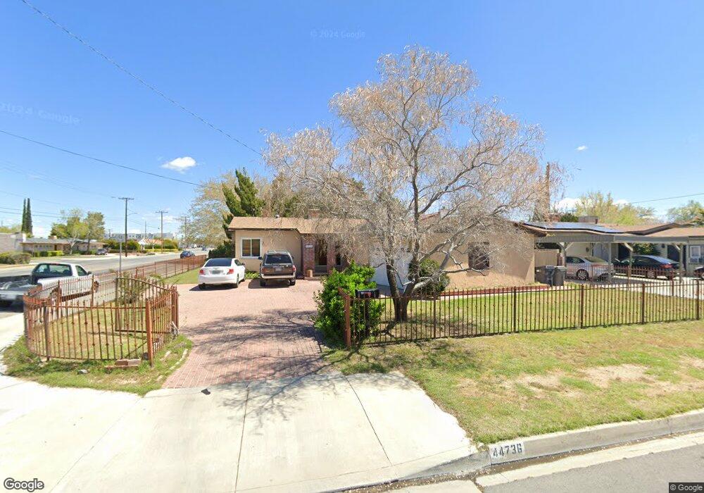
44736 12th St W Lancaster, CA 93534
Central Lancaster NeighborhoodEstimated Value: $390,000 - $432,000
3
Beds
2
Baths
1,297
Sq Ft
$313/Sq Ft
Est. Value
About This Home
This home is located at 44736 12th St W, Lancaster, CA 93534 and is currently estimated at $405,670, approximately $312 per square foot. 44736 12th St W is a home located in Los Angeles County with nearby schools including Monte Vista Elementary School, Amargosa Creek Middle School, and Lancaster High School.
Ownership History
Date
Name
Owned For
Owner Type
Purchase Details
Closed on
Jun 10, 2005
Sold by
Oltion Lucinda R
Bought by
Rodriguez Javier A and Rodriguez Sandra
Current Estimated Value
Home Financials for this Owner
Home Financials are based on the most recent Mortgage that was taken out on this home.
Original Mortgage
$216,000
Outstanding Balance
$115,366
Interest Rate
6.12%
Mortgage Type
Purchase Money Mortgage
Estimated Equity
$290,304
Purchase Details
Closed on
Aug 10, 1995
Sold by
Wagner Ronald V and Willard Sharon L
Bought by
Oltion Lucinda
Home Financials for this Owner
Home Financials are based on the most recent Mortgage that was taken out on this home.
Original Mortgage
$48,000
Interest Rate
7.88%
Create a Home Valuation Report for This Property
The Home Valuation Report is an in-depth analysis detailing your home's value as well as a comparison with similar homes in the area
Home Values in the Area
Average Home Value in this Area
Purchase History
We collect this data history from publicly available records. To have your information removed, we recommend requesting removal directly through your county’s website.
| Date | Buyer | Sale Price | Title Company |
|---|---|---|---|
| Rodriguez Javier A | $270,000 | -- | |
| Oltion Lucinda | $60,000 | Continental Land Title |
Source: Public Records
Mortgage History
We collect this data history from publicly available records. To have your information removed, we recommend requesting removal directly through your county’s website.
| Date | Status | Borrower | Loan Amount |
|---|---|---|---|
| Open | Rodriguez Javier A | $216,000 | |
| Previous Owner | Oltion Lucinda | $48,000 | |
| Closed | Rodriguez Javier A | $54,000 |
Source: Public Records
Tax History
| Year | Tax Paid | Tax Assessment Tax Assessment Total Assessment is a certain percentage of the fair market value that is determined by local assessors to be the total taxable value of land and additions on the property. | Land | Improvement |
|---|---|---|---|---|
| 2025 | $5,933 | $368,961 | $192,134 | $176,827 |
| 2024 | $5,721 | $361,727 | $188,367 | $173,360 |
| 2023 | $5,597 | $354,635 | $184,674 | $169,961 |
| 2022 | $5,361 | $347,682 | $181,053 | $166,629 |
| 2021 | $4,377 | $293,500 | $153,500 | $140,000 |
| 2019 | $3,681 | $237,600 | $124,200 | $113,400 |
| 2018 | $3,209 | $199,000 | $104,000 | $95,000 |
| 2016 | $2,655 | $158,200 | $82,400 | $75,800 |
| 2015 | $2,472 | $143,000 | $74,500 | $68,500 |
| 2014 | $2,099 | $109,000 | $56,800 | $52,200 |
Source: Public Records
Map
Nearby Homes
- 1103 W Milling St
- 0 W Lancaster Blvd Unit SW26048281
- 947 W Oldfield St
- 0 W 15th St Unit 25008497
- 925 W Oldfield St
- 46135 10th St W
- 44423 Kingtree Ave
- 0 Vac Vic 195 Ste Ave 06 Unit 23-270071
- 0 Vac Vic Avenue F8 75 Stw Unit SR19141185
- 44516 15th St W
- 44410 Loneoak Ave
- 44804 Lorimer Ave
- 1438 W Ivyton St
- 44632 Fern Ave
- 1639 W Norberry St
- 0 W Newgrove St
- 0 Ave J Corner of Genoa Ave Unit 24003618
- 44615 Grove Ln
- 106 W Avenue I
- 44632 17th St W
- 0 Avenue H Vic Division St Unit SR18169266
- 7000 Vac Cor 70th W Ave G
- 70 Vac 70th W Cor Avenue F
- 0 Vac 60th W Vic Avenue F10 Unit SR18125012
- 0 Vac 64th W Vic Avenue F12 Unit SR18068991
- 0 Vac Cor 20th Stw Ave L12 Drt Unit SR18045140
- 1 Vac 60th W Ave F12
- 0 Vac Date Ave Vic Old Field St Unit SR17220972
- 11 Vac Ave E2 Vic 11 Plw
- 0 Vac Vic 5th Stw Ave C8 Unit SR17208501
- 0 Vac Cor 20th Stw Ave L12 Drt Unit SR17162453
- 0 Vac Sierra Hwy Vic Avenue A14 Unit SR17155782
- 13 Street Wast and Ave F
- 0 Vac 64th W Vic Avenue F12 Unit 1109127
- 0 Vac 64th W Vic Avenue F12 Unit 1202672
- 0 Vac Vic Avenue L8 5th Stw Unit SR22163170
- 0 Vac 60th W Vic Avenue F10 Unit SR20254251
- 10 AC On South West Corner Sierra Hwy and Ave E
- 0 Vac 64th W Vic Avenue F12 Unit 497494
- 0 Vac Ave E12 Vic 18 Stw Unit SR19000539
Your Personal Tour Guide
Ask me questions while you tour the home.