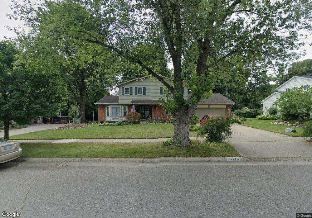
44743 Brookside Rd Plymouth, MI 48170
Estimated Value: $519,900 - $558,000
--
Bed
4
Baths
2,190
Sq Ft
$247/Sq Ft
Est. Value
About This Home
This home is located at 44743 Brookside Rd, Plymouth, MI 48170 and is currently estimated at $540,475, approximately $246 per square foot. 44743 Brookside Rd is a home located in Wayne County with nearby schools including Canton High School, Smith Elementary School, and West Middle School.
Ownership History
Date
Name
Owned For
Owner Type
Purchase Details
Closed on
Jul 2, 2013
Sold by
Hett John E
Bought by
Lalinsky Christine M
Current Estimated Value
Home Financials for this Owner
Home Financials are based on the most recent Mortgage that was taken out on this home.
Original Mortgage
$100,000
Outstanding Balance
$73,021
Interest Rate
4.02%
Mortgage Type
Credit Line Revolving
Estimated Equity
$467,454
Purchase Details
Closed on
Jul 2, 2002
Sold by
Mckelvey Barbara H
Bought by
Hett John E
Create a Home Valuation Report for This Property
The Home Valuation Report is an in-depth analysis detailing your home's value as well as a comparison with similar homes in the area
Home Values in the Area
Average Home Value in this Area
Purchase History
| Date | Buyer | Sale Price | Title Company |
|---|---|---|---|
| Lalinsky Christine M | -- | 1St Security Title Agency In | |
| Hett John E | $282,300 | -- |
Source: Public Records
Mortgage History
| Date | Status | Borrower | Loan Amount |
|---|---|---|---|
| Open | Lalinsky Christine M | $100,000 |
Source: Public Records
Tax History Compared to Growth
Tax History
| Year | Tax Paid | Tax Assessment Tax Assessment Total Assessment is a certain percentage of the fair market value that is determined by local assessors to be the total taxable value of land and additions on the property. | Land | Improvement |
|---|---|---|---|---|
| 2025 | $3,602 | $233,800 | $0 | $0 |
| 2024 | $3,602 | $215,900 | $0 | $0 |
| 2023 | $3,432 | $203,600 | $0 | $0 |
| 2022 | $4,619 | $199,200 | $0 | $0 |
| 2021 | $4,426 | $195,500 | $0 | $0 |
| 2019 | $4,294 | $173,200 | $0 | $0 |
| 2018 | $2,937 | $169,190 | $0 | $0 |
| 2017 | $2,050 | $35,200 | $0 | $0 |
| 2016 | $3,842 | $165,800 | $0 | $0 |
| 2015 | $12,297 | $157,120 | $0 | $0 |
| 2013 | $11,914 | $124,800 | $0 | $0 |
| 2012 | -- | $120,000 | $35,150 | $84,850 |
Source: Public Records
Map
Nearby Homes
- 44571 Clare Blvd
- 10839 Brookwood Dr
- 44872 Lynn Dr
- 44736 Lynn Dr
- 44750 Erin Dr Unit 40
- 44877 Erin Dr Unit 2
- 44703 Erin Dr
- 1199 S Sheldon Rd Unit 77
- 45555 S Turtlehead Ct
- 9453 Brookline Ave
- 1125 Sutherland St
- 9264 Brookline Ave
- 9230 Brookline Ave
- 1338 S Harvey St
- 9195 N Canton Center Rd
- 9060 N Sheldon Rd
- 9405 Northern Ave
- 12260 High Meadow Ct
- 638 S Harvey St
- 11701 Tuscany Ct
- 44727 Brookside Rd
- 44759 Brookside Rd
- 44800 Clare Blvd
- 44734 Clare Blvd
- 44711 Brookside Rd
- 10511 Brookwood Dr
- 10001 Creekwood Cir
- 10512 Brookwood Dr
- 10015 Creekwood Cir
- 44702 Clare Blvd
- 10527 Brookwood Dr
- 10200 Trailwood Rd
- 10029 Creekwood Cir
- 10528 Brookwood Dr
- 10509 Jo Ann Ln
- 10445 Jo Ann Ln
- 44547 Brookside Rd
- 10238 Trailwood Rd
- 10543 Brookwood Dr
- 10525 Jo Ann Ln