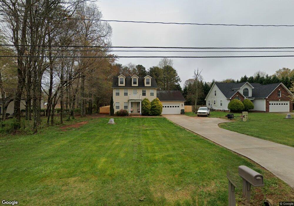
4475 Mooresville Rd Salisbury, NC 28147
Estimated Value: $312,960 - $356,000
About This Home
This home is located at 4475 Mooresville Rd, Salisbury, NC 28147 and is currently estimated at $341,990, approximately $199 per square foot. 4475 Mooresville Rd is a home located in Rowan County with nearby schools including Hurley Elementary School, Southeast Middle School, and West Rowan High School.
Ownership History
We collect this data history from publicly available records. To have your information removed, we recommend requesting removal directly through your county’s website.
Purchase Details
Purchase Details
Home Financials for this Owner
Home Financials are based on the most recent Mortgage that was taken out on this home.Purchase Details
Home Financials for this Owner
Home Financials are based on the most recent Mortgage that was taken out on this home.Purchase Details
Purchase History
We collect this data history from publicly available records. To have your information removed, we recommend requesting removal directly through your county’s website.
| Date | Buyer | Sale Price | Title Company |
|---|---|---|---|
| -- | None Listed On Document | ||
| $139,000 | None Available | ||
| $160,000 | Chicago Title Insurance Co | ||
| $100,000 | -- |
Mortgage History
We collect this data history from publicly available records. To have your information removed, we recommend requesting removal directly through your county’s website.
| Date | Status | Borrower | Loan Amount |
|---|---|---|---|
| Previous Owner | $136,482 | ||
| Previous Owner | $31,980 | ||
| Previous Owner | $127,920 |
Tax History
We collect this data history from publicly available records. To have your information removed, we recommend requesting removal directly through your county’s website.
| Year | Tax Paid | Tax Assessment Tax Assessment Total Assessment is a certain percentage of the fair market value that is determined by local assessors to be the total taxable value of land and additions on the property. | Land | Improvement |
|---|---|---|---|---|
| 2025 | $1,685 | $248,757 | $30,000 | $218,757 |
| 2024 | $1,685 | $248,757 | $30,000 | $218,757 |
| 2023 | $1,685 | $248,757 | $30,000 | $218,757 |
| 2022 | $1,233 | $163,268 | $26,000 | $137,268 |
| 2021 | $1,220 | $163,268 | $26,000 | $137,268 |
| 2020 | $1,220 | $163,268 | $26,000 | $137,268 |
| 2019 | $1,220 | $163,268 | $26,000 | $137,268 |
| 2018 | $1,052 | $141,898 | $26,000 | $115,898 |
| 2017 | $1,052 | $141,898 | $26,000 | $115,898 |
| 2016 | $1,052 | $141,898 | $26,000 | $115,898 |
| 2015 | $1,064 | $141,898 | $26,000 | $115,898 |
| 2014 | $1,058 | $148,004 | $26,000 | $122,004 |
Map
- 2885 Wright Ave
- 0 Mooresville Rd Unit CAR4356691
- 1115 Joy St
- 245 Spicewood Ln Unit 25
- 41 Old Farm Rd
- 101 E Chamblee Dr
- 119 Progress Place
- 220 Kent Rd
- 206 Cedar Dr
- 120 Regency Rd
- 6 Old Farm Rd
- 1050 Gibson Rd
- 1030 Gibson Rd
- 303 Brook Valley Dr
- 358 Autumnlight Dr
- 2100 Airport Rd
- 113 Browns Farm Rd
- 190 Goodnight Rd
- 140 Overbrook Rd
- 825 Timberlane Trail
- 4465 Mooresville Rd
- 4485 Mooresville Rd
- 1160 Phillip St
- 3070 Airport Rd
- 4455 Mooresville Rd
- 3050 Airport Rd
- 1160 Phillip St
- 1150 Phillip St
- 1165 Phillip St
- 4105 Mooresville Rd
- 3045 Airport Rd
- 3035 Airport Rd
- 4103 Mooresville Rd
- 3030 Airport Rd
- 3055 Airport Rd
- 1155 Phillip St
- 1155 Phillip St Unit 54
- 1140 Phillip St
- 3025 Airport Rd
- 1145 Phillip St
Ask me questions while you tour the home.