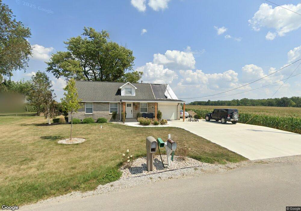
4476 Saint Peter Rd Fort Recovery, OH 45846
Estimated Value: $114,000 - $310,000
3
Beds
1
Bath
1,044
Sq Ft
$184/Sq Ft
Est. Value
About This Home
This home is located at 4476 Saint Peter Rd, Fort Recovery, OH 45846 and is currently estimated at $192,259, approximately $184 per square foot. 4476 Saint Peter Rd is a home located in Mercer County with nearby schools including Fort Recovery Elementary School, Fort Recovery Middle School, and Fort Recovery High School.
Ownership History
Date
Name
Owned For
Owner Type
Purchase Details
Closed on
Aug 15, 2025
Sold by
Schoenherr Eleonora J and Dues Alex J
Bought by
Kaiser Nathan D and Knapke Aubrey S
Current Estimated Value
Home Financials for this Owner
Home Financials are based on the most recent Mortgage that was taken out on this home.
Original Mortgage
$175,000
Outstanding Balance
$174,848
Interest Rate
6.72%
Mortgage Type
Credit Line Revolving
Estimated Equity
$17,411
Purchase Details
Closed on
Jan 12, 2019
Sold by
Brockman Nicholas J and Brockman Angela M
Bought by
Schoenherr Eleonora J
Home Financials for this Owner
Home Financials are based on the most recent Mortgage that was taken out on this home.
Original Mortgage
$45,000
Interest Rate
4.7%
Mortgage Type
New Conventional
Purchase Details
Closed on
Oct 20, 2003
Bought by
Brockman Nicholas J and Thobe Angela
Create a Home Valuation Report for This Property
The Home Valuation Report is an in-depth analysis detailing your home's value as well as a comparison with similar homes in the area
Home Values in the Area
Average Home Value in this Area
Purchase History
| Date | Buyer | Sale Price | Title Company |
|---|---|---|---|
| Kaiser Nathan D | $303,333 | None Listed On Document | |
| Schoenherr Eleonora J | $60,000 | None Available | |
| Brockman Nicholas J | $85,000 | -- |
Source: Public Records
Mortgage History
| Date | Status | Borrower | Loan Amount |
|---|---|---|---|
| Open | Kaiser Nathan D | $175,000 | |
| Previous Owner | Schoenherr Eleonora J | $45,000 |
Source: Public Records
Tax History Compared to Growth
Tax History
| Year | Tax Paid | Tax Assessment Tax Assessment Total Assessment is a certain percentage of the fair market value that is determined by local assessors to be the total taxable value of land and additions on the property. | Land | Improvement |
|---|---|---|---|---|
| 2024 | $1,236 | $42,320 | $6,200 | $36,120 |
| 2023 | $1,236 | $42,320 | $6,200 | $36,120 |
| 2022 | $994 | $31,750 | $4,730 | $27,020 |
| 2021 | $997 | $31,750 | $4,730 | $27,020 |
| 2020 | $1,268 | $39,490 | $4,730 | $34,760 |
| 2019 | $1,154 | $35,460 | $4,520 | $30,940 |
| 2018 | $1,196 | $35,460 | $4,520 | $30,940 |
| 2017 | $1,053 | $35,460 | $4,520 | $30,940 |
| 2016 | $902 | $27,240 | $4,100 | $23,140 |
| 2015 | $866 | $27,240 | $4,100 | $23,140 |
| 2014 | $880 | $27,240 | $4,100 | $23,140 |
| 2013 | $926 | $27,240 | $4,100 | $23,140 |
Source: Public Records
Map
Nearby Homes
- 1291 State Route 219
- 2332 State Route 29
- 304 S Wayne St
- 201 W Wiggs St
- 912 Emerald Ave
- 821 Butler St
- 820 Mary Ln
- 401 N Cedar St
- 420 S 1st St
- 6699 Gause Rd
- 501 N 2nd St
- 314 E North St
- 402 E Elizabeth St
- 426 E Walnut St
- 721 Lilac Dr
- 0 Anderson Lots 10 11 & 12 Ln Unit 1037885
- 0 Springer 1-6 & Roadway 14-16 Unit 1037883
- 0 Ohio 118
- 0 Anderson 13&14 & Roadway 12&13 Unit 1037886
- 6799 Debra Ave
- 4475 Saint Peter Rd
- 4513 Saint Peter Rd
- 4380 Saint Peter Rd
- 4610 Saint Peter Rd
- 1370 State Route 219
- 1360 State Route 219
- 1360 State Route 219
- 1352 Ohio 219
- 1352 State Route 219
- 1344 State Route 219
- 1349 State Route 219
- 1330 State Route 219
- 1335 State Route 219
- 1290 State Route 219
- 1290 State Route 219
- 1290 State Route 219
- 1291 Ohio 219
- 1279 State Route 219
- 1268 State Route 219
- 4735 Saint Peter Rd