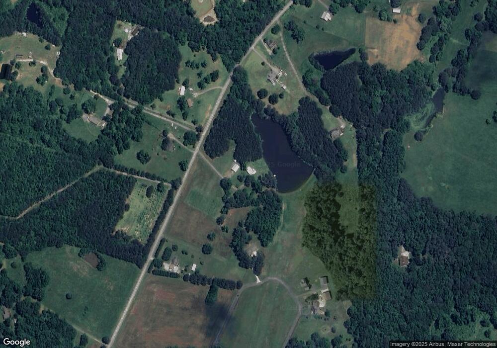
4477 E Broomtown Rd Trion, GA 30753
Center Post NeighborhoodEstimated Value: $427,000 - $451,446
2
Beds
1
Bath
1,204
Sq Ft
$365/Sq Ft
Est. Value
About This Home
This home is located at 4477 E Broomtown Rd, Trion, GA 30753 and is currently estimated at $439,149, approximately $364 per square foot. 4477 E Broomtown Rd is a home located in Walker County with nearby schools including Gilbert Elementary School, Lafayette Middle School, and Lafayette High School.
Ownership History
Date
Name
Owned For
Owner Type
Purchase Details
Closed on
May 27, 2017
Sold by
Lovell David
Bought by
Viriato Azevedo Miguel and Viriato Edna
Current Estimated Value
Purchase Details
Closed on
Dec 29, 2000
Sold by
Mcabee Muriel Alice
Bought by
Lollie Joseph J
Purchase Details
Closed on
Aug 25, 1994
Bought by
Mcabee Muriel Alice
Create a Home Valuation Report for This Property
The Home Valuation Report is an in-depth analysis detailing your home's value as well as a comparison with similar homes in the area
Home Values in the Area
Average Home Value in this Area
Purchase History
| Date | Buyer | Sale Price | Title Company |
|---|---|---|---|
| Viriato Azevedo Miguel | $60,000 | -- | |
| Lollie Joseph J | $130,000 | -- | |
| Mcabee Muriel Alice | -- | -- |
Source: Public Records
Tax History
| Year | Tax Paid | Tax Assessment Tax Assessment Total Assessment is a certain percentage of the fair market value that is determined by local assessors to be the total taxable value of land and additions on the property. | Land | Improvement |
|---|---|---|---|---|
| 2024 | $2,886 | $166,686 | $10,879 | $155,807 |
| 2023 | $2,758 | $157,307 | $8,634 | $148,673 |
| 2022 | $2,465 | $134,485 | $5,373 | $129,112 |
| 2021 | $1,997 | $105,453 | $5,373 | $100,080 |
| 2020 | $1,592 | $86,486 | $5,373 | $81,113 |
| 2019 | $1,231 | $73,525 | $5,373 | $68,152 |
| 2018 | $142 | $5,373 | $5,373 | $0 |
| 2017 | $140 | $5,373 | $5,373 | $0 |
| 2016 | $131 | $5,373 | $5,373 | $0 |
| 2015 | $363 | $13,945 | $13,945 | $0 |
| 2014 | -- | $35,388 | $16,920 | $18,468 |
| 2013 | $142 | $35,388 | $16,920 | $18,468 |
Source: Public Records
Map
Nearby Homes
- 6671 Highway 337
- 6670 Highway 337
- 3523 E Broomtown Rd
- 283 W Oakton Rd
- 113 Dudley Dr
- 1144 Ridgeway Rd
- 1337 Ridgeway Rd
- 0 Ridgeway Rd Unit 1524463
- 5723 Chamberlain Rd
- 0 Martindale Rd Unit 10608820
- 0 Martindale Rd Unit 1520834
- 1184 Mcconnell Crossing
- 881 Bolcar Blvd
- 434 Farm Rd
- 1478 Shinbone Valley Rd
- 132 Short Hollow Rd
- 4628 Highway 337
- 456 Cummings Rd Unit C
- 456 Cummings Rd Unit D
- 456 Cummings Rd Unit E
- 4424 E Broomtown Rd
- 4494 E Broomtown Rd
- 4422 E Broomtown Rd
- 4315 E Broomtown Rd
- 4351 E Broomtown Rd
- 4593 E Broomtown Rd
- 305 Blue Mountain Ln
- 4349 E Broomtown Rd
- 4349 E Broomtown Rd
- 317 Blue Mountain Ln
- 6 Blue Mountain Rd
- 491 E Broomtown Rd
- 53 Parker Ln
- 122 Bigham Rd
- 0 Blue Mountain Rd Unit 8120487
- 0 Blue Mountain Rd Unit 1313972
- 0 Blue Mountain Rd Unit RTC2742361
- 473 Blue Mountain Ln
- 795 Blue Mountain Ln
- 0 Blue Mountain Rd Unit 1257844
Your Personal Tour Guide
Ask me questions while you tour the home.
