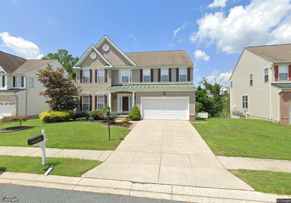
448 Clydebank Dr Abingdon, MD 21009
Estimated Value: $638,976 - $710,000
4
Beds
4
Baths
4,572
Sq Ft
$147/Sq Ft
Est. Value
About This Home
This home is located at 448 Clydebank Dr, Abingdon, MD 21009 and is currently estimated at $671,494, approximately $146 per square foot. 448 Clydebank Dr is a home located in Harford County with nearby schools including Emmorton Elementary School, Bel Air Middle School, and Bel Air High School.
Ownership History
Date
Name
Owned For
Owner Type
Purchase Details
Closed on
Sep 1, 2009
Sold by
Matejka William J
Bought by
Barrett Carl A and Barrett Kum C
Current Estimated Value
Purchase Details
Closed on
Jun 13, 2005
Sold by
Posner Victor
Bought by
Matejka William J and Matejka Ann E
Create a Home Valuation Report for This Property
The Home Valuation Report is an in-depth analysis detailing your home's value as well as a comparison with similar homes in the area
Home Values in the Area
Average Home Value in this Area
Purchase History
| Date | Buyer | Sale Price | Title Company |
|---|---|---|---|
| Barrett Carl A | $440,000 | -- | |
| Matejka William J | $453,600 | -- |
Source: Public Records
Mortgage History
| Date | Status | Borrower | Loan Amount |
|---|---|---|---|
| Closed | Barrett Carl A | -- |
Source: Public Records
Tax History
| Year | Tax Paid | Tax Assessment Tax Assessment Total Assessment is a certain percentage of the fair market value that is determined by local assessors to be the total taxable value of land and additions on the property. | Land | Improvement |
|---|---|---|---|---|
| 2025 | $6,092 | $604,167 | $0 | $0 |
| 2024 | $5,599 | $558,933 | $0 | $0 |
| 2023 | $5,599 | $513,700 | $102,400 | $411,300 |
| 2022 | $5,442 | $499,267 | $0 | $0 |
| 2021 | $0 | $484,833 | $0 | $0 |
| 2020 | $5,428 | $470,400 | $102,400 | $368,000 |
| 2019 | $5,164 | $447,467 | $0 | $0 |
| 2018 | $4,855 | $424,533 | $0 | $0 |
| 2017 | $4,593 | $401,600 | $0 | $0 |
| 2016 | $140 | $395,533 | $0 | $0 |
| 2015 | $4,743 | $389,467 | $0 | $0 |
| 2014 | $4,743 | $383,400 | $0 | $0 |
Source: Public Records
Map
Nearby Homes
- 2815 Lanarkshire Way
- 311 Tiree Ct Unit 401
- 419 Clydebank Dr
- 566 Kirkcaldy Way
- 589 Kirkcaldy Way
- 400 Teresa Marie Ct
- 525 Kirkcaldy Way
- 309 Tall Pines Ct Unit 7
- 301 Tall Pines Ct Unit A
- 2310 Bell's Tower Ct
- 2302 Arthurs Woods Dr
- 2306 Bells Tower Ct
- 311 Laurel Woods Dr
- 452 Deer Hill Cir
- 2911 Islay Ct
- 2909 Islay Ct
- 2802 Haddaway Ct
- 2818 Singer Woods Dr
- 202 Burkwood Ct
- 201 Burkwood Ct
- 450 Clydebank Dr
- 446 Clydebank Dr
- 444 Clydebank Dr
- 441 Clydebank Dr
- 443 Clydebank Dr
- 439 Clydebank Dr
- 442 Clydebank Dr
- 445 Clydebank Dr
- 437 Clydebank Dr
- 2812 Lanarkshire Way
- 447 Clydebank Dr
- 2814 Lanarkshire Way
- 435 Clydebank Dr
- 2810 Lanarkshire Way
- 440 Clydebank Dr
- 2816 Lanarkshire Way
- 2808 Lanarkshire Way
- 449 Clydebank Dr
- 433 Clydebank Dr
- 307 Tiree Ct Unit 102
Your Personal Tour Guide
Ask me questions while you tour the home.