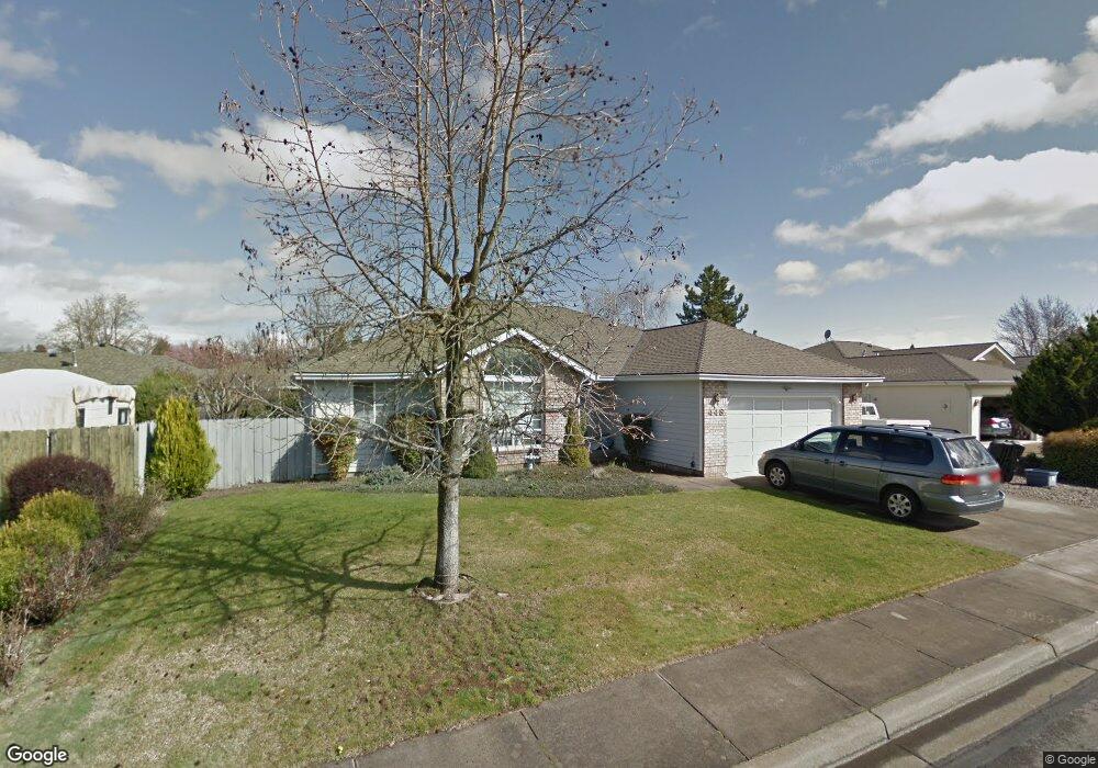
448 Creekside Cir Central Point, OR 97502
Estimated Value: $387,741 - $462,000
3
Beds
2
Baths
1,606
Sq Ft
$274/Sq Ft
Est. Value
About This Home
This home is located at 448 Creekside Cir, Central Point, OR 97502 and is currently estimated at $440,435, approximately $274 per square foot. 448 Creekside Cir is a home located in Jackson County with nearby schools including Richardson Elementary School, Scenic Middle School, and Crater High School.
Ownership History
Date
Name
Owned For
Owner Type
Purchase Details
Closed on
Mar 25, 2011
Sold by
Johnston Thomas R and Johnston Pamela S
Bought by
Johnston Thomas P and Johnston Pamela S
Current Estimated Value
Purchase Details
Closed on
Nov 6, 2009
Sold by
Johnston Adele A
Bought by
Johnston Pamela S
Purchase Details
Closed on
Jan 8, 2009
Sold by
Johnston Adele A and Johnston Thomas R
Bought by
Johnston Thomas R and Johnston Adele A
Create a Home Valuation Report for This Property
The Home Valuation Report is an in-depth analysis detailing your home's value as well as a comparison with similar homes in the area
Home Values in the Area
Average Home Value in this Area
Purchase History
| Date | Buyer | Sale Price | Title Company |
|---|---|---|---|
| Johnston Thomas P | -- | None Available | |
| Johnston Pamela S | -- | None Available | |
| Johnston Thomas R | -- | None Available |
Source: Public Records
Tax History Compared to Growth
Tax History
| Year | Tax Paid | Tax Assessment Tax Assessment Total Assessment is a certain percentage of the fair market value that is determined by local assessors to be the total taxable value of land and additions on the property. | Land | Improvement |
|---|---|---|---|---|
| 2025 | $4,404 | $264,890 | $69,360 | $195,530 |
| 2024 | $4,404 | $257,180 | $67,340 | $189,840 |
| 2023 | $4,262 | $249,690 | $65,380 | $184,310 |
| 2022 | $4,163 | $249,690 | $65,380 | $184,310 |
| 2021 | $4,044 | $242,420 | $63,480 | $178,940 |
| 2020 | $3,926 | $235,360 | $61,630 | $173,730 |
| 2019 | $3,829 | $221,860 | $58,100 | $163,760 |
| 2018 | $3,712 | $215,400 | $56,400 | $159,000 |
| 2017 | $3,619 | $215,400 | $56,400 | $159,000 |
| 2016 | $3,513 | $203,040 | $53,160 | $149,880 |
| 2015 | $3,366 | $203,040 | $53,160 | $149,880 |
| 2014 | $3,281 | $191,390 | $50,110 | $141,280 |
Source: Public Records
Map
Nearby Homes
- 465 Creekside Cir
- 487 Creekside Cir
- 21 Hickory Ln
- 659 Jackson Creek Dr
- 25 Donna Way
- 570 Bachand Cir
- 871 Holley Way
- 349 W Pine St
- 895 Holley Way
- 420 Mayberry Ln
- 3364 Snowy Butte Ln
- 429 Mayberry Ln
- 3642 Oak Pine Way
- 619 Palo Verde Way
- 3506 New Ray Rd
- 407 Silver Creek Dr
- 114 Cedar St
- 3220 Freeland Rd
- 3307 Freeland Rd
- 626 Griffin Oaks Dr
- 297 Brandon St
- 462 Creekside Cir
- 281 Brandon St
- 467 Vincent Ave
- 489 Vincent Ave
- 317 Brandon St
- 486 Creekside Cir
- 265 Brandon St
- 449 Creekside Cir Unit 1
- 435 Vincent Ave
- 498 Creekside Cir
- 501 Vincent Ave
- 353 Brandon St
- 296 Brandon St
- 300 Brandon St
- 278 Brandon St
- 257 Brandon St
- 310 Brandon St
- 270 Vincent Ct
- 268 Vincent Ct