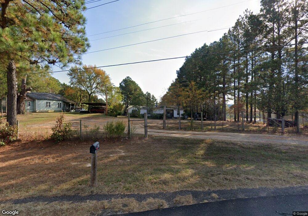
448 Highway 71 N de Queen, AR 71832
Estimated Value: $84,311 - $236,000
--
Bed
1
Bath
912
Sq Ft
$191/Sq Ft
Est. Value
About This Home
This home is located at 448 Highway 71 N, de Queen, AR 71832 and is currently estimated at $174,328, approximately $191 per square foot. 448 Highway 71 N is a home located in Sevier County with nearby schools including Dequeen High School.
Ownership History
Date
Name
Owned For
Owner Type
Purchase Details
Closed on
Aug 6, 2009
Bought by
Gomez Venustiano and Gomez Amanda
Current Estimated Value
Purchase Details
Closed on
Jul 18, 2009
Bought by
Gomez Venustiano and Gomez Amanda
Purchase Details
Closed on
Jul 8, 2009
Bought by
Gomez Venustiano and Gomez Amanda
Purchase Details
Closed on
Jun 18, 2009
Bought by
Gomez Venustiano and Gomez Amanda
Purchase Details
Closed on
Jan 30, 1998
Bought by
Gomez Venustiano
Purchase Details
Closed on
Jun 5, 1995
Bought by
Gomez Manuel
Purchase Details
Closed on
Aug 19, 1991
Bought by
Winkley George
Create a Home Valuation Report for This Property
The Home Valuation Report is an in-depth analysis detailing your home's value as well as a comparison with similar homes in the area
Home Values in the Area
Average Home Value in this Area
Purchase History
| Date | Buyer | Sale Price | Title Company |
|---|---|---|---|
| Gomez Venustiano | -- | -- | |
| Gomez Venustiano | -- | -- | |
| Gomez Venustiano | -- | -- | |
| Gomez Venustiano | -- | -- | |
| Gomez Venustiano | -- | -- | |
| Gomez Manuel | $24,000 | -- | |
| Winkley George | $26,000 | -- |
Source: Public Records
Tax History Compared to Growth
Tax History
| Year | Tax Paid | Tax Assessment Tax Assessment Total Assessment is a certain percentage of the fair market value that is determined by local assessors to be the total taxable value of land and additions on the property. | Land | Improvement |
|---|---|---|---|---|
| 2024 | $117 | $14,370 | $4,080 | $10,290 |
| 2023 | $117 | $14,370 | $4,080 | $10,290 |
| 2022 | $117 | $14,370 | $4,080 | $10,290 |
| 2021 | $117 | $14,370 | $4,080 | $10,290 |
| 2020 | $117 | $14,370 | $4,080 | $10,290 |
| 2019 | $190 | $10,090 | $2,880 | $7,210 |
| 2018 | $190 | $10,090 | $2,880 | $7,210 |
| 2017 | $166 | $10,090 | $2,880 | $7,210 |
| 2016 | $161 | $10,090 | $2,880 | $7,210 |
| 2015 | $161 | $10,090 | $2,880 | $7,210 |
| 2014 | $148 | $5,716 | $1,646 | $4,070 |
Source: Public Records
Map
Nearby Homes
- 143 N Rolling Oaks Dr
- 151 N Rolling Oaks Dr
- 150 N Rolling Oaks Dr
- 110 Rolling Oaks Dr
- 102 Rolling Oaks Dr
- 135 Rolling Oaks Dr
- 156 N Rolling Oaks Dr
- 101 Rolling Oaks Dr
- 118 Hwy N
- 325 Crosstrails Rd
- 1426 Highway 71
- 0 Tbd 80 000 Unit 25003489
- 904 E Collin Raye Dr
- 117 N Rolling Oaks Dr
- 118 Rolling Oaks Dr
- 125 Rolling Oaks Dr
- TBD Collin Raye Dr
- TBD E Stilwell Ave
- TBD Arkansas 329
- 608 W Eighty Thousand Rd
- 441 Highway 71 N
- 458 Highway 71 N
- 426 Highway 71 N
- 470 Highway 71 N
- 475 Highway 71 N
- 352 Robinson Loop
- 414 Highway 71 N
- 484 Highway 71 N
- 412 Highway 71 N
- 540 Highway 71 N
- 490 Highway 71 N
- 348 U S 71
- 401 Highway 71 N
- 126 Warren Dr
- 116 Grace Ln
- 169 J B Logan Cir
- 408 Highway 71 N
- 408 Highway 71 N
- 505 Highway 71 N
- 506 Highway 71 N