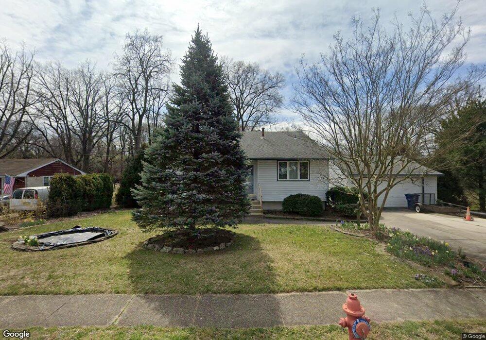
448 Rynning Ave Maple Shade, NJ 08052
Estimated Value: $301,142 - $391,000
Studio
--
Bath
1,336
Sq Ft
$263/Sq Ft
Est. Value
About This Home
This home is located at 448 Rynning Ave, Maple Shade, NJ 08052 and is currently estimated at $351,786, approximately $263 per square foot. 448 Rynning Ave is a home located in Burlington County with nearby schools including Maude M. Wilkins Elementary School, Ralph J Steinhauer Elementary School, and Howard R Yocum School.
Ownership History
Date
Name
Owned For
Owner Type
Purchase Details
Closed on
Jul 26, 1997
Sold by
Bush James R and Bush Violet E
Bought by
Jackle H Kenneth
Current Estimated Value
Home Financials for this Owner
Home Financials are based on the most recent Mortgage that was taken out on this home.
Original Mortgage
$70,000
Outstanding Balance
$10,455
Interest Rate
7.5%
Estimated Equity
$341,331
Create a Home Valuation Report for This Property
The Home Valuation Report is an in-depth analysis detailing your home's value as well as a comparison with similar homes in the area
Home Values in the Area
Average Home Value in this Area
Purchase History
| Date | Buyer | Sale Price | Title Company |
|---|---|---|---|
| Jackle H Kenneth | $95,000 | Congress Title Corp |
Source: Public Records
Mortgage History
| Date | Status | Borrower | Loan Amount |
|---|---|---|---|
| Open | Jackle H Kenneth | $70,000 |
Source: Public Records
Tax History
| Year | Tax Paid | Tax Assessment Tax Assessment Total Assessment is a certain percentage of the fair market value that is determined by local assessors to be the total taxable value of land and additions on the property. | Land | Improvement |
|---|---|---|---|---|
| 2025 | $6,559 | $172,800 | $42,800 | $130,000 |
| 2024 | $6,369 | $172,800 | $42,800 | $130,000 |
| 2023 | $6,369 | $172,800 | $42,800 | $130,000 |
| 2022 | $6,271 | $172,800 | $42,800 | $130,000 |
| 2021 | $6,210 | $172,800 | $42,800 | $130,000 |
| 2020 | $6,228 | $172,800 | $42,800 | $130,000 |
| 2019 | $6,000 | $172,800 | $42,800 | $130,000 |
| 2018 | $5,896 | $172,800 | $42,800 | $130,000 |
| 2017 | $5,827 | $172,800 | $42,800 | $130,000 |
| 2016 | $5,740 | $172,800 | $42,800 | $130,000 |
| 2015 | $5,616 | $172,800 | $42,800 | $130,000 |
| 2014 | $5,445 | $172,800 | $42,800 | $130,000 |
Source: Public Records
Map
Nearby Homes
- 11 Rose Ave
- 21 Paul Rd
- 5 Paul Rd
- 6 Woodbine Ave
- 9 Woodbine Ave
- 35 Farnsworth Ave
- 1720 Media Rd
- 215 Chestnut St
- 305 Oak Ave
- 66 W Center Ave
- 427 Cutler Ave
- 57 S Terrace Ave
- 25 Appley Ct
- 37 James Run
- 306 Cherry Hill Blvd
- 47 S Lippincott Ave
- 304 S Forklanding Rd
- 8323 Maple Ave
- 313 Cherry Hill Blvd
- 748 Cooper Landing Rd
- 442 Rynning Ave
- 438 Rynning Ave
- 443 Rynning Ave
- 441 Rynning Ave
- 25 E Woodcrest Ave
- 100 W Woodcrest Ave
- 98 W Woodcrest Ave
- 23 E Woodcrest Ave
- 435 Rynning Ave
- 96 W Woodcrest Ave
- 21 E Woodcrest Ave
- 424 Rynning Ave
- 427 Rynning Ave
- 26 E Woodcrest Ave
- 94 W Woodcrest Ave
- 24 E Woodcrest Ave
- 99 W Woodcrest Ave
- 19 E Woodcrest Ave
- 418 Rynning Ave
- 430 Florence Ave
Your Personal Tour Guide
Ask me questions while you tour the home.