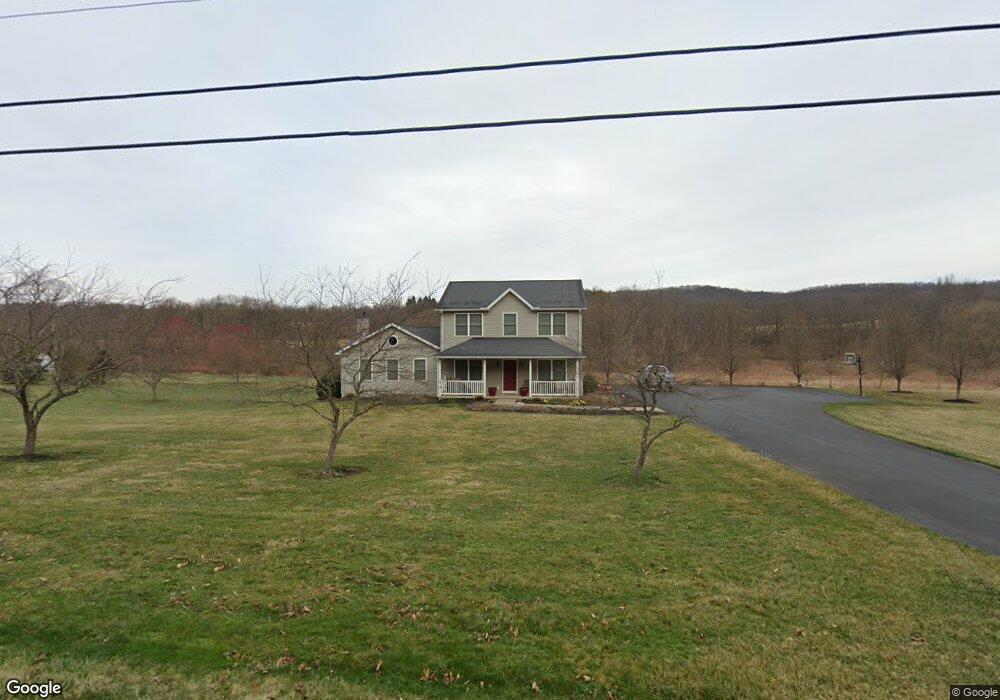
448 Stevenson Rd Port Matilda, PA 16870
Patton NeighborhoodEstimated Value: $611,000 - $687,000
3
Beds
3
Baths
2,460
Sq Ft
$262/Sq Ft
Est. Value
About This Home
This home is located at 448 Stevenson Rd, Port Matilda, PA 16870 and is currently estimated at $644,498, approximately $261 per square foot. 448 Stevenson Rd is a home located in Centre County with nearby schools including Park Forest Elementary School, Park Forest Middle School, and State College Area High School.
Ownership History
Date
Name
Owned For
Owner Type
Purchase Details
Closed on
Jul 1, 2009
Sold by
Zeek Vivian M
Bought by
Norman Eric J and Norman Tasha J K
Current Estimated Value
Home Financials for this Owner
Home Financials are based on the most recent Mortgage that was taken out on this home.
Original Mortgage
$286,000
Outstanding Balance
$182,347
Interest Rate
4.86%
Mortgage Type
Construction
Estimated Equity
$462,151
Create a Home Valuation Report for This Property
The Home Valuation Report is an in-depth analysis detailing your home's value as well as a comparison with similar homes in the area
Home Values in the Area
Average Home Value in this Area
Purchase History
| Date | Buyer | Sale Price | Title Company |
|---|---|---|---|
| Norman Eric J | $115,000 | None Available |
Source: Public Records
Mortgage History
| Date | Status | Borrower | Loan Amount |
|---|---|---|---|
| Open | Norman Eric J | $286,000 |
Source: Public Records
Tax History Compared to Growth
Tax History
| Year | Tax Paid | Tax Assessment Tax Assessment Total Assessment is a certain percentage of the fair market value that is determined by local assessors to be the total taxable value of land and additions on the property. | Land | Improvement |
|---|---|---|---|---|
| 2025 | $5,574 | $96,260 | $30,935 | $65,325 |
| 2024 | $6,256 | $96,260 | $30,935 | $65,325 |
| 2023 | $6,256 | $96,260 | $30,935 | $65,325 |
| 2022 | $5,075 | $96,260 | $30,935 | $65,325 |
| 2021 | $5,075 | $96,260 | $30,935 | $65,325 |
| 2020 | $5,075 | $96,260 | $30,935 | $65,325 |
| 2019 | $3,687 | $96,260 | $30,935 | $65,325 |
| 2018 | $4,920 | $96,260 | $30,935 | $65,325 |
| 2017 | $5,854 | $96,260 | $30,935 | $65,325 |
| 2016 | -- | $80,010 | $14,685 | $65,325 |
| 2015 | -- | $80,010 | $14,685 | $65,325 |
| 2014 | -- | $80,010 | $14,685 | $65,325 |
Source: Public Records
Map
Nearby Homes
- 113 Manhasset Dr
- 190 Michael Rd
- 112 Montauk Cir
- 111 Harvard Rd
- 112 Harvard Rd
- 95 Greenmeadow Ln
- 111 Wildernest Ln
- 107 Wildernest Ln
- 209 Shadow Hawk Ln
- 144 Kenley Ct Unit 144
- 108 Heiskel Dr
- 991 Scotia Rd
- 291 Oakley Dr
- 2074 Mary Ellen Ln
- 1952 Highland Dr
- Lot 2 Julian Pike
- 656 Severn Dr
- Brandywine Plan at Grays Pointe - Single Family Homes
- Dartmouth Plan at Grays Pointe - Single Family Homes
- Crestmont Plan at Grays Pointe - Single Family Homes
- 443 Stevenson Rd
- 499 Stevenson Rd
- 468 Stevenson Rd
- 403 Stevenson Rd
- 391 Stevenson Rd
- ON Stevenson Rd
- Lot #1 Stevenson Rd
- Lot on Stevenson Rd
- 0 Stevenson Rd
- 131 Manhasset Dr
- 147 Manhasset Dr
- 108 Basin St
- 33 Curve Hill Rd
- 171 Manhasset Dr
- 154 Manhasset Dr
- 102 Michael Rd
- 104 Michael Rd
- 3479 N Atherton St
- 183 Michael Rd
- 178 Hidden Meadow Ln